
| |||||||||||||

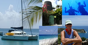
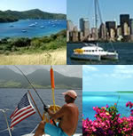
Ocean Passage As this update is completed, we are working our way down the Leeward Islands in the northeast Caribbean Archipelago. So far, we’ve strolled on the streets of the upscale French island of St. Barthelemy, probably the nicest, cleanest island we’ll see in the Leewards of the Caribbean. It's been said St. Barth's holds a special place in Jimmy Buffet's heart and we can see why. We have also visited the Dutch island of Saba, where it was a “turf and surf” paradise for us as we hiked up 1064 steps and trails to a 2,855 foot peak on one day, and then participated in two scuba dives on the island’s amazing reefs the next day. Then, it was on to the Dutch island of St. Eustatia (“Statia”), our first island visit where there are the remains of a volcano. Rich with history and once the biggest trade center in the Caribbean, it was not uncommon for two hundred sailing ships to be anchored at Statia's harbor in the 1700’s. The slave trade was centered here too. Statia's port was burned by the British, though, and the island never recovered as a trade center – more on the reason for the arson later. The reefs of Statia include old wrecks, lava flows and some of the most strikingly colored coral reefs we’ve seen in years. The reefs are healthy and teaming with life. It is the best diving we’ve ever experienced. The sheer abundance and diversity of sea life in Statia ever so slightly surpasses the diving in Belize and the Caymans, and that’s saying something! Leaving Statia and heading to St. Kitts, we were hoping for food fish but hooked a beautiful billfish instead. A small marlin hit the port trolling line and we fought him for 45 minutes as he jumped and shook his head. But, about 500 feet away from the boat and far below the surface he broke the leader and got away. Thrilling, though! We also saw a whale.At any rate, things are going very well here as our most-excellent Caribbean adventure continues. This report will be in two parts. Part One will review how we came to the decision to travel offshore rather than island hop. Part Two will be a reproduction of the actual logbook and further commentary thereon. Both before and after our direct offshore passage from Florida to the Virgin Islands, we have been asked hundreds of questions by scores of sailors and landlubbers alike. In response, we have produced the in-depth report below in light of the high volume of interest we received. From our worldwide supportive e-mails (which are greatly appreciated, by the way), we know that some of you very much enjoy looking at charts and figuring out what our actual routes have been. Well, this log’s for you! Our exact course can be plotted if you so desire. Watch-by-watch and day-by-day, we will share what it was like. It was a significant offshore undertaking for just two people. And so, if you are game for this tough one, get some sleep, eat well and be rested – it won’t be an easy pleasure cruise. Also, we know some of you prefer to skip the text and simply peruse photographs. If so, the pictures start at PART TWO, so scroll down several pages below and you'll find them. Alright, all you salts who have requested "the skinny" on how we decided to go offshore and why, let’s go through the analysis that resulted in the route we plotted. After all, heading hundreds of miles offshore without a wealth of knowledge and a sound plan would be foolhardy at best and down right stupid at worst. Like outer-space, the sea is an environment within which man cannot alone survive. So, let's do our homework and weigh the benefits and risks of various plans. After so doing, we'll shove off and head to sea in Part Two! PART ONE: Deciding on a Route to the British Virgin Islands With Christmas over and Indigo Moon ready to go, the time has come to make way to the Virgin Islands and onward south – eventually to Venezuela for hurricane season. We ready the boat for ocean work. ALL systems on the boat are 100% and in perfect working order – a miraculous feat for any boat owner. We also feel confident we have more than the standard safety and survival gadgets to get us through a tough spot. Questions remain. The boat is surely prepared, but what about us? And what route will we take to the Virgin Islands that are over one thousand miles away? It does not take much research at all to discover that there is no easy way to the Caribbean from Florida. There are two basic options: Plan “A”: the “thorny path”; or, Plan “B” known as “I-65.” The plans are delineated below. PLAN A: ISLAND HOPPING DOWN THE "THORNY PATH" At the outset, let’s get our geography straight. In my mind, I always incorrectly picture the Caribbean Islands being almost due south of Florida. After all, everybody talks about "heading south", right? But, the Caribbean Archipelago is not due south. On the contrary, it is hundreds of miles to the east of Florida (the British Virgin Islands are roughly 700 miles east of Ft. Lauderdale). Thus, there is tremendous eastward mileage involved if departing from Florida. It's not as bad if departing from the northeastern United States. Norfolk, Virginia, for example, would be a better point of departure in order to reduce some of the easting. But that means staying in the northeastern U.S. until the end of hurricane season and the end of November! That means COLD WEATHER! So, that plan is not an option. We have to leave from south Florida. So, let’s study the eastward mileage from Florida. If you look at a big planning chart of the Caribbean, the southern tip of Cuba, Haiti, the Dominican Republic, Puerto Rico and the Virgin Islands form an island chain that runs almost due east.
At first blush, it appears that it would be easy, straightforward and safe to leave south Florida and “island-hop” southeast down through the Bahamas and Turks and Caicos. Then jump down to the Dominican Republic and sail east along the coasts of the Dominican Republic and Puerto Rico, and then jump further east to the Virgin Islands. From there, it looks easy to head to St. Martin and on down the closely spaced islands of the Caribbean Archipelago, finally turning south at Guadeloupe. On that entire route, you would always be near land. So why not do that!? Being near land is good, right? Well, here’s the rub. Below 25 degrees latitude (about the middle of the Florida Keys), the trade winds kick in hard and blow from east to west. The trades seasonally vary in intensity and also in direction occasionally, but the winds pretty much blow hard and continuously day after day and week after week from the eastern quadrant.
If you try the “island hopping” route, you must travel hundreds of miles, from the Bahamas to the Virgin Islands, upwind directly into heavy seas and the steady trade winds often 20 knots or better and rarely less than 15 knots for long. Motorsailing for hundreds of miles to windward into steep wind-driven seas and 20+ knot winds is a very, very bad plan for both boat and body. Sailing and tacking back and forth to windward in such conditions for over a thousand miles is a ludicrous plan as well. That is why the island hopping route is known as the “thorny path” and it is notorious for breaking boats and spirits alike. No trade routes were ever established to windward down the thorny path and for good reason. One overwhelmingly popular book, The Gentleman’s Guide to Passages South, by Bruce Van Sant, touts a rather technical and tedious methodology for forecasting local island weather and suggests “tricks of the trades” to assist you in jumping from island to island down the thorny path in small, favorable weather windows. He calls his method the "thornless path." Much like advancing under enemy fire by running forward to hide behind the next tree or rock while the enemy reloads, you wait for lulls in wind and seas and jump ahead to the next “fox hole” anchorage and wait. By so doing, though, it takes weeks or maybe months to get to the Virgin Islands. And it’s inevitable, you WILL get hammered now and then anyway in head-on rough seas. Van Sant’s book has been very successful and he has hundreds of disciples who prefer to risk using his tactics as opposed to going far offshore. Van Sant states in his book that he was once caught in “survival” type storm in a small boat at sea and thereby has good reason to adhere to his subsequent pledge to sail close to shore no matter what. But, we have a few concerns about Van Sant’s perspective. For example, he claims his general strategy rests primarily upon concerns for comfort and safety (and above all being able to stop and have a cocktail every evening). Though touting safety, he simultaneously recommends what I consider to be risky methods to beat the trade winds. One such method recommends finding calm seas in high winds blowing toward shore by sailing in those strong onshore winds within 80 feet or closer to shores of shear rock cliffs at night so as to take advantage of calm spots caused by the reaction of the winds against the cliffs. He calls these calm spots “night lees.” He goes on to poke fun at cruisers who don’t have the "stomach" for taking advantage of these night lees and suggests a “stress test” to get used to the idea of sailing so close to mountains at night. Also, Mr. Van Sant uses much of the ink in his book “selling” his idea as better, smarter and safer by including numerous “what not to do” stories, the tone of which are arguably condescending to the offshore sailors he refers to as bad examples. The first rule of salesmanship: NEVER knock the competition. We feel Mr. Van Sant’s book pushes too hard in that regard. If an idea is truly superior, it sells itself. Common sense mandates that Van Sant’s method will not be “thornless” by any stretch of the imagination and could result in calamity on reefs surrounding all those islands. For example, two 100 foot-plus mega yachts were lost – that’s right LOST – in the Bahamas last year, one with a leaking transom door in very rough seas and one that was ripped open by a reef. Melissa and I know all too well from first hand experience that despite what Mr. Van Sant suggests, it is not uncommon to be held down for a week or more behind a small island in the Bahamas while waiting for a strong weather system to move off. So, in the end we didn’t feel Mr. Van Sant’s methods were all that inspired or thornless either. His plan, in my opinion, is tantamount to suggesting that if you wait long enough for traffic to thin, you can safely run across a six lane interstate blindfolded. But I say you might have to wait a long, long time to do it, or finally have to run through a little traffic! Also cementing our understanding of the thorny path, we spoke to cruisers who tried the thornless path recommended by Mr. Van Sant, and they reported getting their “brains beat out” just trying to get past Puerto Rico. They would try leaving at first light in the morning, before the trade winds were really kicking and the daily sea breeze hit. They could only do 4 knots into the hard wind and seas. By 8:30 a.m. each day, the wind would pick up further and it would become so rough they had to duck back into a bay and wait another day. This went on for weeks. Against that backdrop, we were not keen at all on Van Sant’s method. Also, as a negative against the thorny/thornless path, we already spent 16 weeks in the Bahamas last year and were not interested in spending much time there, having already seen the best of the Bahamas. We wanted to get to the Virgin Islands as soon as possible and start this cruising season there! PLAN B: HEAD OUT INTO THE ATLANTIC 600 MILES TO "I-65" Ok, so what’s the other option? Well, it’s called “I-65” and it’s a heck of a lot faster and simpler than Van Sant’s method, but it requires going hundreds of miles offshore -- far from the safety of land. Jimmy Cornell, author of “World Cruising Routes” recommends the "I-65" route. Mr. Cornell has compiled THE source for planning offshore sailing routes around all the world’s seas (not just the one passage south to the Caribbean -- a tiny passage compared to crossing the routes in the Pacific for example). Mr. Cornell's book is an amazing compilation of suggested routes around the world, based upon seasonal weather changes and ocean currents, etc. So, what’s the "I-65" plan? Head due east from Ft. Lauderdale. Cut through the Northwest Providence Channel of the Bahamas. Stay above 25 degrees latitude and the trade winds belt. Keep heading east for 600 to 700 miles until you near 65 degrees longitude and then turn due south and follow 65 degrees longitude (thus dubbed the “I-65” route ) down to 25 degrees latitude into the easterly trade winds belt. Your southern course into the trades will result in your vessel entering the trade winds belt at an angle that is perpendicular to the trade winds so that you can kill the engines and sail on a port beam reach the remaining 400 miles to the Virgin Islands. A weather window must be found first, though. You must look at the weather and track it. Identify where all the Low Pressure systems are in the entire northern hemisphere. How strong are they? How fast are they moving and at what latitude? How closely spaced? Are any gaining or losing momentum? Where are all the dips in the jet stream? Track the weather and spot a moving weather feature circling the globe and approaching California that is calm enough and wide enough that you can be assured that no STRONG frontal systems will cross the United States and pass through Florida while you are out to sea. In other words, use a single global “macro” weather window strategy, instead of waiting for a hundred individual “micro” one day, overnight, one hour, or ten minute weather windows on the thorny path. It's still far from easy. Although not near as strong as the trade winds, the prevailing winds above 25 degrees latitude are still easterly, unless a strong cold front blows through on your tail (and you really don’t want that either). Cold fronts associated with Low Pressure (“LO”) systems move west to east and have counter clockwise winds. So, these systems can cause the east wind to go south, west and then north and northwest as the system passes over. Once the LO moves off, prevailing easterly winds often return. Such LO pressure systems can help you sail out into the Atlantic if not too strong. But that’s the problem. It’s very difficult to know if a LO will be a “trolley” or a “freight train” by the time it hits you. People who try to ride these LOs out to I-65 can be successful in sailing the whole way, but they often find themselves in 40-plus knot winds and 14-plus foot seas for days if the LO is too strong. Anyway, if you don’t ride a LO, the prevailing easterly winds are not conducive to sailing straight out into the Atlantic. It would at least double the mileage and you would tack upwind for 1200 miles for ten days to get 600 miles out into the ocean. By then your weather window has slammed totally shut and you could get hammered by a strong LO spinning a gale. Then, you still have to turn south and go another 400 miles! That can turn an 1100 mile trip into a 2000 mile trip and leave you totally exposed to weather. The best option is to find a really calm weather window in a slow moving High Pressure system just after a LO has moved off. You can take advantage of the light and variable winds that will remain for a day or two before the prevailing easterlies rebuild. A wide, calm window like that will make it necessary to motor and motorsail a few days as you make way east in the lull. Regardless of how you get there, though, once you have fought your way out to 65 degrees longitude you can turn right, head south below 25 degrees latitude and hit the strong easterly trades at pretty much a guaranteed good sailing angle to the Virgin Islands. The delivery captains we talked to all strongly admonished us: “you do whatever you can to get out there to I-65; motor till you almost run out of fuel, paddle, whatever it takes. And it will still be a 'beat' (windward, requiring upwind tacking or motoring) to get out there to I-65. In fact it's a beat the whole way to the Virgin islands.” We figured out we can carry enough fuel to get to I-65 with engines all the way if we have to, but we will burn all the fuel and will have to sail after that. All we have to do is make sure we hit the trade winds at the correct angle if we want to be sure we make landfall where we planned to. There are other valid concerns regarding I-65: illness or injury with just two of us on board can spell real disaster if sailing conditions deteriorate beyond the abilities of one crew member. It would be hard to safely keep a lookout and single-hand the boat for days on end. We estimated it would take seven to ten days to get there and that is a long trip for just two people. And obviously, if the boat develops a major problem, or if a catastrophic anomaly destroys the boat (such as a fire, God forbid), we will be very, very, very far from help. All legitimate arguments for the thorny/thornless path and sticking close to land and other boats. Plus, there is no way to ever know exactly what the weather will do. As Van Sant says in his book, if you keep going offshore, sooner or later “you’ll get yours.” He’s right about that. But that goes for his thorny/thornless path too! In reality, it is far more accurate to state that if you keep leaving the dock, sooner or later you'll get yours! OUR DECISION Both options have very real risks. We went back and forth, playing devil’s advocate . I re-read Van Sant’s book thoroughly. We talked to all our cruising friends. It seemed nobody except delivery captains had done the “I-65” route. Most cruisers we talked to looked at us as if we were nuts when we suggested doing “I-65”. That bugged us – were we missing something? Were we crazy? Our friends Richard Johnson, Captain of mega-yacht REBECCA, and Scott Vanerstrom, Captain for the Catamaran Co., were the only persons we found who had routinely done “I-65” yacht deliveries. Richard professionally delivered scores of monohull sailboats from the east coast to the Virgin Island charter fleets years ago. He advised “I-65” was much better and much faster, but added: “just make sure you pick the best calm window you can and hang tough and keep heading east all the way to 65 degrees and don’t let any ‘southing’ slip into your course. With the east trades blowing you westerly, and currents running to the west too as you near the islands, you’ll wind up in Puerto Rico! I’ve had calls from other delivery captains saying: ‘Richard, the good news is that we made it; the bad news is that we are in Puerto Rico and not the Virgin Islands.’” Richard said that I-65 is often a VERY tough trip and that on rare occasions he experienced seas bad enough to damage bulkheads and cause structural failures on some of the 38 to 42 foot sailboats he delivered to charter fleets in the Virgin Islands. Basically, it is known by professionals to be an endurance test. Scott Vanerstrom, who professionally specializes in Lagoon and other catamaran deliveries, was not concerned at all with the Lagoon 380 structurally handling the seas come as they may, but he emphasized the importance of careful weather analysis and picking a good window. Concerned about fatigue and the estimated seven to ten day duration of the trip, we considered bringing extra crew. Our friend Nick on Blue Bonnet has a 1600 Ton USCG license and he considered making the trip with us. Unfortunately, Nick found out several weeks before our departure he had a conflicting work commitment that precluded his coming on an I-65 trip. Melissa and I then thought hard about it and had to come to terms with whether just the two of us could do I-65. So what did we decide? Well, you already know, we opted for I-65. We decided we would rather do the offshore trip in one shot and take that whipping come as it may and get it over with. Besides, in our opinion, a very good weather window offshore is safer, faster, and the only way to go when you want to get somewhere quickly. We are confident in our gale-tested sail handling skills. Our boat is well-found and seaworthy inside and out. All the best safety and survival gear is on board. Thus, the only real question to still be answered: as a couple, do we have the sheer physical stamina necessary to stand watches day after day and still handle storms and emergencies without trepidation or hesitation. After much soul searching, we answered in the affirmative. Next, we compared the two routes assuming equally good weather windows. Assuming favorable weather, we know that close to shore is absolutely more dangerous than offshore. There is, well, THE SHORE, other boaters of various skill levels, surf, reefs and rocks, fog, increased commercial traffic, crazy currents and tricky cuts, inaccurate charts, missing navigational aids, more debris in the water, folks sailing 80 feet from cliffs at night – you name it, all kinds of scary stuff is going on close to shore! In light of all those considerations, we decided offshore is much safer and that we had a decent chance of surviving and being rescued if we met with true disaster "out there." Still, healthy fear lingered. Many tougher, smarter souls than us have perished at sea. But, as the old saying goes: Ships are safe in harbor, but that is not what they are made for. Finally, this thought was up-front in the mix too: what sailor does not dream of long offshore passages and testing his or her seamanship truly at sea? Once you are that far offshore, you can’t seek shelter from rough winds and waves. You must trim your sails and face it, and you gain increased experience about yourself and the sea. Whether or not you think you are ready for it is irrelevant at that point. We felt ready and we wanted to expand our skills as a cruising couple by making a hard non-stop passage of over a thousand miles. Melissa is fearless and had no qualms about making an offshore passage. She proclaimed it was time to "kick it up a notch." Although very confident about our decision, we wanted assurances in the “weather department.” So, we hired a professional weather forecaster who provides services to cruisers. We retained weather Guru Chris Parker to help us pick a weather window. Also, we set it up so we could call him everyday on the satellite phone and give him our position and obtain up-to-date weather and strategize about the best course for next 24 hours. Although a tough test at times, all went perfectly. In a very speedy six days and 22 hours we covered roughly 1130 miles and made landfall at the Island of Tortola in the British Virgin Islands. That renders an average speed of 6.8 knots. Now that you know how we decided on our route, let’s get to the passage itself! Here is the full report: Part Two: On a passage where we so much as leave sight of land for more than a couple of hours, we keep a log and update it every three hours, along with an annotated chart to snatch up in the ditch bag if we have an emergency. A call for assistance on the VHF isn't very effective unless you know where you are. The trip log includes date, time, speed, course, position, and checklist for systems, such as inspecting the bilges for any water, etc. The person going off watch is responsible for collecting and recording all information in the log. We also write short comments at the end of our watches to keep a record of conditions and/or any concerns. I’ll supply that info, along with more in-depth descriptions about what the entire trip was like. Log definitions: Times are military: 12:00 = noon and 24:00 = midnight COG (course over ground): the actual course the boat is traveling over the earth’s surface, taking into account the effect of currents and winds that can cause the boat’s actual course to “crab” and differ from the magnetic compass heading. SOG (speed over ground): the actual speed of the boat across the surface of the earth, taking into account the effect of currents and winds that can cause the boat’s speed across the ground to differ from the speed it is traveling through the water. POS (position): the boat’s location on the surface of the earth, expressed as degrees and minutes north latitude and degrees and minutes west longitude. For example 26 05.71N = 26 degrees and 05.71 minutes North latitude, and 80 04.43W = 80 degrees and 04.43 minutes West longitude. Miles: we have a trip log on the Furuno GPS that started counting miles after I set it up when I got the boat to New Orleans. We keep track of the total miles we’ve traveled on Indigo Moon since New Orleans. By writing down the new, total mileage every three hours, we can determine “passage” miles too. So, now that you know what it took just to untie the lines, FINALLY! -- lets go! I take the first watch. Once we settle into a schedule, we will take three hour watches in the daytime and six hour watches at night. Melissa will take 18:00 to 24:00 (6:00 p.m. till midnight) and I will take 24:00 to 06:00 (midnight to 6:00 a.m.). During the day, Melissa will be on watch 06:00 to 09:00 and 12:00 to 15:00, and I'll be on watch 09:00 to 12:00 and 15:00 to 18:00. We are “stoked” -- anxious with nervous energy and a healthy fear is more like it! Sure, you bet we are fearful! But that, after all, is but a manageable symptom of cognizant, rational thought about a potentially dangerous undertaking, right? Chris Parker has given us a 5 day forecast (as long a forecast as he can commit to) and we have a “thumbs up” indicating we should leave as early as possible today on December 27th. The forecast by Chris is pretty neat in design: it is a moving estimation of wind and waves and precipitation along our route as both Indigo Moon and weather patterns move along our intended course for five days. Here is a copy of Chris' forecast: Buddy & Melissa: You picked a good day to go. I would leave as soon as you possibly can Tue27 morning, as the greatest threat for bad weather will be E of the Bahamas Thu29, and it would be best if you were near, say, 26N / 72W by Thu29 afternoon. You will not have any problem getting East...in fact, you're going to have a greater challenge trying to get S...so take advantage of every opportunity to point the vessel SSE. Currents will also play a role...and both currents & wind will keep you on an E course thru Thu29 or Fri30. Our source for detailed sea surface currents disappeared, but I have some general guidelines for you: I see no problem with your intended course thru NW Providence Channel, then E thru the pass between Eluthera & Abaco. You will likely encounter a stiff 1 kt + current flowing from SE to NW along Eluthera & Abaco...so you'll do best to motor / motorsail ENE. I would keep going E, until you encounter current, which will probably be as soon as you hit the deep water on the E side of a line from Eluthera - Abaco. Once you hit the current, steer ENE across it rather than fighting it too much. Within 40-60 mi you should be clear of the current...when you are, resume an E to ESE course along 26N, trying to work your way to 25N as you can. You may encounter current against you if you lie S of about 24-30N near 73W to 72W. You will probably encounter favorable current if you can pass near 22-30N / 68W...to 22N / 67W...to 21N / 66W. So I think I'd set 22-30N / 68W as an intermediate way point, and try to work your way toward that area. Forecast: In general, the longer you remain near about 24N, the longer you'll have light winds, along S side of RIDGE. So if you want to make more East-ing, remain near 24N a while longer. When you do turn SE as above, you may wish to steer a bit closer to ESE in lighter winds, say 130-degrees...waiting to come off to 150-160 degrees when winds build S of 22N. Have a great trip, and let me know if you need anything else. Do prepare yourselves for strong squalls Thu29 afternoon thru Thu29 night. Cheers...Chris. The forecast looks good, except that the 29th (my Birthday) looks pretty wild with strong squalls! As we depart Ft. Lauderdale, a cold front just came through two days ago. It is cold enough this morning for light coats and hats and we encounter “sea smoke” as we approach the warm Gulf Stream.
The Gulf Steam is still fairly rough, with large swells left over from the LO that just went through. Melissa is on watch. While crossing the Gulf Steam, we take some water over the new trampoline we made, so I go forward after the seas calm down to see how it is holding up.
As the morning sun warms things up a little, I decide to try out the new fishing lures Brian and Shannon Hermann gave me for my “early” birthday party. I know all too well that if I want to fish, it’s best to do it in the first few days of a passage before Melissa gets too tired to be rousted out of her bunk to help land a fish.
I miss a big Mahi Mahi that throws the hook, but we manage to snag a little bitty Mahi Mahi that we can pan sauté for dinner!
We are happy. We have again made it across the infamous Gulf Stream without any trouble at all. The wind angle is too close to make good speed by sail alone, so we are motorsailing and making great time! Indigo Moon has 190 gallons of fuel on board, 52 in the main tanks (the two stock 100 liter tanks) and the rest in drums and jerry jugs in the cockpit. That amount of fuel will ensure that we can safely go straight out to “I-65” in winds too light to sail and not waste any time or distance so doing. Lagoon catamarans have smallish fuel tanks so we need jugs on long trips. Most boats carry 100 to 150 gallons of fuel. So, our fuel load is not too exorbitant from that perspective. (Non-transitional insert about using engines on a sail boat): The "sail only" crowd cringes when we speak of engines and large amounts of fuel are brought into play. We take a little heat from sailing purists now and then. Although we've touched on it before, just so that everybody knows where we stand, we are not sail-only “purists” because we choose not to be. Some hard-core sailors view engine use as indicative of a lack of skill and a failure to connect spiritually with the cosmos and blah Blah BLAH. Years ago, as a Hobie Cat sailor, I used to be a sail-only purist by default. In the summer of 1979, on my Hobie 16, I tacked ten times upwind underneath the Destin, Florida, bridge. Outbound against a swift inbound current, I perfectly tacked ten times to cover only a sixty foot distance while traffic came through in both directions at the same time! I didn't have a motor to push me under the Destin bridge, and the girls I hoped to meet were out on the beaches (that means I HAD to get under the bridge and out to the beaches or die trying). Ok, I guess I wasn't really a purist. If I would have had a motor, I would have used it (and not gotten screamed at by so many powerboaters trying to get under the bridge). I also used to get becalmed in Lake Pontchartrain for HOURS on summer afternoons in ninety-five degree heat. All I could do was swim under the trampoline in the shade and wait for the afternoon thunderstorms to kick in (and gust to sixty knots sometimes). With absolute precision, I would sail that little Hobie within inches of anything, often patting things like pilings, docks, boats and swim platforms with my hand and smiling as I swooshed by under sail and getting every last half-inch out of a tack. There is a valuable confidence and sailing skill-set that comes from that. It was perfect training for becoming an expert sail handler on a cruising catamaran. To the "sail-only" at all cost crowd, listen up: despite our unvarnished zeal to run engines anytime at our whim and caprice, we are still keenly cognizant of the depths of beauty and accomplishment that sailing yields. It is our mindset as cruisers on the move to new destinations all the time, however, that sailing "against all odds" in adverse conditions just be able to say "we sailed the whole way", is . . .well. . . boring. More importantly, though, sometimes it is often unsafe to adhere to a sail-only commitment. For example, it is not uncommon for an unfamiliar windward anchorage to be 4 hours away with engines, or engines and sail, but 9 hours away by sail only. If the seas are rough and storm clouds are building, and the sun will set in five hours, I'm cranking the engines and seeking safety in daylight! The real issue: is it prudent to unnecessarily risk damaging the boat or injuring Melissa or myself so that we can say we always sail and never motor? The answer is: NO! Against that backdrop, the only thing we care about on this trip is the safe delivery of very precious cargo (us and Indigo Moon) to the Virgin Islands as fast as it can be done utilizing every available means of propulsion and combinations thereof to achieve the highest boat speed during our intentionally chosen weather window out to I-65, all as mandated by common sense and the professional delivery captains. We still sail plenty, but mostly when it is fun and practical (as it should be). We'll sail full time soon enough anyway. When we hit the trades, we will shut the engines off most all the way to South America and we can be zen-based sailing purists then, but only if we feel like it! Don't get me wrong, I'm not knocking the sail-only folks. Live and let live and good for them. (End of non-transitional insert about engines on a sailboat.) Now back to the passage! Our truly biggest fear at sea is falling overboard and not being found. Accordingly, we have all our offshore gear set up to prevent such a disaster. To move around the boat, we hook our harness tether to jack line straps shackled to deck fittings and can walk to the bow and back and still remain secured to boat.
My notes reflect Chris Parker’s forecast for today. The winds are lying down, as are the seas. The wind has become very light at less than three knots on our nose. No more sailing tonight, but I leave the main up with one reef just in case we get some wind. On my watch, we enter the Northwest Providence Channel in the Bahamas. We will head east between the Berrys and the Abacos, then out the Northeast Providence Channel and past the northern end of Eluthera and east out to sea for several hundred miles to the I-65 "on-ramp." The wind has now completely died. Calm, calm, calm and we are glad we have lots and lots of fuel so we can keep moving! We eat fish for dinner and have a nice hot meal. WOW! The new 12 volt powered UFO brand television antenna I mounted 57 feet high at the top of the mast is amazing! Seventy-six miles out at sea and we are picking up television signals from Ft. Lauderdale and watching the news while we eat dinner. The B&G autopilot is now talking to our Furuno GPS/Radar units so that the autopilot will steer to waypoints I entered in the Furuno GPS. Heretofore, we have set the autopilot manually. As part of our last work cycle in Ft. Lauderdale, I finally broke out the manuals, called the B&G and Furuno factories, bought the necessary cables and wired the units together. It was easy as pie and I could kick myself for waiting so long to do it! Now the units are talking perfectly and the autopilot is following the track line to the next waypoint. There are only six waypoints on this entire passage, and only two once we clear the Bahamas: I-65 and Tortola! So, we relax down below and watch the radar while looking out of the great panoramic windows of the salon and let the boat steer itself, all while we watch the news and have a good hot dinner with all the trimmings. We enjoy our first sunset of the passage:
The sky is relatively clear and there is no moon. We have never been offshore in a full moon. Out of total coincidence, ninety percent of our offshore passages have been during the darkness of new moons. This is the first night I get to enjoy the new LED tricolor navigation light I installed at the mast head. With the red, green and white navigation lights at the top of the mast, we don’t have to use the stock navigation lights at deck level. This greatly increases night vision as there are no distracting lights at eye level. Oh what a wonderful experience! I tried to photograph the new masthead light, but it can’t be done. The boat moves around too much. Looking up, the sky is black and a billion stars are out amongst a few low clouds. The Milky Way is as bright as a line of white spray paint. The tricolor light at the masthead is not directly visible, but its multi-colored beams of light reflect off the wind instruments, television antenna, and VHF antenna, making the fluorescent markings on the Windex indicator really “pop.” There is a comforting, interesting mixture of red and green and white light around the mast head instruments. This soft glow cuts patterns against the night sky as the masthead moves in the seas. One of my Christmas gifts from Melissa is an “iRiver” MP3 player. I already loaded about fifteen CD’s on it. Also, we got some earphones that block out all the wind noise. Plus, Melissa got a portable CD player and several classic books on CD for her watches. We’re set for night watch! So, I am motoring along in flat seas, gazing upon the stars and enjoying the amazing stereo quality of my new MP3 player. I have described this fun before in other reports. It really is an experience you have to feel for yourself. So beautiful, it’s hallucinatory. I begin to think about the Metropolitan Museum of Art and some of the HUGE modern art paintings there – maybe 30 feet by 30 feet or more. You know what? I might buy a 40 foot by 40 foot canvas one day and paint “night watch” to try and capture the view of the sails and masthead lights against the enormous and spectacular night sky and its reflection upon the surface of the sea. It is bigger than anything! It would command a huge canvas to even scratch the surface of this majesty. There is significant traffic in the Northeast Providence Channel. There are two cruise ships hanging around, all lit up brightly with deck and cabin lights. Rectangular on the horizon, they each look like a 90 year old’s Birthday cake ablaze with candles. I hear the two cruise ship Captains discuss trying to get just far enough offshore from Eluthera to dump “black water” (sewage). Yuk! Can you imagine how much crud comes out of those tanks? I am luckily past them and headed offshore. There is other traffic too. A smallish mega-yacht overtakes me. Then, out of nowhere, another big powerboat in front of us to the east turns its navigation lights on as we approach. That phantom boat sits in one spot and turns its lights off again after we pass it. Of course, I can see him on radar. Who knows what he is up to, but it does not look good! We all manage to miss each other. With the wind picking up directly against us, I am losing speed. Plus, there are adverse currents slowing us down. We are encountering the currents off Eluthera that Chris Parker predicted. The seas are still pretty calm though and it’s a pleasant, smooth ride with no spray or slamming. There is no moon until 05:00 when a sliver of moon peeks over the eastern horizon, being chased closely by the sun. At sea, you begin to see a little bit of light in the sky a full hour before sunrise. It has been a great first 24 hours and I am elated but still somewhat nervous, wondering what may lay 1000 miles ahead of us. Out of nowhere, I think: Will there be bad storms instead of squalls? Good God! – WILL THERE BE LIGHTNING?!!! Without complaint, Lord, I’ll meet your whim and caprice in wind and waves, BUT PLEASE, OH PLEASE don’t send us into the lightning! Melissa relieves me. Well rested, Melissa as usual, has slept very soundly at sea. I spend an hour after my watch adding fuel to the main tanks and checking all systems. I go below and try to sleep. I am still trying to sleep. I get a little bit of sleep, but I am still “thinking” too much and I am restless. Melissa has no comments in the log. I am sleeping a little, but decide to get up and fish. We turn on the stereo and enjoy the calm ride. No fish. I relieve Melissa at 3 p.m. ( 15:00) As we motorsail, the weather looks “iffy.” Dark clouds are becoming more and more menacing to the north and northeast. The wind picked up and moved just enough off our starboard bow to allow us to motorsail with the sails as closely hauled as possible. Eventually, with darkness approaching, I reduce our sail area just in case and put one reef in the mainsail. Full sail is good up to 22 knots of wind. The sail plan for a Lagoon 380 in sustained winds is as follows: Force 5 winds (up to 22 knots): full sail, both main and jib. Force 6 winds (22 to 26 knots): one reef in the main and full jib. Force 7 winds (27 to 28 knots): one reef in the main and one reef in the jib. Force 7 winds (29 to 33 knots): two reefs in both the main and the jib. Force 8 winds (34 to 38 knots): two reefs in the main and three reefs in the jib. Force 9 winds (39 to 44 knots): drop mainsail completely and three reefs in jib. Above 44 knots, all sail is dropped and the mainsail bag and boom will be quite enough sail, thank you. We expect no sustained winds above Force 7 on this trip. Keep in mind that brief gusts can be handled by easing the sheets or the traveler to “spill” the extra air off the sails. If I get more than three brief solid gusts above the sail plan, I reef to the next level and reduce sail to be safe.
Like an airplane, Indigo Moon will become more efficient as we travel, because she will be a couple of thousand pounds lighter after we burn fuel and use up some of the 150 gallons of water on board. I hit the rack and Melissa takes over till midnight. With the wind still just a little off the nose, she is making over 8 knots motorsailing with the sails as closely hauled as possible. Melissa wakes me early. The winds are backing and almost on the nose and the jib is luffing and rubbing in the diamond wires and spreaders of the mast. The wind is blowing a solid 25 knots. So, we turn on all the deck lights and harness in and tether to the jack lines and manage the angry sails. We use a winch to furl the jib because the line loads are way too powerful to be tamed by hand. We then reefed the mainsail again, using the cockpit winching system that allows sails to be reduced without us having to leave the safety of the cockpit (unless there is a tangle of lines, etc.). After reducing the mainsail further, we sheet it in tightly amidships to serve as a dampener. By leaving it up, we smooth out some of the side to side rolling in the rough seas. It is a strange scene, trimming sails at night. With the deck light on, the sails are the brightest white. The decks are also blinding-white in the absolute blackness that surrounds the boat. The winds whip sails and sheets violently and the mast shudders as the boat pitches and rolls unpredictably in heavy seas that can’t be seen or predicted in the absolute blackness. Without warning, huge geysers of spray rush into the light out of nowhere to soak the whole boat (and us in our foul weather gear). It seems like we are in a simulator or on a movie set. The essence of wild, this experience simply does not seem real. In these conditions, we are quick to realize sail handling will require extreme caution and patience. Melissa and I thoroughly discuss exactly what we are going to do and how we are going to do it before we touch the first line. It would be very easy to wind up unconscious on the deck or missing a few fingers out here. It is now midnight and I take the helm. It’s also my Birthday. Good GOD, I am 50 years old! It seems I was a teenager only last week, and still forget that I'm not 18 when lifting things, etc. I sure don’t feel 50! Oh well, “it beats the alternative” as they say. What will Neptune give me for my Birthday? BIG SQUALLS!
Lagoon catamarans are pretty good about not slamming (seas pounding on the underbelly between the hulls in big waves) compared with many other brands of cat. Lagoons have high bridgedeck (underbelly) clearance and slamming only occurs when heading directly into steep, closely spaced seas of four feet or taller. I have learned (after our trip from New Orleans to the Florida Keys) that I can often slow down and eliminate slamming, or greatly reduce it. But all cats slam in just the wrong conditions and we are taking a few hits. Melissa sleeps like the dead, even though it sounds like someone is hitting the hulls with a two-by-four now and then. Of the 400 or so days we’ve been living in paradise and unparalleled comfort on Indigo Moon, less than ten of those days have been truly uncomfortable at sea. This might be one of them. As the next three hours click off, it’s no picnic. Standing watch in rough weather at night is disconcerting (especially when it’s your boat at risk) and the hours pass very slowly. Melissa and I laugh about the mind games we play with ourselves on night watch. It’s called “don’t look at the clock until you are certain at least one hour has passed.” We keep a cheap, solar powered, digital, waterproof wrist watch strapped to the bimini frame at the helm to keep time. It has a button that, when pushed, causes the watch to light up green for two seconds. It’s impossible to win the clock game! I checked the clock a while back at 3:00 a.m. and made the log entry. I’ll tell myself: Man, it HAS to be at least 4:00 am by now! I sneak a peak at the clock and it’s only 3:15. Watches pass in very slow motion - especially at night. It seems that neither Melissa nor I can ever wait a full hour before peeking at the clock. Well, we’re in it now! It’s ROUGH! My watch from 03:00 to 06:00 will last what seems like eight hours. In the predawn blackness, it’s still hard to tell what the seas and squalls look like. There is no hour of predawn first light today with these thick squalls and clouds blocking the sun. As dawn arrives, the daylight finally reveals to me the nature of the squalls.
Melissa comes up refreshed and rested and wishes me a Happy Birthday and I am very happy to be relieved of my watch. I finally feel tired enough to sleep hard through anything. I add fuel and check all systems before going below, and I explain to Melissa that she should wake me up if the wind angle changes so as to allow us to sail. After taking a good hot shower, I make a breakfast of fruit and toasted bagels, slathered with butter and honey. Immediately following my satisfying breakfast, I hit the rack for a solid nap. By mid-morning the weather has dramatically improved. Melissa has that luck. She wakes me at 10:30 with news that sailing is definitely possible. I jump up and we raise the sails fully and sheet her in! After we kill the engines and trim the sails, Indigo Moon sails beautifully at over 8 knots. Good, we can save some fuel!
We are lucky that the wind has shifted to the southeast, allowing us to sail east and not risk any cross track error that would result in any southing at all. I catch a little nap before my watch at noon. We have now settled into the schedule where I start my three hour watches at 9:00 a.m. and 3:00 p.m. and my six hour watch at midnight. Sometimes, though, we'll let each other sleep longer if we are on watch and not too tired yet. The boat’s motion is fine under fast sail and I get more quality sleep. It’s my watch at noon and there is a Birthday Party waiting for me in the salon! Melissa has somehow managed to stow away gift wrapped presents and a birthday card. She sings Happy Birthday and it is great to turn 50 years old, hundreds of miles at sea. We cut up and enjoy sailing and the beautiful day. I try my hand at fishing, hoping for a Tuna, but no luck.
The wind is filling in from the southwest as a LO moves northeast off the Carolina coasts. We are far south from the LO, but are getting a free ride on the southern fringes of the LO as pressure gradients interrupt the easterlies. The wind and seas keep building, coming from our starboard beam and aft starboard quarter. It is a great sailing angle! We are making 8 to 9 knots under sail alone.
When looking at photographs, keep in mind that waves are always bigger and it’s always much rougher that pictures relate. Basically, if you can make out any waves at all the seas are four feet or better. If you can see sizable waves in a picture that appear four to six feet, the seas are more like eight to ten, etc. The edge of the LO has now become a little too strong for comfort! Light, scattered showers are hanging around and it’s getting rougher still. Our calls to Chris Parker for weather updates take place every morning at 10:00 a.m. We also email our Baton Rouge friend, John Blackman, every morning and supply him with coordinates. We file all our float plans with John. He's one of the smartest and most determined lawyers I know who is also an avid and experienced sailor to boot. Most every weekend year-round, rain or shine, you can find John and his lovely wife, Judy, plying the waters of Lake Pontchartrain and the Gulf Coast aboard their fabulous 473 Beneteau, OMEGA. We are certain he would not settle for less than a world class rescue effort if we ever go missing. As far as Chris Parker's forecast goes, we have no real surprises. He sees no truly significant variations in his original forecast. There are only small differences in what we get locally versus what is forecast. For example, if the forecast is 15-20 knot winds and four to six foot seas, it is not impossible to find yourself in a hot-spot with steady 25 knot winds and solid six to seven foot seas. Moreover, if there are only a few scattered squalls, you can be unlucky and have all of them cross your path, leaving wide patches of clear sky elsewhere. We have that type of rough luck on three of the seven days of this trip. It has become unpleasantly rough. Our “trolley” LO that pushed us along so nicely this morning is starting to take on “freight train” characteristics. We are taking lots of “green water” over the decks and every hatch and stanchion is being vigorously leak-tested. I grab a bite to eat, check the generator and see how the battery charger is doing. As part of our system, we have a Heart Freedom inverter/charger. When it senses AC power coming in from the dock or the generator, it automatically charges the batteries with a 100 amp charger – that charging power is pretty good and can 100% fully recharge our batteries in a couple of hours on about one gallon of fuel to the generator. While under sail, with no engines to charge the batteries all day, the boat has placed a demanding load on the battery system. The autopilot in particular requires lots of amps. The autopilot system uses a 12 volt electrical motor to spin a hydraulic pump that pushes a hydraulic ram back and forth. The ram is connected to the steering linkage and there is sensor mounted on the steering linkage that tells the brain of the autopilot what is going on and which way the rudders should be turned to keep the boat on course. In heavy seas, this system must work VERY hard against the steering loads put on the rudders in heavy seas. Finishing my dinner, I check the battery indicator and the batteries are 100% fully recharged, so I kill the generator. Melissa and I study the radar. The BIG storm aft is still on our tail, about 20 miles due west. It’s not gaining on us, but we are not getting away from it either. To be safe, we take in two reefs in both the mainsail and jib so that Melissa will have some “insurance” if the winds keep building. I’ve had quite a Birthday! I’m exhausted and hit the rack at 8:30 p.m. Still under sail only, Melissa does not wake me. With two reefs in the sails we are good for up to 33 knots of wind. Thus, it’s a good thing we reduced sail before I went to bed; otherwise my already shortened sleep time would have been interrupted to come up and help reef sails again. Melissa wakes me at 23:45 to get ready to take my watch at midnight. It’s still rough. I am barely awake when Melissa nervously tells me she has finally, for the first time in her life, been scared badly by lightning. In the black sky, she saw lots of lightning in the big storm clouds aft during her watch. No big deal to her. Then, she saw a tremendous lightning strike between her and the clouds, out in the open where the entire monster could be clearly seen. She describes it: "It was one of those huge strikes that looks like the root system of an Oak Tree, with multiple, major bolts and lots of medium ones branching off." Ten to fifteen miles away is nothing at sea. That looks like it is right next to you. So, that big lightning strike gets Melissa’s attention and she is scared very badly. Of course, I almost faint just hearing about it. Less than halfway into the trip, we are getting tired to the bone. The last 24 hours have been rough with unforeseen tasks and not enough sleep. It takes a lot of energy just to hang on in rough seas. Add to that reefing sails several times and we are now tired. That kind of tiredness amplifies emotions. More easily upset and scared, my mind begins to wander in directions that are not so good. As I take my watch at midnight, my mind is going negative on me within only a few minutes: Will the storm catch us? God, it’s huge and covers the radar screen! What if we get hit by lightning? We might get fried! At a minimum the electronics will be fried! It might burn a hole in the hull. It might cause a fire! Wouldn’t that be awful? Is it going to get rougher still? Please don’t let it get rougher! Is this fun? Why are we doing this? Oh, yeah, paradise in three more days. . . paradise in three more days. . . paradise in three more days. You know, boats are just plain trouble. You have to be crazy to buy a boat! Man, we had a really nice house in Baton Rouge! I could be sleeping in my king size bed right now, all snug as a bug in a rug. Why are we doing this? Oh yeah, paradise in three more days. . . paradise in three more days. . . . SNAP OUT OF IT!!! This is not that bad! Stop projecting about what might happen and take it as it comes. It has to have been an hour since I took the helm and it must be at least 1:00 a.m. It just MUST BE! I reach up and press the button on the wrist watch. The green glow reveals the time: I've been on watch only 27 minutes. Well, I’ll play with the radar and pass the time. Hmmm. . . let's see, the storm aft is losing ground! Good! The radar screen is getting more active with squalls ahead. I am managing to get lucky and sneak past quite a few. Then, at 04:30, I finally get "busted" big time. Most all the squalls have dissipated, but there is one six-mile-wide heavy-cell gaining on me and it just won’t leave me alone! No lightning, but a very solid squall. I can’t get away. At 7 knots I can only do so much. The wind starts to gust to 28 and I decide to furl the jib and stow it completely. Tired and not concentrating solely on the task at hand, I ever so slightly mishandle the jib sheet on the winch and the four wraps on the winch instantly zip off. The sail violently yanks the sheet out of my hand and all the way out until the bitter end's eight knot hits the line clutch and stops. All of this happens literally in less than a second. Had I been holding the line incorrectly, it would have cut off a few fingers or worse. Thankfully, my sailing glove protects me from rope burn. Scared wide awake and now keenly focused after the close call, I get the jib back under control and quickly furled. I double-reef the mainsail and sheet it in very tightly so that a jibe won’t hurt us. As part of the new gadgets I installed in Ft. Lauderdale, I added another set of B&G wind, speed and depth displays inside the boat at the navigation station. I also installed a remote control for the autopilot. So, I can sit inside and see the wind angle, wind speed and water depth, and also use push buttons to steer the boat. The only thing we don’t have duplicated inside are the engine controls. But, in the open sea away from traffic you can set the throttles and let the Yanmar engines tend to themselves. The panoramic vertical windows of Lagoon catamarans make it possible to see perfectly and stand watch inside. Of all the advantages of a Lagoon catamaran, this feature is arguably the most valuable to me. As such, the plan is to be able to go inside during storms and run the boat from the navigation station.
As this squall overtakes me, I am ready at the new "command center" inside at the navigation station. I have cranked the engines and have them running in forward gear at 2700 rpm. The squall hits hard. Gusts to 42 knots and solid 39 knot winds are whipping Indigo Moon. All of a sudden, the wind direction goes crazy and passes behind the boat and jibes the main – good thing I had the rig already set up to take it. I abandon my course momentarily and used the autopilot remote to steer into the wind and ease the pressure on the mainsail. The wind will not settle in one direction. It’s “cat and mouse” and I am definitely the mouse. I finally give up on futile diversionary tactics and reset the autopilot on the original course and let the squall do as it will. It is six miles wide and I am directly in the bull’s eye, moving with the squall. For about forty-five minutes it pours. Heavy sheets of rain pelt the coach roof and decks. An easy four inches of rainfall-per-hour is coming out of the middle of this squall. We rock and roll and the seas keep building. The wind gauge records another 40 knot gust, but thankfully returns to the 30 knot range. The rain hits so hard it sounds like the boat is getting drenched with pea gravel. I can’t see anything outside. The windows are obscured by water as if we are driving through a carwash. I use the radar and adjust it constantly to make sure nothing is in our path - not that there should be – we have not seen another vessel or anything else on the sea surface for days now and there were no targets out there for 24 miles when this little growler caught me! Everything is perfectly fine. But it still makes me nervous, and these kinds of scary night watches are not fun like those magic nights when the sky is clear and the stars are out and reflecting upon smooth seas. The mood swings are profound. I get to thinking negatively again: Will the rest of the trip be like this? I’m tired, I mean REALLY tired. If the rest of the trip is like this, I will have to get more sleep somehow. Hey, at least there is no lightning! God, why did I think that! It will jinx us! I should have kept my mouth shut. The lightning could start anytime, you know. Please, Lord, don’t send me into the lightning! Why are we doing this? It costs about $10,000 to ship the boat to the Caribbean. Is it worth $10,000 to go through this? Hmmm . . . Sure it is! The boat is fine. You are fine. Everything is fine. Stop projecting! You’re just tired, that’s all. It’s all ok. Go play with the radar again and check the clock. By the end of my watch, I am beat in every sense of the word. I wake Melissa and asked her how she liked the storm we just went through an hour and a half ago. “What storm?” she asked. I can’t imagine how, but she slept soundly through it all. The morning shows more clouds ahead. One cloud looks like a giant wave crest breaking toward the rising sun. Although there is still a lot of moisture and instability in the atmosphere, at least the seas are calming some and we motor along comfortably.
The seas are laying down now and we are motorsailing again. We run the generator and make fresh water with the water maker. For the first time we see another vessel. We thought we would see more traffic and at least a few other sailboats on our route, but there has been no traffic since the Bahamas. To our south, an oil tanker overtakes us and is headed east along 25 degrees latitude. After it overtakes us a few miles to the south, we watch it disappear ahead of us on the horizon. It’s amazing how fast a ship can appear and then disappear over the horizon. The forecast from Chris is that the winds will keep dying down and turn east, then light and variable for at least 24 hours. All is right with the world again. Last night’s terrors are already forgotten as I enjoy the calm ride and listen to music. It’s a beautiful day at sea. Evidently, 25 degrees latitude is “I-25” for eastbound ship traffic, as we’ve seen three today on the same exact course. I will keep this is mind and be alert as we get closer to crossing that busy “highway.” As the sun sets, it is great to be enjoying the calm weather. The rough seas the day before are definitely lying down, but there are some pretty big swells still hanging around. That type of motion is nice, though, and it’s been a beautiful afternoon at sea.
We must take advantage of the calm. We clean and cook and make water. When it's rough, none of that is possible. When it is really rough, all you can do is hang on. In the much appreciated calm seas, we cook a hearty meal and watch a DVD: The Life Aquatic with Steve Zizzou. It’s sort of weird watching movies way out here. It seems like we are breaking the rules, skipping school, or smoking in the boy’s room – getting away with too much self-indulgent fun. I shower and hit the hay, hoping for a full sleep cycle. I caught a few naps today, but I need some REM sleep badly. Melissa gets out her “Books on CD” and listens to Treasure Island while on watch – anything to stay awake and pass the time at night. Both of us have an unshakable “tired edge” now and I can’t seem to get adequately rested. But, at the same time, we are getting used to that physical state and it’s okay for now. Mercifully, I am sleeping like a log in the calm seas. I take over the helm. It is New Year’s Eve. We already knew that we would spend both my Birthday and New Year’s Eve, just the two of us, hundreds of miles out at sea on the Moon. We liked the idea, and I must say this is just way too cool! It is another magical night. It is very calm. The surface of the water is almost slick, but slow rolling swells remain. It is FUN out here. I grab my MP3 player and start another spiritual night watch. This is the clearest, darkest night I have ever seen. Not one cloud and 360 degrees of horizon-to-horizon stars. With the clean air remaining after the cold front, the visibility is crystal clear and the stars dance and shimmer to the music. And so my mood swings high again as the profound beauty of this night sinks in. I begin to spin good thoughts for a change: This experience is fantastic! Doing this offshore crossing was a great decision! Truly in the “once in a lifetime” category, I wish everyone could be here and see and feel our place in the universe from out here, right now, just as I see it. I love this so much. I love being at sea. I love boats – I always have. Everybody should buy a boat and go far offshore at least once. I am so, so very lucky that I get to do this and see these amazing sights. Our planet is so beautiful and the universe is amazing. I feel the energy of the universe flowing through me. I feel a deep spiritual connection with whatever higher power is “out there.” This is the best Church. Thank you, Lord, for this wondrous life and for allowing me to sit so close to you on this perfect night. And the music plays on. I think further about the stars. I study the most brilliant ones with the binoculars. I remember the words of Mark Twain’s Huckleberry Finn: “We had the sky up there, all speckled with stars, and we used to lay on our backs and look up at them and discuss about whether they was made or only just happened.” Orion is overhead and he will travel west across the night sky until his knee hits the western horizon, his bow pointed toward the sea as if bowfishing. Soon thereafter, the sun will rise up and outshine him. Some of the stars are so amazingly bright tonight! Binoculars really bring out the best in the twinklers. I know that atmospheric turbulence and ripples in the earth’s blanket of air disturbs the pinpoint images of stars. Even on clear and calm nights like tonight, the atmosphere’s movement causes the frequencies of light to shift, known as the Doppler Effect. These changes in the frequency of light result in color changes and the stars flicker green, red and blue. It’s all magic, that’s what it is! It’s a big magic show, and I am the unlikely guest of honor tonight. This definitely makes up for my stormy Birthday night. I try again to photographically capture the glow of the masthead navigation lights. Even on this very calm night, the best shot is pretty bad.
I push the button on the watch and it glows: 01:27. I went an hour and twenty seven minutes before checking the time! It is a perfect night. And, the greatest show on earth continues, satellites pass quickly overhead. Shooting stars are blazing. I see a few true “long-tails” that are bright and leave a thick bright trail across a big patch of sky. It is amazing how far away the strobe lights on jet aircraft will catch your peripheral eye. I see lots of air traffic and wonder what makes strobe lights so effective in signaling the human eye’s peripheral vision. I will never forget this night. It is flawless. At about 04:00, all of a sudden I see a tremendous amount of light instantly appear just over the horizon to the northeast. And I am talking “city lights” BIG. Nothing is on 24 mile radar (the limit of our radar’s range). I look through the binoculars and see nothing but a very bright, wide glow coming from over the horizon. What little hair I have left stands straight up! I look away to the radar and look back to the mysterious glow. Just as I do, I see the glow disappear as if a switch is turned off. The lights never come back on and it is a total mystery. At 04:30 we reach a turning point. Chris Parker indicated we could start turning a little south early at 25 degrees North and 68 degrees West. So I put in a new waypoint of 24 degrees North and 65 degrees West and head about twenty degrees to starboard. We are now one day away from “I-65” and hitting the trade winds. Melissa rises to greet a new day and has her breakfast as I feed the engines more fuel, a morning ritual now that we have been motoring for a couple of days. As I am filling the tanks, four beautiful, white Tropic birds with their long tails circle the boat. Hundreds of miles from land, they seem to want to touch down on the Moon and rest. They circle and circle and circle and just can’t bring themselves to do it. Finally, they abandon the idea and fly west. They can land on water, so I don’t know why they were so taken with Indigo Moon. I excitedly report my happy night to Melissa and then hit the sack. Melissa motors along in very calm seas while I catch a nap. Here is a look at what a very calm Atlantic looks like:
As I come up on deck, I am happy to see the sea so calm. We can’t sail, but we are doing fine in the fuel department and can stand another day of motoring and still have 24 hours of fuel in reserve. That should work out fine, because we should hit the trades in a little less than 24 hours. Chris Parker’s forecast this morning by satellite phone is calling for a very calm day today. That is why we started turning southeast and “cut the corner”, dipping below 25 degrees latitude prior to reaching 65 degrees longitude. So, we are taking a 24 hour southeastern “on ramp” toward I-65. And more: Chris now estimates the winds coming from due east at 090 at 15 to 18 knots and 6 foot seas or less for several days after tomorrow and all the way down to Tortola. So, hopefully we won’t have to go all the way to 65 degrees longitude and can head straight for Tortola soon. Now, even more so in a perpetual state of “tired” than before, the fuel barrels feel twice as heavy. Fueling-up takes longer, because I forget the paper towels, or the pliers to open the barrel's bung cap, or my rubber gloves, or maybe the fuel-fill deck-fitting key, or the biocide fuel additive. I have to make several trips back and forth, grouching because I can’t quite get my act together. Everything takes more concentration and I try to stay focused, but, as they say, “I ain’t as young as I used to be.” After all, I’m 50! A.A.R.P. is even sending me mail now! All things considered, I am probably averaging four hours of REM sleep a day. Of course, Melissa is having no problems with sleep. In fact, if not at the helm while underway, she has a hard time staying awake. As the afternoon wears on, the seas get calmer:
And calmer still:
By late afternoon it’s still very calm, but the clouds are becoming somewhat menacing. A breeze starts to fill in and we change course again, 40 more degrees to the south, to a heading of 160. That will allow us a wind angle that will be too close to sail, but we can cheat a little and motorsail. We are already east of where Chris Parker said we can start turning more south, but I want insurance. We can’t go wrong by heading a little farther east and we have the fuel to do it. I would really be depressed if we went through all this and then hit the trades too soon and found ourselves in Puerto Rico or the Dominican Republic – thereby thrown into the “thorny path” after all!
Melissa takes the helm and I get a quick shower and get into bed. I am trying to be more disciplined in not lingering when my watch is up. I am always tempted to hang around and chat with Melissa and fiddle with the boat. I will need more energy if the trade winds turn out to be on the strong side tomorrow. We are too tired to care very much about the New Year. With a quick hug and a kiss the New Year’s celebration is over and I take the helm while Melissa disappears into the shower and then goes to bed thereafter. There is a chance of squalls in the forecast. In the trades, the squalls seem to form in the early morning hours after midnight (always my watch – which is good because I can handle most of it without waking up Melissa and the opposite is not always true). By 02:00 the clouds are thick and the radar busy with rainstorms. No lightning. No anvil top cumulus formations. No micro bursts; just numerous small cells of two to six miles in diameter with winds in the mid-thirty to forty knot range They are so numerous, it will be useless to try and dodge them. After getting my butt kicked a couple of nights ago, I decide to take down all sail and motor through the storms. No contemplation or deviation. I’ll get it over with and secure the boat and go below to stand watch as the squalls do their thing. By morning the squalls are played out and the weather is nice. I have already raised full sail again and we are sailing with the engines off. Chris Parker’s forecast is for winds out of 090 degrees (due east) and our course directly to Tortola will be 183 degrees when we make our final turn. Thus, we will be on a very good sailing angle that will ensure our ability to sail without any help from the engines. The morning is nice. The seas are moderate and we are making good speed. It’s calm enough for me to go forward and run the water maker. Still sailing along with no engines, we run the generator to charge batteries and run the water maker. The time has come. We are finally at the last waypoint and we turn and head straight for Tortola. The wind angle is good and we enter in a waypoint and hit “Go To” on the Furuno which in turn commands the autopilot to steer directly to Tortola. We have burned about 130 gallons of fuel and now have two full fuel tanks and two five gallon jugs in reserve for a total of approximately 60 gallons -- that's enough fuel to motor at full cruise speed for about 35 hours! Accordingly, we have a very comfortable margin of fuel in case we need it to fight currents or wind changes.
But the wind is getting too good! It’s starting to stay in the 20 knot to 25 knot range and the seas are building. Also, the seas are confused and the boat speed varies significantly. The seas are a combination of four to six foot wind driven waves and six to eight foot swells, both running in different directions. Every now and then, a big wave broadsides Indigo Moon’s port side and the winds blow a wall of spray over the whole boat. Foul weather gear is a must outside and we are definitely enjoying the new instrumentation at the navigation station inside and can stay out of the elements now and then. Also, Melissa has discovered that wearing earplugs outside greatly reduces fatigue. At the helm, the wind angle is far enough toward the port beam that in the helm seat (on the port side) we are fully exposed to the strong wind as it blasts past the side of windshield. It is tiring to endure high wind constantly howling in your ears. With earplugs in, though, it even seems that the seas are much calmer. Apparently, much of our internal senses of what “rough” is comes from the wind noise. Block out the wind noise and it’s much more comfortable going to windward. We are only making six knots in heavy winds. I have the sail area reduced more than necessary to take it easy on the rig and the boat. The seas are so rough that it is hard to gain any speed. We have spurts of speed, only to be tripped up by sets of big swells. The autopilot performs miraculously, though, and I have the sails trimmed so that we are doing the best we can do. I am exhausted. I have reefed the sails four times on this watch, trying to get the sail area to match the ever changing wind speeds that are now gusting to 27 to 30 knots. No motoring in squalls this time. I have the sails double reefed and watch the radar. With the sail plan I have up, we are good to 33 knots of wind. Most of the squalls are now gusting to 35 knots and we simply ease the mainsheet and let out the traveler a little to spill air off the mainsail when needed. In spite of the even rougher seas, we are managing to make over 6 knots. I relieve Melissa and was greeted by the usual: a radar screen beginning to light up with squalls. The forecast has changed for the worse. Originally, Chris Parker estimated winds in the upper teens and seas in the six to eight foot range. Now, the forecast calls for at least ten foot seas, solid 25 knot winds and higher, with a small craft advisory in effect. We are in a "hot spot." The seas we are experiencing are ten to twelve foot swells with solid eight foot wind driven waves on our port beam. The winds are gusting to 29 knots and it won’t be letting up for several days. Soooo. . . we will have a wild ride for the remaining duration of the trip. I was looking forward to a nice easy sail in the trades, but it will not happen. Instead, this will be a rough and tumble endurance contest to the end. It is dark and rough and I am growing very, very tired of the quick and violent motion of the boat in these seas. I am tired of the wind howling. I am tired of getting soaked with spray and tired of getting in and out of foul weather gear just to use the head. I’ve had enough! This is the longest watch of my life: monotonous, boring, very uncomfortable, and frustratingly out of my control with no way to moderate any of it. I cannot wait for this to be over! Ok, it’s official. We have never been in sustained winds and seas of this size for this many hours before. As I’ve said, pictures cannot capture how rough the seas are. If you see anything that looks remotely like a wave in a photograph, it’s pretty rough. If you see big waves and it looks rough, it’s VERY rough. Here is a sequence of pictures to illustrate what we have been experiencing last night and today:
During my watch, I see a ship close by and realize we're on a collision course. I call the freighter: “Freighter located near (thus and so coordinates) this is sailing catamaran Indigo Moon.” I call over and over and over as the distance between us closes from five miles to one mile. We finally pass so close I can read the name on the bow: Marylin Kennedy. So, I call the Marylin Kennedy. A heavily accented foreign voice responds in English so poor I give up instantly and simply answer: “Indigo Moon out. ” The squalls come early today. Here are some pictures of the reefed sails and squally weather.
I keep telling myself: the water is on the outside of the boat and the people are on the inside of the boat, so everything’s cool! Yet, the conditions are still grating on my nerves. The Furuno GPS has a Time-To-Go (“TTG”) display that calculates the distance to the next waypoint and the time to go in days, hours and minutes. It also gives the exact date, hour and minute of arrival, all based on the current boat speed and course. As the boat speed changes, the unit recalculates and updates this information every thirty seconds or so. On a tough passage like this, I watch the days, hours and minutes count down and it is a big deal when the day counter hits zero and it’s merely a matter of hours and minutes left to the destination. I study the chart and we are sailing over an undersea mountain range with deep canyons. It is very thought-provoking to imagine what it would look like if I could see 26,000 feet to the bottom and look at sub sea mountain ranges. We are making better speed now. In the heavy seas heretofore, I had reduced sail to slow the boat down and be on the safe side. However, I look at the wind speeds and seas and decide to shake out a reef in both the jib and the main so as to increase sail area and have only one reef in each. The boat speeds up and the ride gets better. The extra speed helps the boat get past some of the swells before they can slow her down. It’s my watch. I check the batteries and see that the autopilot has gobbled down all our available amp hours. I’ll run the generator and recharge the battery bank. I go down into the hallway of the port hull to the generator panel and turn the key. The green instrument lights go dim and the starter is silent. I spontaneously exclaim: Oh no! Melissa immediately responds: “WHAT?!; WHAT IS IT?!!” (knowing my “we are in trouble now” tone of voice all too well). I inform her that the generator battery is dead. So, now I have to run the main port engine to charge the batteries. I take the helm. I begin to pick up bits and pieces of VHF weather radio out of Puerto Rico. The small craft advisory is still in effect and it won’t be lifted for several days. Ship traffic is picking up. Three ships overtake me, all headed east on a parallel course south of mine. I watch the voltage indicator on the B&G wind indicator and see that we are up to 13.8 volts and the batteries are being charged correctly by the Yanmar engine's alternator.
Oh what a lovely sight. There is a punctuation mark to all this and I can see it now. That wipes away seventy-five percent of my angst. As I watch the miles tick off, it I can’t believe how far away mountain peaks can be spotted and how LONG it takes to get there. We are closing in and, as usual, the excitement of landfall begins to turn exhaustion into elation. I begin to play my usual mind games about remaining distances: So, you’re tired, okay. But, we only have 28 miles left – that’s nothing more than crossing Lake Pontchartrain from New Orleans to Slidell. Remember how easy that was? It’s a four hour pleasure sail now! We are getting close and I am happy. I want to wake Melissa, but dare not! She finally wakes up and comes up on deck. She's excited too and we talk of how very strong the smell of Tortola is. A mix of smells including dirt, vegetation (both decomposing and blooming), and other smells we can’t describe, it is a very pungent scent!
As the sun comes up, we are elated to see our favorite cruising grounds come to light.
We are still sailing and won't start the engines until we head windward up Sir Francis Drake Channel to Road Town. It's great to be sailing in the B.V.I.'s! That concludes the logbook entries and officially marks the conclusion of the passage. Six days and twenty-two hours and we have successfully by-passed all those weeks of “thorny path” misery. We proceeded to Road Town, anchored, dropped the dinghy, mounted the outboard on the dinghy and went to customs and immigration. Up since midnight, I was a “zombie” by then. But, we had to check in first with Customs and Immigration. Then we could proceed to Nanny Cay where the Catamaran Co. agreed to let us tie up at their charter fleet docks for a couple of nights to wash the boat and get a battery for the genset. I was so exhausted I had trouble walking and was actually land sick. Immigrations was a nightmare and the rudest lady we’ve encountered in a long time professionally tortured me, much to her delight. Nonetheless, we survived it and motored to Nanny Cay and installed Indigo Moon in the marina. It was all beginning to sink in. We made it. It is beautiful in the B.V.I. (despite how rude our reception was). We have achieved a major milestone. The envelope has definitely been pushed. Although I had been up since midnight, I didn’t go to sleep. By the end of the day, Indigo Moon was fully washed, sails and all. I bet we got ten pounds of salt off of her. I installed a new battery for the generator after an adventurous hitchhiking and cab ride experience to the NAPA dealer in Road Town. I walked at least a mile while lugging a battery, so I guess I found some reserve energy – or maybe I was just that excited to be in the Virgin Islands. At any rate, by sunset, all was ship shape and we had a nice dinner and slept the sleep of the dead with air conditioners running aboard a motionless ship. The next morning was splendid. We saw the sun rise up and cast shadows on the valleys of Tortola. Pretty as a picture, Indigo Moon sat at the dock with not one thing out of place after 1130 miles offshore. What a fabulous ending to this chapter of our adventures!
And so it was. Get ready. Our next report is totally upbeat and will feature the British and U.S. Virgin Islands with great photographs of our six weeks there! Think of it. In one heaping-helping, that’s equivalent to six years' worth of one-week charter boat vacations! It was awesome and we can’t wait to share it with you. As we wrap up this report we are in Antigua. A large island, Antigua is a British entity and hosts many resorts. We are anchored at English Harbor where British Admiral Lord Nelson served as a young captain at the age of 26. He operated out of the facilities here, now known as Nelson's Dockyard. His mission at the time was the enforcement of the Navigation Act which prohibited British Colonies from trading with their former enemy, the United States. Of course, Lord Nelson went on to become the most famous figure in British Naval History by sailing the warship H.M.S. Victory into battle off Cape Trafalgar in October of 1805. Nelson brilliantly defeated the French and Spanish Fleets and Napoleon's plans to take the War to England were shattered. Nelson's stunning victory had massive ramifications and ended Napoleon's dreams of a French Europe. During our European travels when I was a six year old child, I had the thrill of standing on the decks of the H.M.S. Victory and it is very intriguing for me to be here and see where Admiral Nelson got his start as a young officer. Very near our anchorage, Eric Clapton has a huge seaside estate atop a secluded cliff, complete with his own recording studio. Also, the 39th annual Antigua Sailing Week is about to get underway. It attracts 200 sailboats, from 30 foot bareboats to 120 foot Maxi racers from around the world! There is a "classic" regatta too with old wooden-masted "J" boats and it is supposed to be a "world class" event. The regatta is a week away and there are already several twenty to forty million dollar classic sailboats here along with millions and millions of dollars worth of 100 foot plus SWAN's, OYSTERS and other high-dollar sailing yachts of overwhelming dimensions. The docks are busy. Sailbags, lines, battens, and rigging covers the docks. Crews are fast at work servicing winches, furlers, and blocks. All while supplies are taken on. The electricity is building in the air as the racing crowd prepares to do battle. It is sailing NIRVANA and we are soaking up every drop of it! Until next time, hoping this finds everyone happy and healthy,
If you would like to receive an e-mail notifying you of updates to the web site, subscribe here. |
||||||||||||||||||||||||||||||||||||||||||||||||||||||||||||||||||||||||||||||||||||

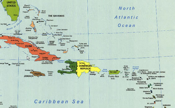
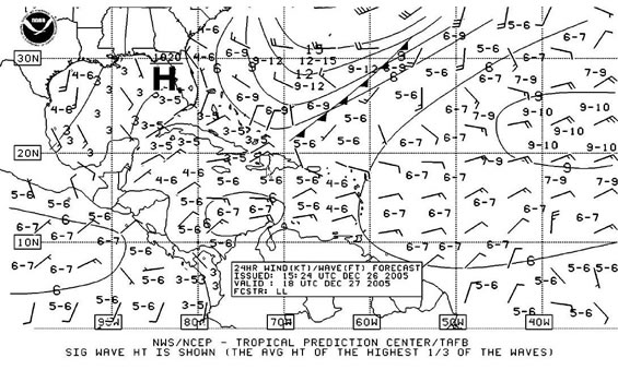
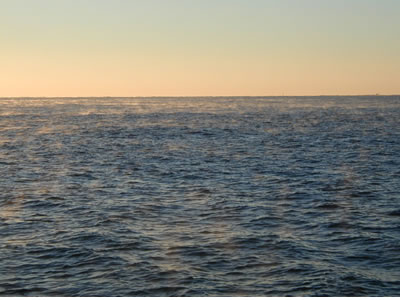
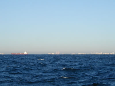
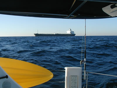
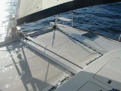
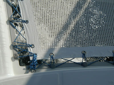
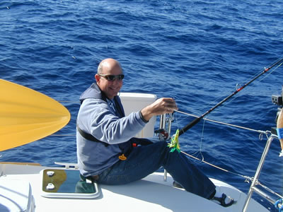
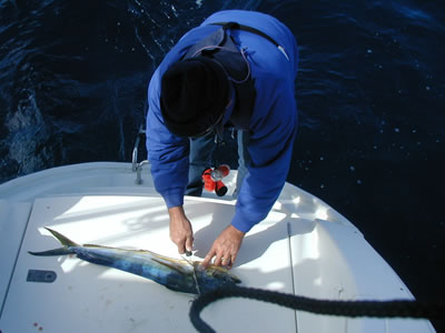
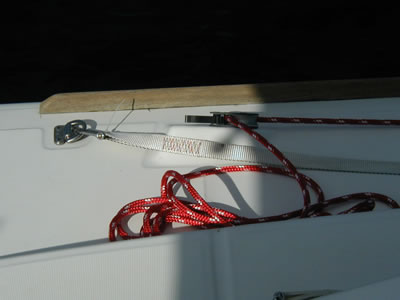

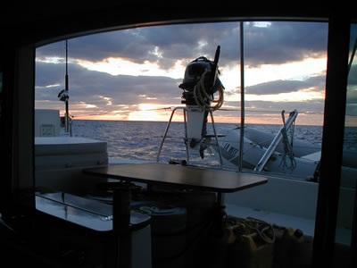
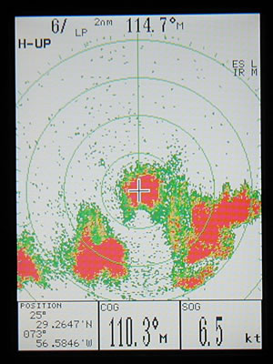
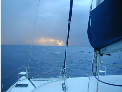

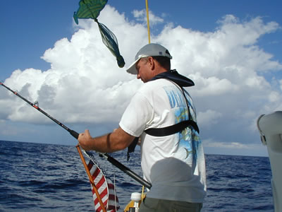
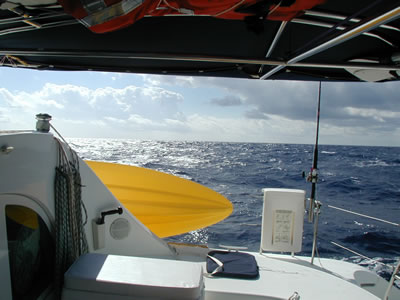
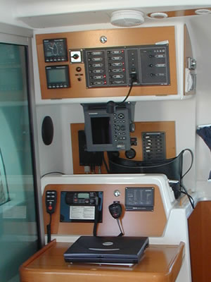
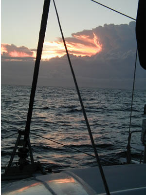
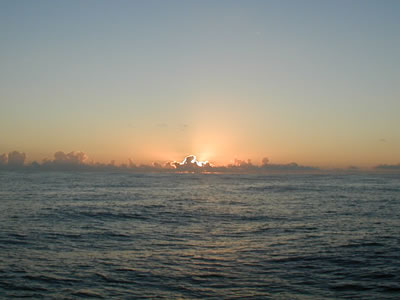
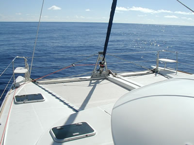
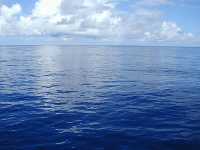
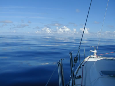
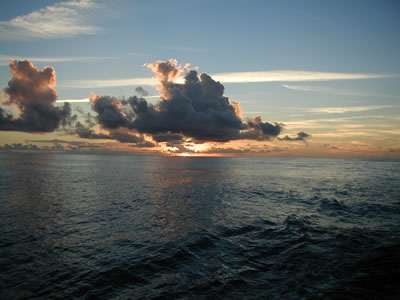
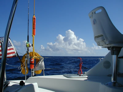
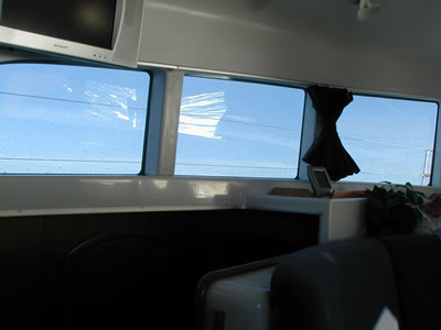
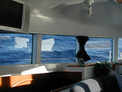
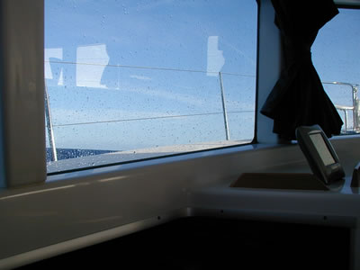
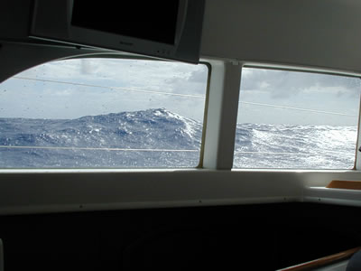
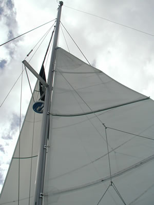
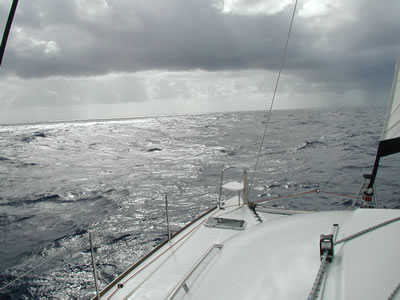
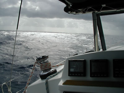
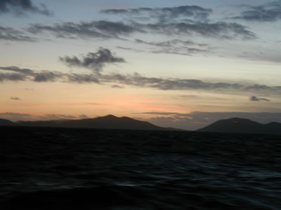
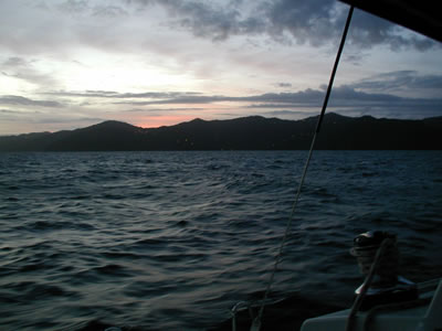
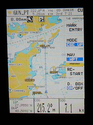
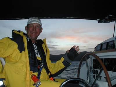
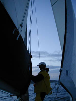
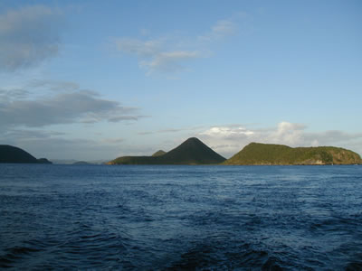
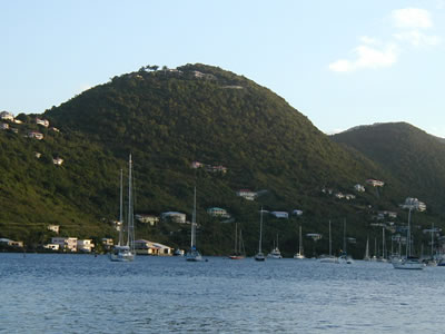
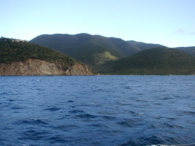
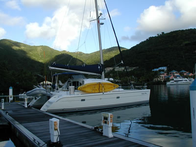
|
![]()