
| ||||||||||||
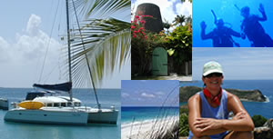
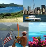
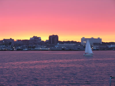
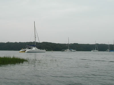
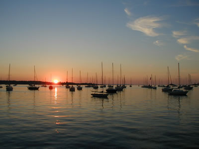
United States East Coast - Part One WE HAVE MADE IT TO THE CARIBBEAN! Our route covered over 1130 miles in the open Atlantic Ocean non-stop for seven days from Ft. Lauderdale, Florida, to the island of Tortola, B.V.I. We are currently "on vacation" big-time, with all boat work and maintenance strictly on hold for a few weeks while cruising in the British and U.S. Virgin Islands. For now, we're "living the dream” as they say and loving it! As I wrap up the final editing on this edition, it is sunset and we are moored just off Turtle Point in Caneel Bay at the Island of St. John, U.S.V.I. This spot is very special to us, because on April 22, 1997, Melissa and I were married right here at Caneel Bay on the lawn of Turtle Point. We had no idea back then that in less than nine years we would be moored here on our own catamaran. Unbelievable! In fact, right now I am sitting in the cockpit and looking west a few miles across Pillsbury Sound. The sun has disappeared behind the mountains of St. Thomas. Against the orange and purple twilight sky, the mountains mimic black velvet and the island's lights sparkle like a thousand loose jewels were sprinkled upon the velvet peaks. The water is calm and the reflection of St. Thomas and its "jewels" is dancing gracefully upon the surface of the Sound. So purely pleasing is this sight, one can gaze upon it with full heart for hours. It’s a magical time for us as we enjoy the satisfaction of having achieved many goals to get this far. Neither does it hurt our feelings to be living in bathing suits and basking in the sun while enjoying upper eighty degree weather in paradise during January! In short, all is fantastic here! We plan to spend quite a while "vacationing" in the Virgin Islands before heading south on a tour of the Caribbean Archipelago. Our trip this season will hopefully lead all the way to the northern coast of Venezuela where we plan to spend four months of the hurricane season this year. After that, who knows? We have abandoned deliberating about long-term plans, time tables and predispositions about destinations. All such previous efforts proved useless. Thus, we will simply let the months and years unfurl naturally. Like a leaf in the breeze, we will see where each day brings us as we continue to drift and skitter across the water. Looking back, we’ve covered thousands of miles and seen and done quite a lot since our prior report on the Southern Bahamas. During the six months of hurricane season, we sailed from southern Florida to Massachusetts and back! Upon our return to Florida in November, we hauled the boat out at Lauderdale Marine Center and performed a month of upgrades, improvements and maintenance. Then, on December 27th we set sail from Ft. Lauderdale and arrived in the British Virgin Islands seven days later on January 3, 2006. As such, just the two of us spent both my 50th birthday (on December 29th), and New Year's Eve hundreds of miles offshore in the Atlantic while making that passage. So, now that you're up to speed on where we are now, let's cover a lot of seaway and catch you up in the trip log department. Initially, we were going to post the entire six-month east coast report in one segment, but it's way too long. So, we will break up the east coast trip into two reports (probably still too long anyway, but hey, as I've said before -- just look at the pictures if you're in a hurry -- we won't be offended at all). Anyway, the first half of the east coast report is produced below. The second half will follow in a couple of weeks. So, here we go. By now, you know the drill: grab a drink and a snack and turn off the cell phone if you want to have any hope of making this a non-stop passage! Ready? Let’s slip those lines and get underway! Ft. Lauderdale, Florida to Norfolk,Virginia Upon our return to Ft. Lauderdale from the Bahamas in June, Melissa and I planned to re-provision and head north quickly to escape the then upcoming 2005 hurricane season. Indigo Moon, however, needed routine maintenance after a sixteen week journey through the Bahamas. Ft. Lauderdale is now our provisioning and maintenance port of choice. We enjoy the area and have made wonderful friends there. Moreover, with the plethora of superb marine services at hand, it is the best place to work on the boat. As such, upon our return from the Bahamas we decided that Ft. Lauderdale was the logical place to look for dock space and spend a month or so attending to several boat tasks, as well as flying to Baton Rouge, Louisiana, for a visit with family and friends. In the “small world” department, turns out we found a Ft. Lauderdale dock to rent at Gateway Terrace Apartments, a large retirement community located directly on the Middle River. Just so happens, while shopping for catamarans three years ago, Gateway Terrace is where we first saw a Lagoon 380 in person (Shannon Marie) and where Melissa declared after an inspection of Shannon Marie that she had finally found “our boat”, meaning she would be willing to live on a Lagoon 380. We made an offer on Shannon Marie, but the owner would not negotiate. We then contacted The Catamaran Company and pursued a newer Lagoon 380. We quickly closed a deal and the rest is history. Life really is a circle. We found ourselves right back at the exact location where we first set foot on a Lagoon 380. We had a lovely time at Gateway Terrace. Though perfectly maintained and landscaped, it's an old complex of typical south-Florida cinder-block construction. The population is diverse. There is a Baroness living there. One gentleman sits by the pool everyday and looks out across the Middle River at the ten million dollar mansion he used to own. For other retirees, the little efficiency apartments are the most opulent accommodations they've ever lived in. If you want to engage the "social scene" at Gateway, just go do laundry! There are three different laundry rooms at the huge complex. Senior ladies and gents show up neatly dressed and ALL are eager to tell you their story -- and tell even more stories about whomever just walked out of the laundry! All of them had great tales to tell and, of course, they enjoyed having us "youngsters" around for a month as a fresh audience .
Hurricane season begins June 1st. We were still in Ft. Lauderdale and solidly into July, all because we had not been able to timely tear ourselves away from the striking beauty of the waters in the southern Bahamas. Thus, we felt as though we were flirting with hurricane disaster and made earnest efforts to expedite our tasks. We departed Ft. Lauderdale on July 17, 2005. Destination: Beaufort, North Carolina. The trip would require a three day offshore passage in the Atlantic while taking advantage of the favorable northerly currents of the Gulf Steam at speeds of up to four knots. We departed Ft. Lauderdale via Port Everglades on a perfect day in July.
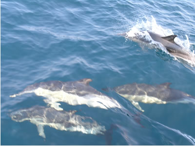
Melissa and I were re-energized and are happy to be underway on a new leg of our adventure. The offshore weather forecast was good enough, but there was a chance of scattered showers. We decided to take alternating watches of 6 hour durations, twenty four hours a day. I like the "dog shift" of midnight to dawn, so we worked around that. I now call our "six on six off" watch schedule “six and six and take your licks!” Before heading out on this passage, with just two of us aboard, we decided it would be a good idea to kick our personal safety gear up a notch. We added new harnesses and gear to our arsenal. The new harnesses have a life vest built in that inflates by a CO2 cartridge when a handle is pulled. To each harness/vest we added a personal strobe light, a bright orange inflatable "safety sausage" to wave (five foot long and five inch wide tube that is flat and rolled up tight when deflated -- exactly like the party favors that you blow through to make the strip of rolled up paper shoot out like a lizard's tongue), and a STORM brand whistle - the loudest whistle you have ever heard. The rule: if you are outside the cabin, however briefly, you MUST be harnessed in with all gear and tethered to the boat at all times. The greatest offshore danger by far is not rogue waves, or the Perfect Storm, or sharks, or pirates, nor all the other scary stuff folks mostly daydream about. Rather, far and away the greatest threat at sea is the simple accident of falling overboard while other crew members sleep, or do not notice the fall, etc. It takes seconds, not minutes, to lose sight of objects in even moderate seas. We have experimented, sailing right by large debris at close range and then averting our eyes away for just thirty seconds. In all but one case, we were never able to spot the debris again - and I still have 20/15 long-range vision in both eyes. Accordingly, we have a very healthy fear of going overboard. And so, tethered in and bristling with safety gear we began our watches. It always takes me a few days to settle in offshore. Melissa never has trouble sleeping, but I am always too “wired” to sleep soundly for the first 24 hours on a passage. Plus, at first I tend to stay up too long during my off-watch hours. Eventually, a mild exhaustion kicks in and I start sleeping soundly. Once offshore, we started hunting. The prey: fast-running center of the Gulf Stream Current heading north. If we find the “sweet spot” of the current, we can pick up several knots and significantly shorten our passage to Beaufort. It’s not long before "old friends” show up: Dolphins!
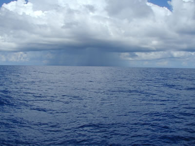
A mid-afternoon rain shower developed directly in our path. No lighting, no billowing cumulus cloud tops, just a healthy little rain shower. We did not alter course and saw it as a chance for a fresh water wash down of the rigging and decks. We reefed the sails to reduce our sail area and experienced a few wind gusts up to 28 knots while sailing directly through its center, enjoying a good shower. Heavy rain on the waves makes a very beautiful sight. Hard to describe, the rain gives the surface of the sea a soft, smoky look. The rest of the day was uneventful as we made our way north.
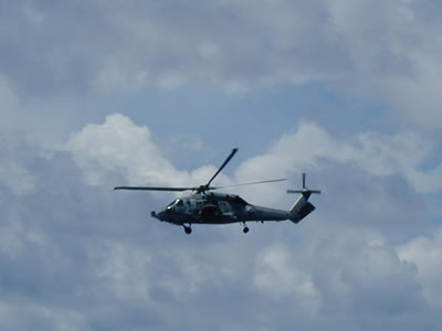
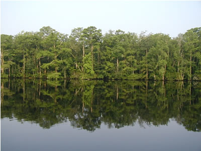
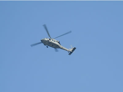
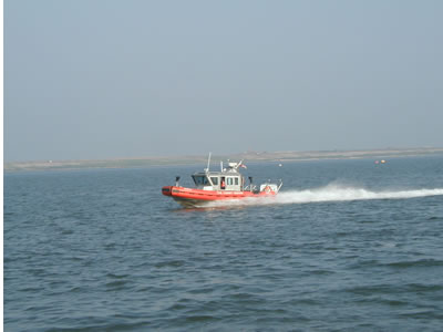
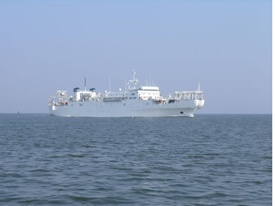
Our second day at sea was perfect. The Atlantic Ocean was very calm. The ocean was a brilliant cobalt blue, contrasted by bright white cumulus clouds. We raised full sails in the warm air and bright sun. Melissa and I have gotten better at recognizing perfect days when they appear. When we first began cruising, we were often preoccupied with getting projects completed, getting to the next destination, or worrying about whatever. In hindsight, we realized we did not pay 100% attention to the “perfect days” we were leaving in our wake. Nowadays, we try to recognize those perfect days instantly as they present themselves (often unexpectedly), and completely immerse ourselves in the experience while putting all else on hold. This was just one of those perfect days. It was late morning when I first heard a Warship transmitting on the VHF radio. This was new for me. We don’t have much Warship traffic in Louisiana, or the Gulf of Mexico. It dawned on me that, as a civilian sailor, I never before encountered a Warship at sea. (Of course, as an Operations Specialist in the U.S. Navy in the early seventies, I had lots of Warship experiences while on active duty at sea). I started to listen carefully. The Warship was calling other vessels within ten to fifteen miles of its location and warning them to stay clear by at least two miles. We were over a hundred miles offshore, about due east of Savannah. As I listened to several conversations over the next hour, the coordinates discussed continued getting closer and closer to us. In the meantime, a Navy helicopter showed up and circled Indigo Moon so closely I could see the whites of the pilot’s eyes. I called Melissa up on deck and we waved as if to say “hey y'all, it’s just us!” The helicopter turned away and flew low over the horizon.
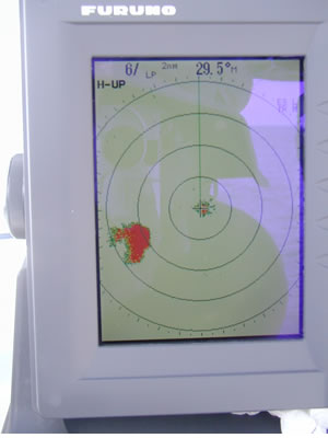
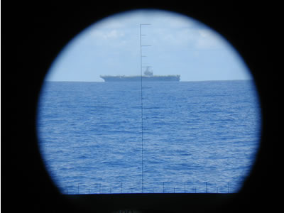
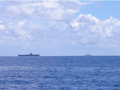
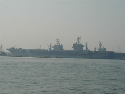
More time passed and sure enough the call came: “Vessel located at (latitude and longitude), this is Warship Seven One.” I looked down at the GPS and it’s me! I can’t see any ships, or anything else on the horizon, though. I answered: “Warship Seven One, this is 38 foot sailing catamaran Indigo Moon, over. Warship Seven One responded: “Roger, Indigo Moon; we are currently on a collision course with you, but Warship Seven One will deviate ten degrees to starboard. So, maintain your present course and stay clear – at least two miles off our port beam – we are conducting operations.” I answered: “Roger Warship Seven One, I will comply. Indigo Moon, out.” And just take a wild guess at what came over the horizon! Warship Seven One is the nuclear powered Aircraft Carrier USS Roosevelt. What a rush!!! Now we can say that the Roosevelt deviated course for little Indigo Moon to pass by. We got a chuckle out of that. Much to our delight, the Roosevelt began launching jets – lots of them. We had a free air show. As this continued, I noticed a plane off our stern, very far away and very low on the horizon. Flying ridiculously low, it got closer, and closer, AND . . . . SKEEEEEROOSH! About 100 feet off the deck and at several hundred miles per hour, the "F-Series" fighter jet rocketed right by us, more missile than airplane. The sound was so loud it was if the earth had just been ripped in half. Two years ago, Melissa gave me some really neat Nikon binoculars that have a compass built in, along with horizontal and vertical scales that you can see in the field of view and use as ranges to estimate distances. Seeing the Roosevelt through these binoculars reminded me of the old "periscope” submarine scenes in WW II movies. Just so happens, the lens of my little Olympus digital camera fit snugly into one of the eyepieces of the binoculars and, viola, a “periscope” shot.
As the carrier got closer, we saw that it was escorted by a couple of cruisers, one a foreign Spanish-speaking vessel that we determined (by eavesdropping on the VHF radio) was a guest to observe flight operations.
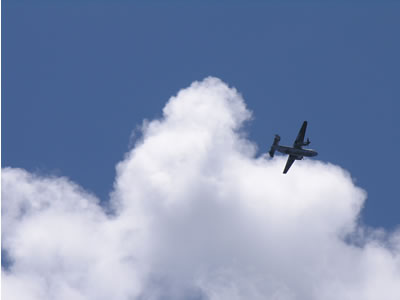
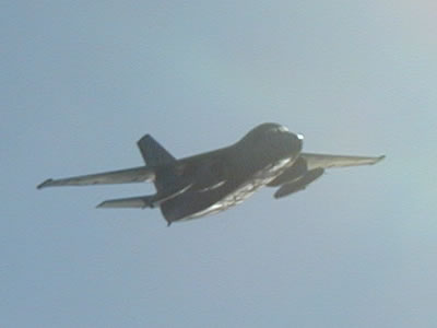
Many different types of planes began taking off and flying various patterns around the area, close enough for us to capture shots of them without a zoom lens.
At one certain moment, we counted eighteen planes in the air surrounding us. We had a great thrill seeing all of that. The jets kept sneaking up on us about every thirty minutes all afternoon! At one point during my watch in the early afternoon, while Melissa was sleeping soundly on the salon couch, a jet snuck up from behind and hit the gas right by us. So close and so loud, it caused the whole boat to shudder. I didn't see it coming. The sound, louder than any rock concert and as sudden as an explosion, caused Melissa to jump up and run out of the salon so fast that, for an instant, I thought she was going to keep running and jump ship! Once we caught our breaths, I told her it was a shame her nap was interrupted. She said she didn’t even know she was sleeping. In fact, she could not remember anything at all about what she was doing just prior to the “attack.” It badly scared us every time. A fighter jet lighting its afterburners within a few hundred feet of you is just not a sound you can prepare for, or ever get used to. And it was not my first time at that “rodeo.” They know what they are doing. Pilots gain lots of speed and altitude far away and then glide down right near you. It's like putting your car in neutral and coasting down a hill with the engine idling. The victim hears NOTHING coming. With the skill and timing of Indy Car Drivers, the pilots see how close they can come to you and then they "pop the clutch" and hit the gas at full throttle. I told Melissa about my time as an Operations Specialist and Enlisted Man, on the USS Richard E. Byrd DDG 23 during the early seventies. At sea, it was common for the F4 Phantom jet pilots to glide in silently to within a few hundred feet of the ship and then rocket straight up with afterburners maxed out. I figured it was sphincter training – to toughen us all up in case the enemy had one of those alleged low frequency weapons that caused the enemy to “fudge their undies.” We discussed the fact that the jet blast is the last sound many casualties of War hear as a bomb or bullet bores in on them. A sobering thought. All in all, our chance meeting with this fleet of Warships was quite intimidating and I can’t imagine how terrifying it would be to have the US Military after us in earnest. I also explained to Melissa, much to her dismay, that our sails were a big white speck on the endless blue sea and that we were obviously a sole, irresistible focal point upon which gun sights could be set by fighter pilots. I caught one of the slower perpetrators. (maybe doing only 200 knots instead of 600 knots). My pal Dave Reeves claims the pilots were exercising their “visual liberties” and hoping to see a pretty girl sunbathing nude, etc. I don't know how good a look you can get at 200 knots, though.
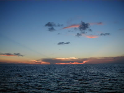
We continued to listen to the VHF and late in the day we heard a “Navy Oiler” calling the Roosevelt. Sure enough, a very large Navy fuel ship rose up on the northwestern horizon and passed us headed southeast and out to sea toward the Roosevelt (which had long disappeared over the horizon in that direction). Surely the fuel bill was pretty big that day. We speculated about how much money per hour it costs an aircraft carrier to conduct an air show at sea. As the sun set, we were ever so grateful for one of the most perfect "ocean" days we have ever experienced on Indigo Moon.
The hunt for fast Gulf Stream currents continued into the night. We had been gaining a couple of knots here and there, but at about 1:00 a.m. I finally hit the “sweet spot” and we were doing over 11 knots as opposed to our usual speed of about 7 knots!
It was not long before the sun started to come up and with the help of the Gulf Stream we were really clicking off the miles!
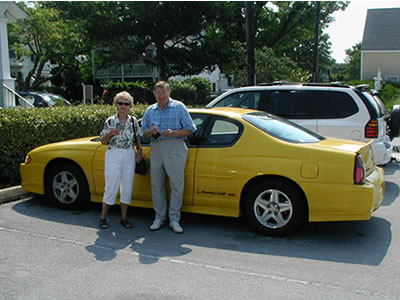
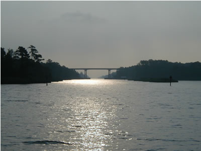
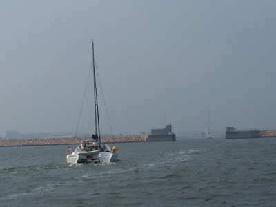
It took us three days to reach Beaufort, North Carolina. It was a logical destination in that it is the last chance to duck inside to the Intracoastal Waterway south of Cape Hatteras. It is actually a shorter distance to use the Intracoastal and go on the “inside” past Cape Hatteras. As an added bonus to the shorter distance we would also avoid the notoriously dangerous seas that develop in the shallow shoal-ridden waters off the Cape. Plus, it would be nice to take a break from the three days of six on and six off. But, we had an even better reason to make landfall at Beaufort, NC. My step-dad, Carl Custer, now lives nearby at Emerald Isle with his new wife, Lee. Carl married my mother, Marion, in 1983 and was a wonderful husband to her and step-dad to my sister, Anne, and me. Marion died of Alzheimer’s disease in 2001 and it was a very tough time for all of us. After mom’s death, Carl relocated to the Carolinas and we are happy that he has remarried and started a new and rewarding life there. In order to make landfall at Beaufort during daylight hours, though, we had to slow down. Just after dawn, we entered the ship channel at Beaufort and got a slip at the City Docks. It was a great reunion with Carl and Lee. Now mind you, Carl is 89 years old, but he drives a new, yellow Monte Carlo SS (and still has his golf clubs in the trunk). I told him that if I was alive and could find the T.V. remote control at 89, I’d consider it a miracle.
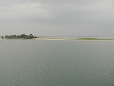
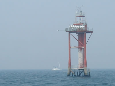
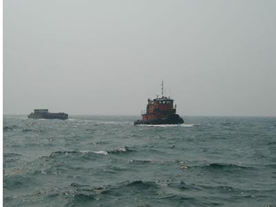
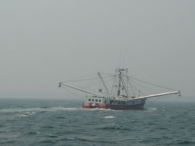
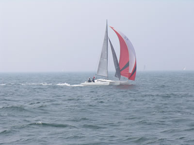
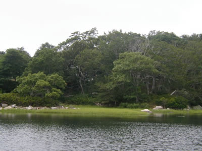
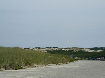
We spent a couple of days at Beaufort and promised to spend more time with Carl and Lee on our return trip south. Wanting to distance ourselves further from hurricanes and 90 degree weather, though, we headed up the Intracoastal to Norfolk, Va. I had only heard/read about travel on the east coast's Intracoastal Waterway ("ICW") prior to this, so this would be our first experience at true, long distance ICW travel. Here are some scenes from our first day on the ICW headed north from Beaufort:
It took us three days to reach Norfolk. We did not run the Intracoastal at night (nobody does except commercial tug and barge traffic), thus slow going is the disadvantage of traveling on the inside as opposed to offshore sailing 24 hours a day. Mid-afternoon on a hot and sunny summer day, about five miles from Elizabeth City, we encountered the most violent and terrifying thunderstorm I have ever experienced on a boat (and being a Louisiana Cajun where a bad thunderstorm happens almost every afternoon in the summer, that’s saying something!). And, from reading my prior trip reports, you KNOW how I HATE lighting! This storm was so bad the Coast Guard issued a VHF radio “Securite” (pronounced Securi-tay) to mariners warning them to steer clear of this very dangerous storm and seek shelter immediately. Unfortunately, we had no choice but to stay our course. In a large body of water at 7 knots, there was nowhere to run and nowhere to hide. The thunderstorm was huge, gaining speed and closing fast from the east. Ironically, we were right offshore from the largest Coast Guard Air Station in the U.S. The fierce clouds rolled in and blacked out the bright afternoon sky. It was night-time dark when the storm hit us dead-on. Steady bursts of 50 knot winds drove solid sheets of rain at us. Monster lightning strikes exploded every eight seconds or so. I have never seen lighting strike repeatedly so close and so fast. I still cannot fathom how we were not hit: 60’ of mast if you include our VHF antenna; nothing else on the open water but us; and, all that lightning surrounding us. We had already donned full foul weather gear and secured the sails (and everything else), before the storm reached us. Thus, the Coast Guard warning was not without at least some utility to us. With navigation lights on and using radar, GPS, and the autopilot so as not to touch the metal wheel, we motored very slowly toward Elizabeth City. For 45 minutes, with little or no visibility whatsoever, we gritted our teeth while Indigo Moon faithfully clawed ahead as the lighting danced and sheets of rain came down. By the time we got to the City Dock at Elizabeth City, about an hour later, you could have dropped a feather and it would have drifted straight down to your feet. No breeze, no rain, no lightning -- just happy crickets chirping and the sweet smell of clean air and rain soaked St. Augustine lawns. I kissed the first piling I got a rope around! From Elizabeth City we planned to proceed the next day through the Dismal Swamp to Norfolk, an alternate route instead of the Intracoastal that is allegedly more wild and picturesque. At the crack of dawn we made our way inland and upriver past Elizabeth City toward the entrance to the Dismal Swamp.
We had not quite made it to the entrance of the Dismal Swamp when my cell phone rang. It was Dave Reeves aboard the 43 St. Francis catamaran ZING. Just so happened, he was a day ahead of us and already in the Dismal Swamp headed north too. His advice: “It’s terrible; it’s way too narrow for catamarans; we are bumping logs; we are dodging trees with the mast, and for miles and miles it’s the same. We would have turned around but we've gone too far, hoping it would get better. Now, it would be farther to turn back than just keep going!” Oh great! We braved a terrible storm, spent a day to get to Elizabeth City, and would now have to spend another day to get back to the ICW. Oh well, we need not see the Dismal Swamp anyway. Being Louisianans, we are already as "swamp savvy" as they come. After thanking Dave for calling in the nick of time, and wishing ZING better luck ahead, we turned around and made our way back to and up the ICW. We spent the next night at Coinjock Marina, actually not a "marina" but rather a long seawall dock right on the banks of a straight stretch of the Intracoastal. There is a pretty good restaurant at Coinjock, specializing in Prime Rib.
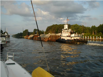
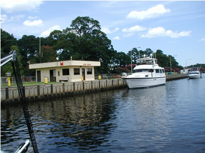
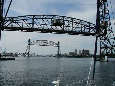
From Coinjock, we were within an easy day’s trip to Norfolk, Va., where ZING had already arrived, being mercifully spat out of the north end of the Dismal Swamp and back into the Intracoastal just south of Norfolk. We were excited, because from Norfolk we would be heading back offshore for the next leg of the trip to Massachusetts. After having spent several days in the ICW, we quickly realized we absolutely prefer offshore passages sailing 24 hours a day and are not cut out for "day traveling" in traffic-clogged canals to get somewhere; to sightsee at a snail's pace maybe, but not to make time and distance. Nonetheless, we are always open to new experiences and it was interesting making our way up the ICW for the first time. We went through the Great Bridge locks south of Norfolk. It’s the first time I ever went through a lock system with Indigo Moon and it was fun.
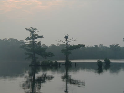
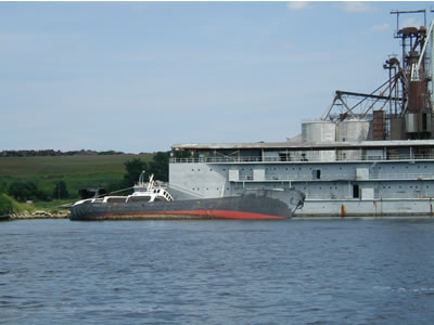
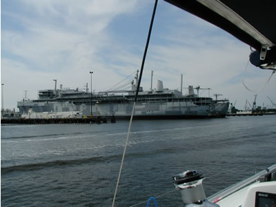
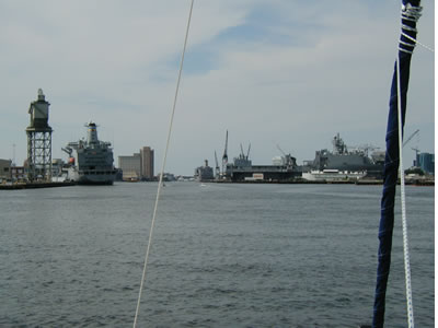
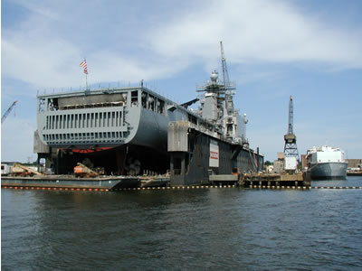
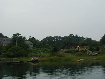
Once through the locks and approaching Norfolk, the waterway quickly became industrial. Norfolk is a huge port with major shipyards and the Navy base where I was stationed in the early 70’s. I had not been back to Norfolk since about 1974 and it was strange to see it again. More than thirty years had passed and it seemed that my memories of Navy service had just about faded beyond specific recollection. But, surprisingly, many remembrances were sparked as we passed the shipyards and Navy docks. I was only seventeen and a high-school drop out back then. It was a tough transition for a troubled teen, but the discipline of the Navy surely helped get me back on track. The old "what doesn't kill you makes you stronger" theory, I guess. Here are some scenes from our approach to Norfolk:
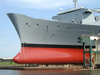
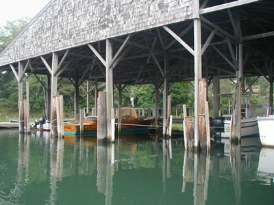
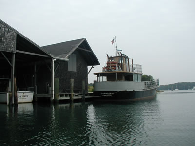
One of the most amazing things I witnessed during my Navy sea duty in the early seventies was an exercise using a decommissioned ship (much like these pictured), as a target to be sunk a few hundred miles offshore in the Atlantic. As part of a fleet of about twenty ships, we steamed single file and took turns firing guns and missiles at a welded up old Navy ship about five miles off our beam. Even the internal hatches were welded shut to make them harder to sink. On our ship, we took turns looking through the “Big Eyes” (high powered binoculars on the signal bridge). While I got my turn at a look, I saw one of our missiles strike the bridge of the target ship. The impact of the missile crumpled and instantly pushed the ENTIRE bridge of the ship below decks. A split second later the missile exploded and the ENTIRE bridge flew back out in huge pieces that soared at least a hundred feet in the air. Hmmm . . . as an Operations Specialist Radar/Navigator, I worked in the bridge of our ship. I figured if we ever took a hit like that, we would not feel a thing! It was simultaneously spectacular, amazing, cool, and utterly horrific to see. As Melissa and I maneuvered Indigo Moon past the Navy docks, that particular Navy memory and a thousand others, good and bad, came flooding back. I remembered too, for example, the mid-morning I arrived at Norfolk for sea duty and set foot aboard the USS Richard E Byrd DDG 23 for the first time. A skinny, scared, shy 17 year-old kid at the time, I lugged my sea bag up the gangplank to be gruffly acknowledged by a young, very tall, very muscular African/Asian American on watch. I would later learn that his nicknamed was "Jap" because despite his extremely dark complexion, he had purely oriental eyes. It was a striking combination. With not a hint of a smile, "Jap" ordered another enlisted man nearby to guard the gangplank and instructed me to come aboard and follow him. He led me, sea bag and all, back to the stern rail at the fantail of the ship where it quickly dawned on me that we were all alone and for no particular reason. Odd to say the least. With another stern glance my way and no remarks, Jap reached deep into his dungaree jacket pockets. He pulled a piece of bread out of one and a bottle of TABASCO out of the other. In workmanlike fashion he began soaking the bread until the whole surface of it was "gravy sopping" saturated with bright orange TABASCO. I quickly assumed this was a "hazing of the new guy" underway. I was sure I was about to be ordered to eat the TABASCO bread. It was clearly an advantage, I thought, to be a Louisiana Cajun. Although this would be a bit extreme, I've been conditioned to handle high-amperage spicing! With all his preparations complete, Jap gave me a big smile (for the first time) and said enthusiastically: "WATCH THIS!" He sailed the bread high into the air at a 45 degree angle against the breeze, all with the skill and grace of a Frisbee champion seeking maximum altitude. Expertly handled during the launch, the bread held together. As its ascent slowed high in the sky, several seagulls attacked the flying TABASCO bread and quickly gobbled all the pieces down in mid-flight. About a nanosecond later, the gulls folded wings and dove straight for the water and crash-landed. They began squawking and drinking and squawking and drinking. Jap slapped me on the back so hard he knocked me onto my sea bag. Barely able to speak through his laughter, he spurted out: "Hey man, did you see that shit? Hooo Weee! Is that shit cool or what? Them sum-bitches' mouth is a burnin' now! Heeeeeee!" This was obviously no fun for the gulls, but I admittedly had no immediate remorse for them whatsoever. I was only thinking better them than me at the time. After that, Jap showed me to personnel and I reported for duty. He was a good friend. The ship had scores of crazy characters on board. And I would fit right in! It was all quite an education in its own right. As Indigo Moon made way up the river, I began remembering plenty about the Navy! Here are some more scenes from Norfolk:
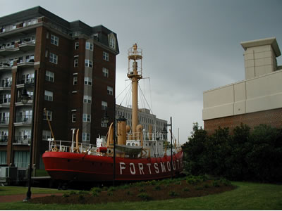
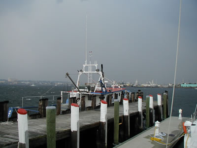
In no time, we arrived at Waterside Marina, on the banks of downtown Norfolk and across the river from Portsmouth. It was a great place to be, within walking distance of a nice mall, theater complex, post office and restaurants. The Reeves (Dave, Jan and Lauren) on ZING were already there and it was a fun reunion! Upon our arrival, Dave treated us to a meal at Outback Steakhouse -- WOW, thanks again, Dave! We had a good time with the Reeves exploring Norfolk, Portsmouth, and getting ready to head north to Massachusetts.
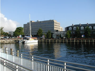
One of the cruising secrets we found was that the Portsmouth waterfront has public docks that are free (with wireless internet, no less). Despite having signage indicating “no overnight docking” we (and a few other boats) docked overnight for almost a week and no one seemed to care. No power and water, though, so we ran the generator.
While staying on the City Docks at Portsmouth, I thoroughly enjoyed coffee and fresh muffins every morning at the Starboard’s Coffee Kiosk, where I had fun chatting with the ultra-nice owners and local patrons. It was a very friendly place to be. Things have changed dramatically since I was stationed in Norfolk thirty years ago. At that time there were signs that said “Sailors and Dogs, KEEP OFF THE GRASS.” The locals seem a lot nicer now and the attitudes of the past have apparently disappeared.
On a different note, military security was very high in Norfolk. Understandably, armed patrol boats made rounds and made sure no traffic approached any of the Navy's interests.
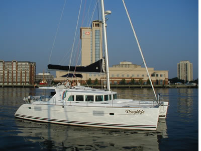
Melissa and I were only a couple of days away from leaving Norfolk. For the most part, we were waiting for a favorable weather window to make our offshore passage from Norfolk directly to Buzzard's Bay and Fairhaven, Mass. In the meantime, we rode the $2 ferry back and forth to Norfolk and visited ZING, went to the movies and hit the summer sale racks for bathing suits at the mall. I bought five nice designer bathing suits (Polo, Tommy Hilfiger and such) for $100.00 total -- that should last me five years! No longer fearful of being in the 'hurricane zone', we had a new incentive to move north. It was late July and Norfolk was experiencing record high temperatures of 100-plus degrees. Indigo Moon managed to keep cool enough, but it took all 30,000 BTU's of air conditioning running at full throttle continuously to keep the inside temp in the seventies! It was miserable outside and we were looking forward to cooler temperatures in New England. ZING was not heading to New England. They were staying at Waterside Marina for a month to make a new trampoline and perform other maintenance, including the replacement of their boom that broke while we were sailing with them in the Exumas. Thereafter, they planned to cruise only in the Chesapeake Bay. We had gone over to say goodbye to ZING when we saw that a new Lagoon 440 catamaran had arrived in the Waterside Marina. Much to our surprise, Captain Scott Vanerstrom (who helped me deliver Indigo Moon to New Orleans after I bought it) was aboard and had just helped the new owners, Larry Grant and his fiancee, Ulla Kristensen, bring the boat around Cape Hatteras to Norfolk. The Lagoon 440’s mast is 70’ high and cannot make it under the 65’ bridges that span the Intracoastal. Thus, they could not sneak past Cape Hatteras on the inside as we did. We all went to dinner and it was not long into the conversation that we encouraged Larry and Ulla to “buddy boat” with us up north. Larry and Ulla had not done any multiple day offshore passages by themselves yet. In fact, Larry and Ulla originally bought the boat with neither he nor Ulla knowing how to sail. That's guts! They are great folks with a "do or die" spirit. Having sold their welding company, their home and ranch, and moved aboard, they planned to learn as they go. Their boat is named Roughlife – a great “tongue in cheek” name considering they have everything you can imagine onboard their 44 foot catamaran. They enjoy all the comforts of luxury land-based living and then some. We told them that if we can make it to Massachusetts offshore on our 38 footer, then surely they can make it on their 44 footer. Plus, how could they NOT go to New England, New York City and all the other cool places above the Chesapeake?! It didn't take much convincing. Instant friends, Larry and Ulla decided to head north with us to see the sights. And so, such is the essence of the cruising life. A chance meeting started an adventure together that would take Indigo Moon and Roughlife on a wonderful trip together all the way to Cape Cod and back. Norfolk, Virginia to Buzzards Bay, Massachusetts Having finally received a good weather window, we cast our lines on August 3 and began our journey.
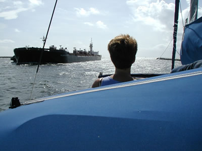
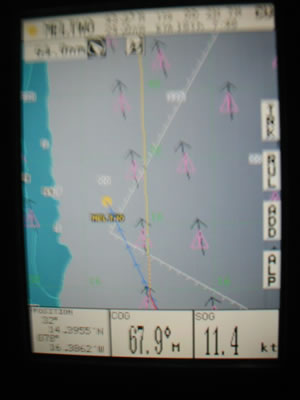
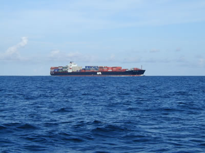
For two days we motor-sailed north toward Buzzard’s Bay, Massachusetts. Roughlife, at 44 feet, has more engine horsepower and waterline and is a significantly faster boat than Indigo Moon, so Larry ran on one engine and adjusted his speed to match mine. We had a couple of interesting nights. With no moon at all, nights were very dark and radar was our best friend. The first night was spent traversing the deep waters off Cape May, New Jersey. There was a big fishing fleet out in numbers. Also, there is a strange custom in the waters off New Jersey: the fishing boats make damn sure they DON’T display ANY navigation lights. All you see are a few white deck lights, making it impossible to visually determine what course the fishing boats are on! Then, to kick it up a notch, several times I changed my course to avoid a fishing boat (that I was also monitoring on radar), and the fishing boat would immediately change course too, remaining in my way. It had to be a form of sport for them. Around midnight, after a near miss, Larry began spotting unlighted, uncharted fishing buoys. These buoys, constructed of 12 inch diameter PVC pipe, jutted out of the water a good six feet. I started seeing them too. And this is in 200 feet of water, so I can’t imagine the utility of the buoys. As such, in addition to improperly lighted fishing boats, we had to watch out for unlighted fishing buoys! You could just barely see them in the dark, mostly after passing them. Oh, and let’s not forget to look for a DEAD WHALE floating on the surface as well! Believe it or not, the Coast Guard issued a VHF "Securite" call on a dead whale right in the proximity of our rhumb line. You think running over a skunk in a car is bad? Just think of what it would be like to sink both bows of Indigo Moon into a rotting whale at seven knots. Yuck! Unlike monohulls that have a chance at grazing and sliding by obstructions, catamarans can be severely damaged if an obstruction is struck by the front crossbar of the cat. Luckily, we made it unscathed through the "hostile Cape May fishing fleet gauntlet" and "the dead whale zone" too. But the most challenging night was yet to come. There are three, major well-charted Shipping Lanes emanating from New York City and the Hudson River out into the Atlantic Ocean. Fanning out eastward, the lanes are aligned in the direction of major offshore routes to destinations such as Europe, Africa and to the South toward the Caribbean and South America. For a fun and exciting night watch, and to hone you radar and plotting skills, I suggest you cross all these lanes with no moon! Indigo Moon and Roughlife, like ducks waddling across the freeway, crossed all three lanes in total darkness and encountered significant and speedy ship traffic. It was good experience. My Furuno radar performed flawlessly and I had no trouble keeping up with the targets and tracking them. Larry has a Raymarine radar system with fancier software. His unit will calculate the course and speed of targets on its own, and it will automatically warn of collision situations. Ships have running lights with the customary red light on the port side of the bridge, green light on starboard side of the bridge, and two white mast lights -- one atop the wheelhouse aft and one on a shorter mast at the bow. The aft light is significantly higher than the bow light. So, it’s easy to see what direction a properly lit ship is headed. With a night sky as black as tar, I relied solely on radar and the navigation lights of other vessels to navigate the shipping lanes without incident. I admittedly got too close for comfort to one ship, though. Roughlife had pulled ahead a few miles and was already clear of traffic. Headed north at seven knots, I tracked a ship headed southwest and coming my way in the northernmost Shipping Lane (the last one we had to cross). I could clearly see the port-side red light and the two white mast lights to the left. The shorter mast light was to the left and the taller mast light to the right. I studied the radar to make sure the bearing of the ship relative to me was changing as it should, indicating we would miss each other (if the bearing of the target does not change and range keeps decreasing you are on a collision course). All indications were that I was going to be able to beat it and cross its path before it got too close, much like beating a train to the RR crossing. I could see the ship’s mast lights getting more and more in line with each other as I kept my course. Then, (and this is the exciting part), the ship’s mast lights became exactly aligned and I could see both the red and green side lights, meaning the ship is coming dead at me. Range: 1.5 miles. It seemed an eternity until those mast lights began to spread out again and the red port light disappeared, leaving only mast lights and the green light on the ship’s starboard side in view. By the way, when the ship comes right at you, the distance between the green and red lights (mounted on the sides of the ship) indicates the beam of the ship. WOW, during the minute or so that the ship was coming right at me and I could see both lights, I was shocked by how far apart the colored side lights were. This ship is HUGE, and doing about 18 knots! As I heard the engines and smelled the exhaust of the passing ship, at less than a mile away when we passed, I felt like a kitten that just had the oil pan of a Chevrolet whiz overhead! That was the only "excitement" during our New York Shipping Lane passage. We had up to seven ships on radar screen at one time, but we managed just fine. And I didn't blame Larry for easing ahead a few miles; no need to linger in the middle of the Shipping Lanes! By the way, ships will not alter course and mostly don’t ever see us anyway from what I can tell. I have installed an expensive array of various radar reflectors high in our rigging to allegedly make us show up better on radar, but I think it's all questionable in terms of effectiveness. Perhaps tantamount to "whistling in the graveyard," though, the radar reflectors calm our fears somewhat. I would like to somehow verify how poorly we show up on a ship's radar, but I have not had any luck getting any freighter to respond on the VHF radio. Most of the big freighter captains/crew seem to be foreign and many can barely understand English (I hear them try to call the Pilot services in ports). Thus, we simply operate at all times with the understanding that ships will probably never see us, won't give a damn if they do, and that we will surely be run down and killed if we get in the way. After the “Night of Ships” in the New York Shipping Lanes, the sun rose as we closed in on the Massachusetts shore. At daybreak, we found ourselves facing New England’s fog, haze and another fishing fleet.
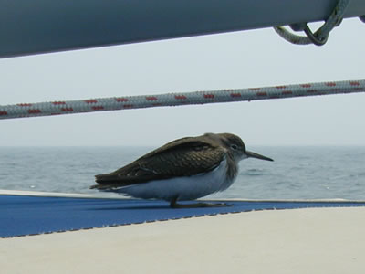
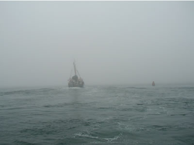
It was an eerie fog. We could see clearly for a short distance and then the haze/fog stopped our vision as if it were a solid fence far off. The sun was bright too and could be seen through the haze/fog. In Louisiana, if the sun is bright, the fog is gone quickly, but not here! This went on for hours and we again kept track of busy boat traffic on the Furuno radar. Birds may have an internal, natural compass that generally guides them on long journeys south for the winter, but they don’t have charts or radar. You can always tell when a bird is lost offshore and needs a rest. It will circle the boat two or three times, make a clumsy, botched pass at landing and then finally give up on anything graceful and simply skid-crash onto the boat. I always stay very still and let them catch their breath (and most of the time they go to sleep in less than a minute). We often get these little hitchhikers and let them sleep as long as they want to.
We finally reached one of the outer Channel Lights leading into Buzzard’s Bay. Although we felt as if we had arrived, due to adverse, strong currents it would take us many more hours to reach our destination: New Bedford and Fairhaven, Massachusetts.
Buzzard's Bay presented very strong currents, fog, and haze, none of which would let up. All sorts of commercial traffic and various tugs and tows were underway in this busy little bay. Literally, for one hour, I ran an almost parallel course with a small tug a tow, both of us fighting a fierce current against us and making only 3 knots.
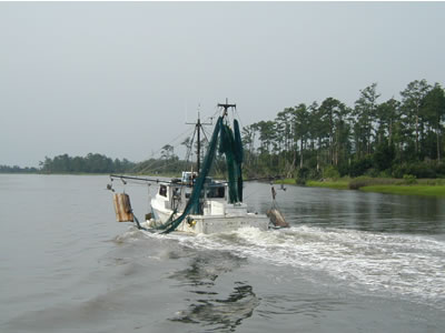
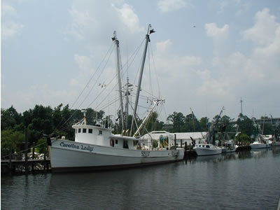
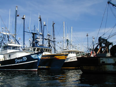
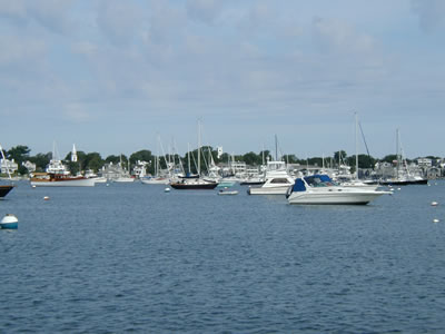
New Bedford hosts one of the largest fishing fleets in the United States, and large fishing vessels are everywhere. We encounter several on our way into New Bedford and Fairhaven.
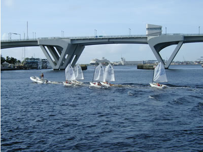
As we got close to the entrance to New Bedford, there was a huge series of regattas underway with several race courses being run simultaneously. Through the haze, we could see lots of action, with helicopters buzzing around taking pictures, etc. New England folks take yacht racing very, very seriously.
Considering he was now ahead of us a few miles, I called Larry on the VHF Radio to check in and see if he had decided on a route into Fairhaven. I asked him to switch and answer Channel 71 (designated a “pleasure” channel and legally a proper channel for us to "chew the fat" on). We talked about the New York ship traffic last night, about the regattas in front of us, how we were going to get into New Bedford, how it was still foggy, so foggy that Ulla thought a tugboat was a lighthouse a few miles back (and so did I) and. . yada yada. About two minutes into our "chat" the crankiest, shortest-tempered, worst “mean-old-bastard-sounding” race committee official I've heard in a while told us in brisk yankee accent to “GET OFF THIS CHANNEL!!!!! IT IS FOR THE RACE COMMITTEE ONLY!!!!!” His admonition was quickly and brutally seconded by a couple of other fast-talking New Englanders who shot scornful remarks at us as if from high-powered rifles. Larry, being blessed with an extremely easy-going demeanor, simply switched off. He waited a while and called the committee to ask how they would prefer us to cut through the race course to get into Fairhaven and New Bedford. I, on the other hand, was being physically restrained by Melissa. She was successful in getting the microphone from me and preventing me from making a long and clear announcement about how the Fairhaven Yacht Club does not own VHF Channel 71 and how if they wanted MY permission to use the PUBLIC'S pleasure channel as “their” race channel, then they had better get a copy of the book “How to Win Friends and Influence People” peruse it carefully, and then ASK ME NICELY to switch to another channel if it would not be too much trouble for ME. Or else, I’ll transmit my readings of Cajun Cooking instructions in a heavy Justin Wilson accent on Channel 71 ALL AFTERNOON! I guess it would not be an exaggeration to say that I was tired from the passage, had no patience to hold still for such an unnecessary, unfounded public reprimand, and was absolutely irritated by the purely snotty tones of the VHF scoldings! In the coming weeks, unfortunately, there would be more unpleasant interaction with rude folks on the VHF. More on that later. After contacting the Race Committee for advice, Larry called on the VHF and asked me to switch to channel 68. He quickly explained where we should cut across the course. I laughed to see a big fishing boat behind us cut right through all three race courses and head straight for New Bedford without so much as a nod to the “yachties.” Racing boats were tacking and gybing, having to race around the big fishing boat. I wanted to cut a corner too after seeing that, but Melissa demanded that cease and desist, get over it all, shut up and behave. Good woman, that Melissa. Finally through the race course, we made our way into the Harbor. It is protected by a giant rip-rap rock wall with a huge gate that can be closed for hurricanes. Well protected, it is the home of a massive fishing fleet and several processing plants.
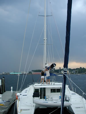
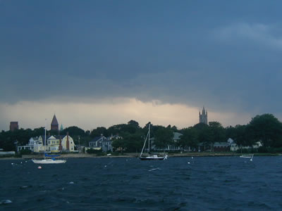
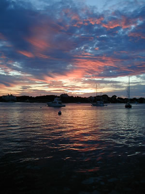
We found slips at Fairhaven Marina and were barely tied up when a nasty little squall came through and blew 40+ knots. After the squall, although dog tired from the passage, we all enjoyed a glorious sunset and then dinner ashore to celebrate a successful passage.
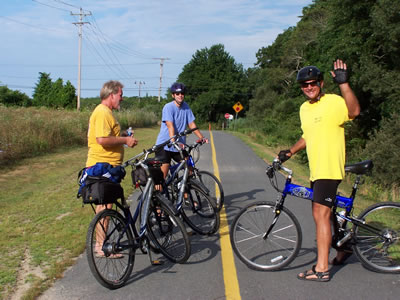
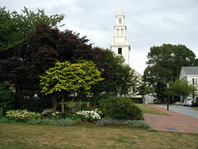
Our docks were located directly at the Fairhaven Shipyard. Fairhaven and New Bedford are both behind the hurricane wall and share the same harbor. Both of these towns are of historical moment, with Fairhaven being settled in the 1600's by Plymouth Colonists, including Mayflower passenger John Cooke. Shipbuilding began in Fairhaven in the 1700's. Also, the first naval battle of the Revolutionary War was fought here in 1775. Old Fort Phoenix still guards the harbor. The most exciting Fairhaven history is that it was here in the late 1800’s that Captain Joshua Slocum rebuilt an old oyster sloop and named it Spray. Slocum departed Fairhaven alone in 1895 to sail Spray around the world. His book Around the World Alone memorializes his three year, solo-circumnavigation and it is still one of the most-read sailing classics. Prior to Slocum, no one had ever circumnavigated solo. Slocum enjoyed great fame as a result of that feat. It would not be until 25 years later that another man, Harry Pidgeon, would complete a solo-circumnavigation, but Harry used the Panama Canal, wherein Slocum sailed the treacherous straights of Magellan. It was not until 1938 that a Frenchman, Louis Bernicott, solo-circumnavigated via Slocum’s more arduous route. In Around the World Alone, Slocum explains a method he used to protect himself and Spray from intruders. When anchored at night, Slocum would spread sharp tacks out on the deck of Spray to keep hostile natives from boarding Spray from dugout canoes. If momentarily boarded, all Slocum would hear was a few yelps and a splash. He declared that the security method of tacks worked well, as long as he remembered to pick up the tacks and not step on them himself the next morning. Well, all that said, one of the oldest buildings at the Fairhaven Shipyard was originally (you guessed it) a tack factory! We spent a couple of days at Fairhaven and managed to tour the town a bit. There is a wonderful new bike trail in Fairhaven, built upon an old railroad bed. We rode bikes for several miles enjoying the bloom of wildflowers along the way. It was a gorgeous summer day in New England with comfortable temperatures in the mid-70’s. Despite its big history, Fairhaven retains a small town feel and many of the neighborhoods we cycled through reminded us of the Garden District in Baton Rouge. Melissa was quite taken with New England and says she would love to live there. I suggested she return when it's snowing and sleeting in January and then decide. While on our bike ride, we stopped and bought fresh produce of the finest kind from a roadside merchant. With heavy bags of corn, tomatoes, beans and fresh bread suspended from the ends of our handlebars, we unsteadily but successfully wove our way back to our marina.
We didn't get to spend much time in New Bedford, but did dinghy across the harbor to get a better look. It was wonderful to be there and enjoy the breadth and depth of nautical history. New Bedford in known especially for whaling history. It is from New Bedford that Herman Melville shipped out in 1841 on a whaling expedition that inspired him to pen Moby Dick. We enjoyed exploring the harbor by dinghy and puttering about in the huge fishing fleet. The boats looked as if they were assembled for a casting call for the movie Perfect Storm and form part of the New England fishing fleet that is well known for braving severe North Atlantic weather and seas to make a catch. Tough boats. Tougher men.
Buzzards Bay, Massachusetts to Oyster Bay, New York Having toured Fairhaven and New Bedford, we decided to move on and explore the more upscale "touristy" areas of Massachusetts such as the Elizabeth Islands, Woods Hole and Martha’s Vineyard – all part of barrier islands to the southeast of Fairhaven. We had a perfectly enjoyable sail across Buzzard’s Bay, taking in the sights while sailing amongst many vessels, both pleasure and commercial. Our first stop in the Elizabeth Islands: Hadley Harbor at Naushon Island. This island has been a Forbes family retreat for some time. China trade merchant John Murray Forbes and his descendents have summered there for more than a century. Sen. John Forbes Kerry and his first cousin Brice Lalonde summered there too. Yep, this is John Kerry’s "blue-blood stomping grounds.” The islands are owned and managed by the Naushon Island Trust, Inc. All the islands are private property and closed to the public, though, except for a few well-marked picnic beaches on small islands. There are about 30 different houses/estates on the islands and those accommodations are time-shared amongst the family. No outsiders. Hadley Harbor is at the east end of Naushon Island and is well protected with moorings. There are no paved roads but many miles of trails through mostly beechwood trees. The free moorings can be used by the public on a first-come first-serve basis. On weekends the Harbor is packed with boats both anchoring and mooring, and rafting up four and five wide in the little harbor. To get a mooring, you have to show up early Monday morning and pick up a mooring line as soon as it's dropped by a weekender heading home. It's nice to be on a mooring, but you can still count on being made nervous by numerous boaters anchoring dangerously close to you on the weekends. All these islands are located just a couple of miles southwest and across a natural Channel from Woods Hole. Woods Hole is the foremost Marine Research Center in the United States. So, we were able to moor our boats in Hadley Harbor for free and dinghy a couple of miles across the Channel into Great Harbor at Woods Hole and explore that area too. One more piece of trivia about Hadley Harbor: in 2004 a fourteen foot Great White Shark wandered into the little harbor and stayed! It turned into a circus, with all sorts of folks chartering boats out of Woods Hole to go see “Jaws.” The shark was nicknamed "Gretel" in honor of the popular fairytale. One young captain we spoke to on the dock in Woods Hole said Aerosmith guitarist Joe Perry hired him to take Perry to see the shark. All sorts of people were racing to see the Great White. In no time, a frenzy of boats were chasing the shark all over the small harbor (and people were trying to do stupid things like touch it). It quickly became dangerous for both people and shark, so the Coast Guard shut it all down and banned the public from the harbor. It took quite a while for the authorities to finally coax the shark out to sea.
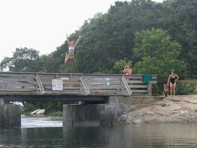
It must be nice to be one of the Forbes heirs and vacation in such a fabulous place. Melissa and I kayaked and dinghied around to explore all the little coves and harbors. One morning we were idling around in the dinghy and came upon some teenage girls having a great time jumping into the water upstream off a small bridge and then floating in the swift current that passed through the narrows underneath the bridge. The little bridge crosses a small cut between islands.The cut connects the harbor to marshes and the Atlantic beyond. Thus, as the tide recedes, the harbor (as much a two feet higher at high tide) drains out swiftly through this little cut. Just on the outside of the cut, though, the channel opens wide to the marshes and the swift current subsides. So, the fast current only runs a short distance and makes a great miniature “rapids ride.” We were in the harbor and did not get too close, lest we get swept under the bridge and then have to wait for high tide to get back. In the picture below, note the dog next to the lady in the black one-piece suit. This is how each jump went: everyone, including the dog, would watch the jumper from the Harbor side. As soon as the jumper hit the water , the dog would bark wildly and bolt in a flash over the road to the highest point of the bank on the other side and launch out into the air. Landing with a big "belly flop" splash in the water on the other side, the dog would time it to almost land on the jumper who by then had been swept under the bridge in the swift current. I think the dog’s game was to see how close he could come to landing on the jumper's back! It was very cool. I don’t know if the teenage girls realized it, but Melissa and I were keenly aware that we were seeing some of the best of their childhood memories.
Our first trip from Hadley Harbor to Woods Hole was exciting. FOG! And, up to four knots of current ripping through the Channel when the tide is running. Plus, fog acts differently here. It might be clear as a bell at Hadley Harbor but “pea soup” thick with fog at Woods Hole. Plus, it’s not morning fog either. A fog bank can engulf you at 2 p.m. I had no idea that Woods Hole is famous for fog. In fact, in the 63rd Edition of Chapman Piloting, at page 304, the text includes a photo of Great Harbor at Woods Hole to demonstrate a type of fog referred to as "Sea Smoke", cause by differences in sea and air temperatures. Such fog is so tenacious it can withstand 20 knot winds and remain remarkably thick. We would quickly learn about Woods Hole fog. On our first dinghy ride into Woods Hole we left Hadley Harbor in clear sunshine and hit so much fog in Great Harbor I could not see ANYTHING. I got a faint glimpse of a big fishing boat that seemed to be headed in the right direction and followed it (Cajun Radar), and Larry and Ulla followed us. Good thing the fishing boat WAS headed in the right direction, or we'd have wound up offshore in dinghies! We finally got close enough to see the shore of Woods Hole, AND to see the huge ferry to Martha's Vineyard leaving the dock and coming our way!
When the fog cleared later in the day, I gulped when I looked out across the gauntlet of rock piles, markers and shoals littering Woods Hole Channel and Great Harbor, all of which we crossed in thick fog. Forest Gump said it best: "Stupid is as stupid does." We won't do that again! Having survived stupidity (yet again), here is the NEW strategy: 1) we will not ever come across to Woods Hole in the fog; 2) we will carry a handheld GPS and use it to make a track line while coming over in clear weather; 3) if fog forms we will follow our GPS trackline back to the boat. I bought a new handheld GARMIN GPS just for the dinghy, so that we will have a GPS with "track line" memory to follow home in the fog or bad weather (like a bread trail, GPS units create a line showing your past route at all times; to re-trace your course simply turn around and follow your old line on the screen). Prior to arriving in New England, we never needed to run for several miles in the dinghy, nor did we have to cross big Ship Channels in fog. In the Bahamas, it was customary to anchor just off a beach and make a short ride to the beach or a dock just a stone's throw away. There is never any fog in the Bahamas. So, it was evident we were not adequately prepared to cross miles of rough, open water in a rubber boat. To rectify our unpreparedness, we added flares, a full set of running lights, good life jackets, throwable seat cushion, bailing bucket, anchor with chain and rope rode, GPS, cell phone, and a handheld VHF radio. One other Woods Hole dinghy "gauntlet" factor: considering the current rips by Woods Hole in the Channel at four knots, and further considering that fairly sharp turns have to be completed to weave through mid-channel obstructions such as rock piles and shoals, megayachts and other large traffic run at high speeds to maintain rudder control in the fast current while steering through all the obstacles. That means the fast moving megayachts make "mega-wakes" too, all to be negotiated by us in the dinghy. And it never failed -- a megayacht always seemed to show up out of nowhere as we approached mid-Channel. One set of wakes was so bad it damn near threw Ulla out of the bow of their dinghy. One hundred feet away, Melissa and I could hear Ulla simultaneously yelping and laughing at the top of her lungs as they hit the big wake and went almost vertical. Woods Hole, rich with Whaling and Marine Research history was fun to explore.
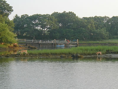
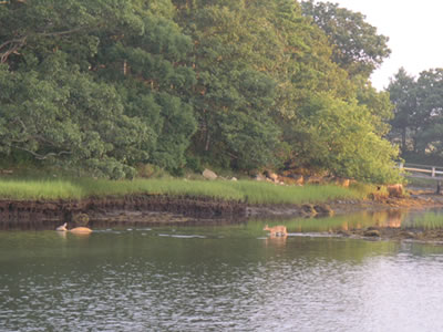
One morning at Hadley Harbor, we awoke to see a whitetail doe and her fawn walking along the shoreline and then swimming to the next island. So peaceful. It was a great place to stay and we were there about ten days, soaking up the serenity.
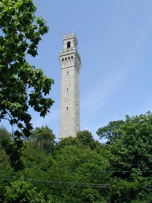
Although Melissa and I would love to have sailed all the way to Maine, we were warned repeatedly that above Cape Cod the lobster traps are so thick you can just about walk on the water upon the very closely spaced floats that mark the traps. Considering Indigo Moon has saildrives and no way of fending off ropes from her propellers, it would be suicidal for our propeller shaft oil seals to venture into lobstering territory proper. Roughlife too has saildrives, so we decided that we would not venture further to the north. Wanting at least to see as far north as Cape Cod, though, we all shared the cost of renting a car in Falmouth. Larry drove us all the way up Cape Cod to Province Town, aka “P-Town” and back.
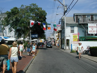
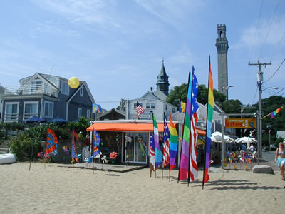
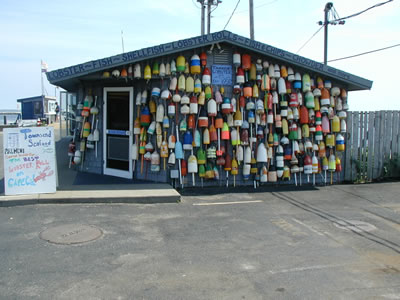
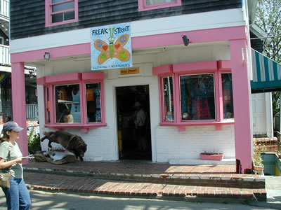
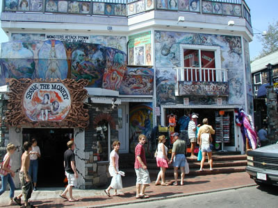
P-Town has a very large gay and lesbian population and is a very popular vacation destination. Further, P-Town enjoys lots of interesting artwork and supports some pretty racy businesses too. It was cool. While on our walking tour, we overheard some very animated, fiercely liberal conversations. One woman was especially energized and preaching to several other women on the sidewalk about politics, social reform, and grieving John Kerry's loss in the presidential race. Regardless of personal beliefs, it's always entertaining to see passionate free speech in action. The lady at P-Town brought back my memories of "free speech alley" at LSU where various speakers would stand on a bench under the live oaks in front of the Student Union and taunt a crowd into polarization. I remember, for example, that David Duke was cruelly masterful at causing a high-spirited free-for-all amongst students at free speech alley.
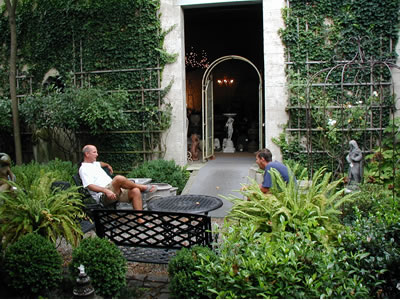
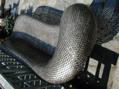
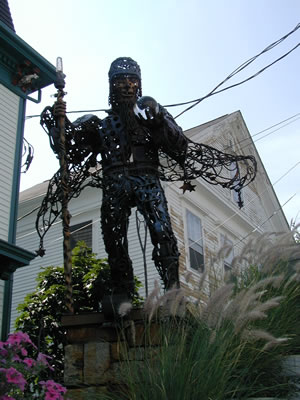
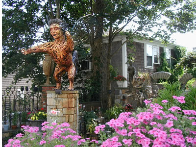
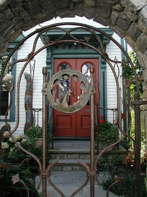
In the metals art department, we came upon a sofa/chaise above made entirely by welding nickels together! It was very unique and I can only imagine the man hours it took to make it! We thought we’d seen a lot, AND THEN, we came upon the most fantastic collection of “yard art” we’ve ever seen. The grounds of a residence had been transformed into an impressive display of art (we could only speculate as to how bizarre the interior must be). The owner is obviously a skilled artisan in metal, mortar and more. A stone fence festooned with whimsical pieces implanted here and there surrounds the gated grounds that are home to numerous large pieces of metal work. We also speculated that the owner of the house is probably unrivaled with the locals as far as hosting the most fantastic parties. Clearly, everybody in P-Town probably wants to be on his “A” list.
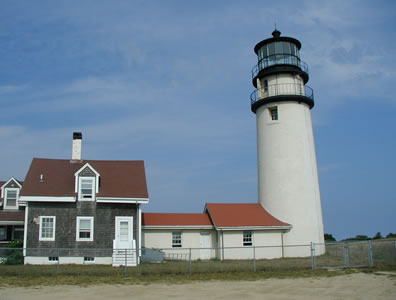
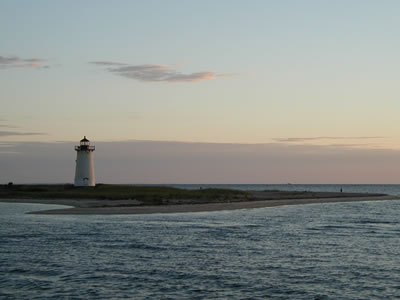
It was mid-afternoon so we piled into the car and began our journey back to Falmouth. Our next stop was the Lighthouse at Cape Cod.
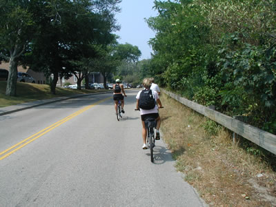
We had a good day exploring Cape Cod by car. It was quite different to be traveling at 60 MPH instead of 7 knots, and we were able to cover a lot of ground. The next day, we all took our bikes into Woods Hole (yes, left Hadley Harbor and crossed the Channel and Great Harbor to Woods Hole with two people and two bikes in each dinghy), and then rode the bike path about six miles to up the Atlantic coast to Falmouth. As veteran cruisers now, our priority was to hunt down West Marine and a grocery store. Then, with packs full of food and new gear (GPS and other do-dads), we biked back to Woods Hole and dinghied back to the boats.
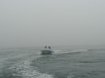
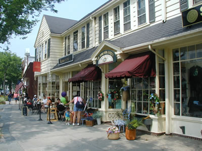
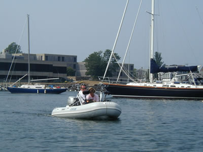
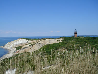
Later in the week, I took a ride from Hadley Harbor all the way to Falmouth in the dinghy! We needed some fuel, having run the generator for a week. There is no fuel dock in Woods Hole! The closest fuel is out the Channel and up the Atlantic coast at Falmouth. We dare not leave Hadley Harbor with Indigo Moon, our mooring would be surely be occupied upon our return. So, at about 10:00 a.m., I grabbed a couple of five gallon jerry jugs and jumped in the dinghy to make a speed run by myself to Falmouth. About a mile out of the Channel and into the Atlantic I hit a fog bank. It got rough too, so rough I had to come off plane and slow to an idle. In fact, it was so bad I got nervous and put on a life jacket (and that, my friends, is ROUGH). I saw the silhouette of a Coast Guard cutter ahead. Hmmm . . . . rather than explain to them that I am not lost but merely stupid and crazy instead, I turned tail and ran back out of the fog bank to Indigo Moon where there was still no hint of fog. I waited a couple of hours and tried again. This time it was easy - no fog and not too rough - and I quickly made it up the coast to Falmouth. As I fueled the jugs and talked to the kid running the pumps, he noticed my LSU hat and said he was an LSU fan. He asked where I was in the harbor and I explained that I was not at Falmouth, but had dinghied over from Hadley Harbor. He shrieked: "IN THAT!" as he pointed at the dinghy. He called out to other guys on the dock: "Hey you guys!! This wild man from LSU came over from Hadley HArbor in a DINGHY!" They all grinned and shook their heads. Oh well, so I'm unintentionally Evil Knievel again. I am happy to report that the dinghy rode even better on the way back with the weight of ten gallons of fuel in the bow. No fog, following seas, full throttle, and twenty minutes on the return trip. Thereafter, we had plenty of fuel to run the generator and make power and water on the Moon. Certainly, Hadley Harbor holds many great memories and we enjoyed our stay there. It was hard to leave the serene paradise. But, long-range cruising means resisting the temptation to remain in one location too long, no matter how perfect the surroundings. Thus, the time came to move on. Destination: Martha’s Vineyard. Located east of the Elizabeth Islands, the Island of Martha’s Vineyard and Chappaquiddick are about eight miles away once you exit the Channel at Woods Hole. Massive ferry’s run from Woods Hole to Martha’s Vineyard, transporting the many vacationers and their vehicles. Martha’s Vineyard has long been one of the most upscale spots for vacationing northeasterners. Formed by glacial action 10,000 years ago, Martha's Vineyard is the largest island in New England. The name "Martha's Vineyard" was given the island in 1602 by Bartholomew Gosnold who named it after his daughter and for the wild grapes found on the island. Further defining the area, the Martha's Vineyard is roughly triangular in shape and has 100 square miles of land, surrounded by 125 miles of coastline. Locals refer to the island in sections of "up-island" and "down island." Edgartown, Oak Bluffs, Vineyard Haven, West Tisbury, Chilmark, and Aquinnah are some of the various towns on the island. We visited elegant Edgartown first. It was the island's first colonial settlement. Wonderfully preserved, there are many meticulously maintained Greek Revival houses, mostly built in the early 19th century by wealthy whaling captains. So clean and perfect, streets look like a Disney presentation or movie set. That pureness was not lost on Steven Spielberg. Edgartown served as the small town of “Amity” in the movie JAWS. The waters off Martha’s Vineyard were perfect for the film too. As shallow as 35 feet offshore, with a clean sand bottom, these waters were ideal for handling JAWS' mechanized shark. Most of the film was shot just off the coast of Martha's Vineyard with care being taken to shoot scenes from angles that kept land out of the background (the movie would not be nearly as scary if it was obvious that Capt. Quint and crew could have easily steamed toward shore when the big fish got after ‘em). Edgartown, and it's well-protected harbor, has been the home of the rich as far back as the early 1800’s. Wealthy whaling captains and prosperous merchants lived there. Its “old-money” past is obvious. Now, many of the rich and famous with “new money” live here too. According to a cabbie we chatted with, the Clintons, Bill Gates, Dan Ackroyd, Diane Sawyer, James Taylor, Michael J. Fox, Mike Wallace, David Letterman, Ted Danson, and Spike Lee allegedly have homes here. I am told the place is also home to many big-time television and film producers. There is no McDonalds here. Commercialization has been kept out. Rumor has it that singer songwriter James Taylor led the effort to fight off McDonalds. The local, heavyweight showbiz crowd has successfully managed to "circle wagons" several times to fend off the worldwide "Cruise Ship" and "Planet Hollywood" invasion that is currently ruining paradise destinations worldwide. On the other side of the harbor from Edgartown is infamous Chappaquiddick (“Chappy”), where Senator Ted Kennedy accidentally drove off a bridge in 1969, resulting in the drowning death of his young female passenger.
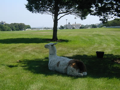
A large waterfront estate near Edgartown is owned by a very successful car dealer. He’s got pet llamas that grace the lawn. Eccentric.
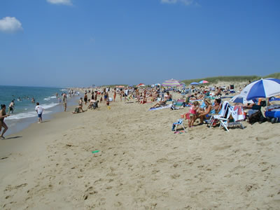
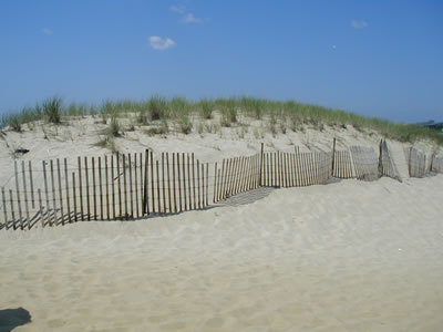
Not far down the shore from the car dealer, Walter Cronkite's mansion sits high on a bluff. Cronkite's famous sailing yacht "On Assignment" was nowhere to be seen, though. One sunny day, Larry and Ulla joined us on a bike ride to the beaches on the south shore of the island. Any fan of the movie Jaws can easily recognize that these are the exact dunes and beaches where the movie was filmed.
More scenes of Edgartown and the harbor:
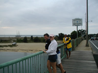
We decided to see Vineyard Haven next. Our friends Chris and Trula Remson, now veteran guests aboard the Moon, were coming in for a long weekend. We reserved a mooring and headed over to Vineyard Haven, where Chris and Trula would arrive on the BIG ferry out of Woods Hole. Larry and Ulla on Roughlife came too. Much to our dismay, the mooring field was OUTSIDE the harbor breakwater in a huge bay. Our moorings were open to high wind and waves coming right at us from the north and east. Making matters worse, quite a few of the big power boats coming and going out of Vineyard Haven ran at full or half speed right by the mooring field. There is supposed to be a no wake zone in front of the outside mooring field we were in, but nobody enforced it. Obviously, the local power boaters knew that and many of them hammered us unmercifully. A significant number of big power yachts just didn't give a damn about running too fast by the crowded mooring field, thereby "waking" the hell out of all the moored boats. Most frustrating were the jerks who seemed to think it was good boating practice to slow down and pass by at half throttle (thus making an even bigger wake). Of course, there were some very considerate power boaters too and I don't want to suggest that all, or only, power boaters are irresponsible. Surely, jerks find their way to the helm of all shapes and sizes of boats, sail and power alike. That said, this was not our first, and surely would not be our last, interaction with the occasional dangerous fool behind the wheel of a big power boat. It seems there is no stopping them. For over a year now on our adventure, I have listened to various VHF conversations and complaints about damaging boat wakes on the VHF. The Coast Guard rarely does anything. If a power boater's behavior is intentionally reprehensible, I'll sometimes engage the perpetrator on VHF (That is until Melissa yanks the microphone out of my hand). More on this subject later in our next trip log. Luckily, by the time Chris and Trula arrived the next day, the wind had shifted and the seas had subsided somewhat. The powerboat crowd had docked for the weekend and thinned out some, making it a little easier to live with the situation. We could at least time dinghy landings and departures between the occasional power boat wake. We had a nice walking tour of Vineyard Haven. We thought Oak Bluffs was not far away and decided to walk over. There just happened to be a big fireworks display that evening and we thought it would be fun to check it out.
After a night tied to the "sea buoy" mooring at Vineyard Haven, we went back to Edgartown so Chris and Trula could experience it. Chris, a classic sailboat aficionado, was especially taken with the plethora of classic wooden sloops, all the way from 20 foot open boats to 40-plus foot yachts. For example, a Hinkley yacht usually turns heads. Here, though, they are common and more than a dozen were moored in the harbor. Even more intriguing to Chris was the local custom of sailing directly to and from moorings. The harbor at Edgartown is full with hundreds of moorings. At any given time, you will see sails raised and a departure under sail. Or, sails luffed and doused as a mooring is picked up. No engines used. Even big boats sail through the middle of the crowded mooring field, demonstrating surgical skill in tacking and such. Anyway, Chris loved that action and said he would love to one day sail his boat through the Edgartown mooring field. We also took the bus to the western end of the Island and visited Gay Head Lighthouse and Cliffs. Chris and Trula really enjoyed their long weekend at the “Vin-yahd” with us.
Larry and Ulla, who are both excellent cooks, graciously invited us all over to Roughlife one evening for a delicious dinner. We had a great time visiting and cutting up. Chris and Trula got to know our new friends Larry and Ulla. They also got to see how grand a big 44 foot Lagoon catamaran is. Our time at Martha’s Vineyard came to an end. Chris and Trula returned home to Baton Rouge. Larry and Ulla were ready to head on too. So, we decided to begin our slow migration south in earnest, sailing next to Newport, Rhode Island.
New England presents interesting history at every turn and Newport is certainly no exception. Founded in 1639, it has much seafaring history, but it was not until the 1880’s, however, that Newport enjoyed its most impressive development. New York’s biggest millionaires began building seventy-room summer “cottages” there at the turn of the century. Ever since, Newport has been a favorite seaside destination of the ultra-rich and ultra-powerful. John F. Kennedy, Jr. and Jacqueline were married in Newport. We enjoyed seeing Newport.
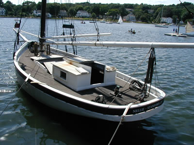
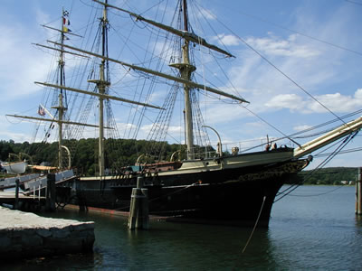
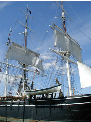
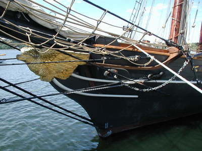
After a quick tour of Newport, it was on to Mystic Seaport, Connecticut. There is a very comprehensive nautical museum there. A complete seaport town has been created with some of the authentic structures being disassembled from various northeastern towns and then moved and reassembled on the 17 acres of the museum. Complete with whaling ships and many other exhibits regarding the construction of sailing ships, it is a fabulous place to spend the day and learn more about the old whaling industry.
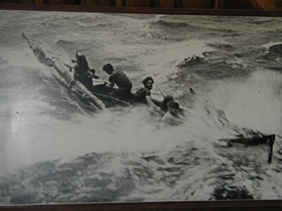
Whaling was a feat of pure bravery. Giving chase to a creature as large as a whale was not for the faint of heart. An old black and white picture, taken of a whaling boat under tow by a harpooned whale, depicts the wild ride you can expect while fighting a whale in a small boat. Those guys had more guts than a burglar!
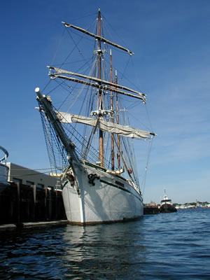
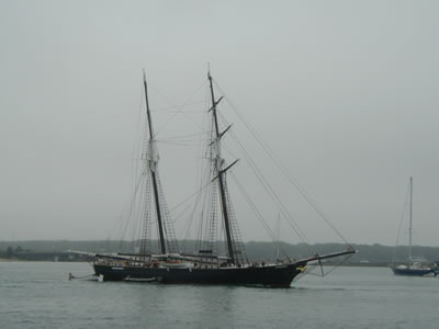
Here are some shots from on board the whaling ship Charles W. Morgan:
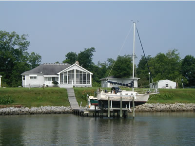
Mystic Seaport was well worth the stop. A few years ago, while on one of our visits to New York City, Melissa and I looked out upon the East and Hudson Rivers from the Seaport at Pier 17 and proclaimed that one day we would sail Indigo Moon (then moored in New Orleans) into the City's harbor. As we moved further west in Long Island Sound on this leg of our trip, that goal was now within a few days reach. We had reservations for a week at Liberty Landing Marina in New Jersey’s Liberty State Park. The marina is located directly across the Hudson River from lower Manhattan at the World Trade Center site. But, in light of our reservation dates, we needed to hold off on our New York City arrival for a couple of days. So, we decided to head to Oyster Bay, Long Island, where Theodore Roosevelt lived for some time. From there we could make it to New York City and Liberty State Park in less than a day. Oyster Bay has a very nice anchorage and it was a good choice. Oyster Bay has some of the most opulent waterfront estates we’ve ever seen. And remember, all we see is posh, private backyards of waterfront property on our travels – so we’ve seen it all. Against that backdrop, the estates at Oyster Bay are in a class by themselves. Not the guy who owns a chevy dealership, or the local newspaper and television station, or ten McDonalds franchises types of estates mind you, but rather the guy whose great-great-grandfather owned a railroad or steel mill at the turn of the century kind of money. It really is something to see.
The big day came. It was hard to believe. In less than six hours we would be cruising down the banks of Manhattan on the East River. We were excited! Anticipation was high. We wondered what it was really going to be like to arrive at New York City in our own boat, a major goal -- no, a major dream -- fulfilled. "Start spreading the news; we're leaving today. We want to be a part of it, New York New York" And so, still cruising in the company of our new friends Larry and Ulla on Roughlife, we weighed anchors and set sail from Oyster Bay one gray morning. We took up a heading toward New York City, knowing its amazing skyline was hiding just over the southwestern horizon . . . . . OK! You must be exhausted after that much time at the helm. We'll relieve you of your watch now. Go below and get some sleep! We took quite a big bite out of the Big Apple and you will have to be well-rested to make it through the next report: a heaping helping of our fabulous New York City visit, and then a trip all the way back south to Florida. Without a doubt, our arrival in New York City and ride down the East River was one of the most exhilarating experiences Melissa and I have had to date on our journey. We look forward to sharing it all with you and will post the next installment soon. After that, we'll get to work on the next big phase -- the Caribbean! Hoping this finds all of you happy and healthy,
|
|||||||||||||||||||||||||||||||||||||||||||||||||||||||||||||||||||||||||||||||||||||||||||||||||||||||||||||||||||||||||||||||||||||||||||||||||||||||||||||||||||||||||||||||||||||||||||||||||||||||||||||||||||||||||||||||||||||||||||||||||||||||||||

|
![]()