
| ||||||||||||
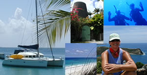
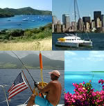
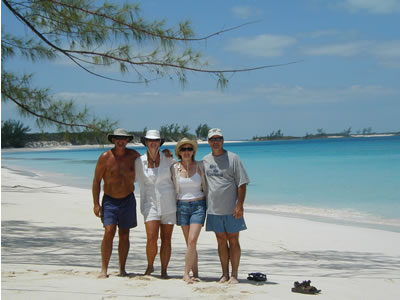
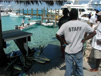
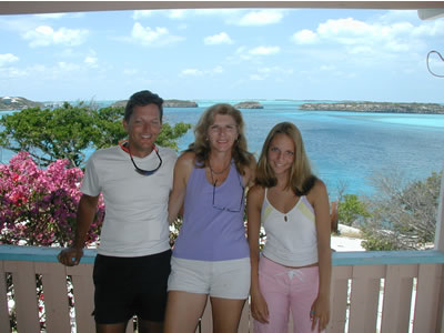
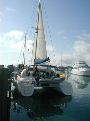
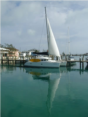
Exumas, Bahamas Hello Family & Friends! We hope this finds everyone as happy and healthy as we are. I begin this installment on the 4th of July in Fort Lauderdale, Florida. Sitting at the salon table of Indigo Moon, I am watching numerous small boats pull water skiers and wake boarders in the Middle River where we have rented a dock for a month. It’s sunny, HOT and humid this afternoon. Blissfully, we are hooked to shore power and all three air conditioners are humming. Without further ado, let’s get started on catching you up on our travels! Our last two installments provided a thorough tour of the popular Northern Bahamas, focusing on the Sea of Abaco, and Abaco’s barrier islands. This installment (including a second that will follow shortly), will take you through the remote southern Exumas, including George Town, Long Island, Conception Island, San Salvador, Cat Island, Nassau and Bimini. It is with great pleasure that we recall the joy of the second half of our Bahamas journey through its beautiful southern islands. Please come along and share the best with us! Part I: The Waning Days of our Abacos Adventures Melissa and I decided to stay in the Abacos longer than we originally planned, so that her cousin, Mendy, and her husband Jim could come visit us. We took Jim and Mendy to the Nipper’s Pig Roast on Guana Cay. We also introduced them to our friends, Richard and Mary Beth Johnson, Captain and Master Chef respectively of the Motor Yacht Rebecca.
We spent a nice day at the beach with Mendy, Jim, Richard and Mary Beth, snorkeling, shelling and enjoying a picnic. There is a really neat pavilion that has been constructed as part of the new Orchid Bay Development on Guana Cay and we made good use of it.
After spending a couple of nights at Orchid Bay, we set sail for Hope Town and made sure that Jim and Mendy saw all the sights described in our Abaco trip reports.
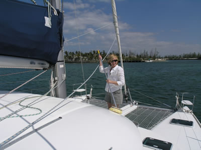
A few days later, we moved down to the southern end of the Abacos to Lynyard Cay, raising the spinnaker in light air. It was a nice sail south.
We spent the night anchored off Lynyard Cay and enjoyed star gazing and glow worm pondering. What’s that, you say? Well, we didn’t know what we were looking at, but the anchorage’s bottom was full of phosphorescent-green blinking lights. Turns out, glow worms were mating at the time (at least that’s what I was told by semi-serious sources weeks later). The next morning we decided to go fishing. One thing that Jim wanted to do was catch a dolphin fish, AKA Mahi Mahi, or maybe a Wahoo, both known for their brilliant markings and great food value. On a mission for fish, we set our sails early and left out of Little Harbor’s channel into the Atlantic. We motor sailed and trolled north, offshore in the Atlantic all day. At the end of the day, we came back into the sea of Abaco at Loggerhead channel at the south end of infamous Whale Cay and anchored at Baker’s Bay. We fished hard and used all the tactics. I trolled through areas of seabirds working the water’s surface. I followed charter boats. I tried different lures. I did everything we could, but not a strike. Then, at about 2:00 pm, I was cruising along at 7 to 8 knots, studying the baits as they worked perfectly in Indigo Moon’s wake. Everybody else had given up paying attention and were instead napping or reading novels, etc. And then . . . I can’t believe my eyes! There is a thin, pointed black stick, about two feet long, knocking around one of the lures. It’s a little White Marlin chasing one of our baits! He's jousting and clubbing at the lure with his bill! I played around trying to hook him up, even simulating for him a kill by allowing the bait to fall back after a good clubbing by the Marlin. For just a second, he took it. . . .zip. . . .zip-zip, went the reel. Then, nothing. We did not hook him and the whole experience lasted less than a minute. By the end of the day: score ZERO! We got skunked! It is of moment to point out that as of that date, I had never caught a truly decent food fish, nor any type of “bragging rights” sport fish for that matter on Indigo Moon! When I bought the boat and delivered it home to New Orleans from Ft. Lauderdale, I trolled for three days across the entire Gulf of Mexico. Then, when we left New Orleans, I trolled across the Gulf of Mexico again. Not a Mahi Mahi or Wahoo to be found. Instead, all we snagged were two lousy Bonitos -- nasty, inedible, trashy cousins in the tuna family. I also trolled across the Gulf Stream to the Bahamas thereafter. Nothing! Needless to say, by the end of the day of fishing with Jim and Mendy, I was pretty demoralized in the fishing department. Almost two years of owning Indigo Moon and not one fillet of any kind of offshore catch had hit the BBQ grill! I was starting to think I should give away all my tackle to somebody who could get some use out of it. Despite having no luck at fishing, it was a very nice “Day at Sea” that let Jim and Mendy experience a tiny taste of what offshore passage making is like. We reeled in the lines and entered Loggerhead Channel as the sun dipped low in the western sky. We anchored in Baker’s Bay, one of our favorite spots. It was obvious that construction had begun in earnest on the Passerine Project. There was a large barge full of heavy equipment beached by Disney’s old Treasure Island project. It was sad to see “the beginning of the end” of the wild north end of Guana Cay. As we entered the anchorage, we were happy to see a Lagoon 37 by the name of Jus Dreamin’ that belongs to Denny and Diane Daranek. I had been visiting with Denny about boats on the internet for a couple of years and this was the first time we were able to meet with each other face to face.
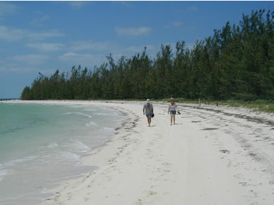
We had Denny and Diane over for dinner on Indigo Moon. Good food; great company; and lots and lots of laughs. No fish. Chicken on the grill. It was a great time enjoyed by all. By chance and much to our surprise, we witnessed the night launch of a rocket from Cape Canaveral. Darkness had fallen an hour prior and the moon wasn’t yet up. We had finished with dinner and were cutting up in the cockpit of Indigo Moon. All of a sudden, Diane looked up and said “Wow, what’s that!?” It took us a while to figure it out, but it was a big rocket, jettisoning stages, and continuing upward with a strange-looking white veil of atmospheric pressure emanating from it’s nose, sort of like a jelly fish streaming back from it as it compressed the atmosphere in its path. With no ambient light to diminish the show, we got a great view through binoculars. We found out later that it was a defense satellite being placed into orbit. The next morning, Jim and Mendy walked with us around the Atlantic beach at the northern tip of Guana. We cut through the island (right past and ignoring the new “no trespassing” signs) and toured what was left of the old Disney facilities, now in transition. Although the place was full of equipment and looked like it should be full of activity, there was no one there. We found out that an injunction issued and that the work was suspended until the Supreme Court reviews Guana Cay residents’ right to a hearing regarding their objections to the development.
From Bakers Bay we went to Treasure Cay and Denny and Diane came along as well. The wind was beginning to kick up and we all needed to leave the open waters of Baker’s Bay to find a protected anchorage.
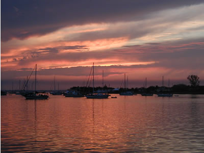
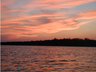
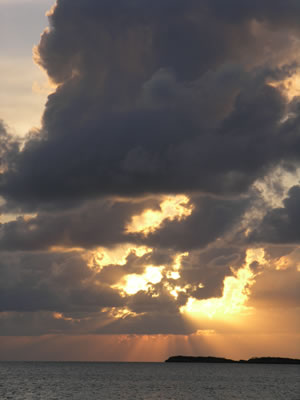
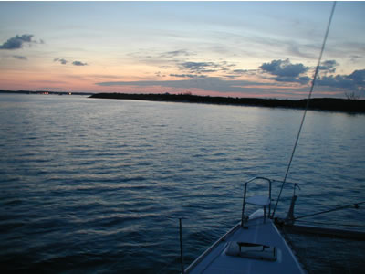
Before we knew it, it was time for Jim and Mendy to return home to California. We stayed at the Conch Inn Marina in Marsh Harbor for a few days after Jim and Mendy left so that we could do some minor maintenance, provision the boat, and give Indigo Moon a thorough washing and detailing. Melissa and I also got busy making a new plan for exploring the southern Bahamas During our stay at the Marina, there was a pretty strong front, with thunderstorms that passed through. This spring has been very strange in that cold fronts kept coming, even a month after they should have started stalling out well north and west of the southeastern United States. The next day the front passed and we spent our last evening at Marsh Harbor and enjoyed a brilliant sunset promising good weather. As the saying goes: “red sky at night, sailor’s delight…”
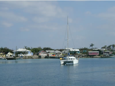
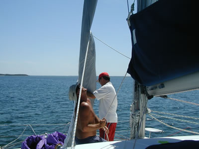
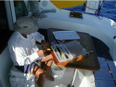
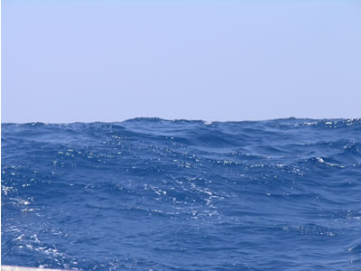
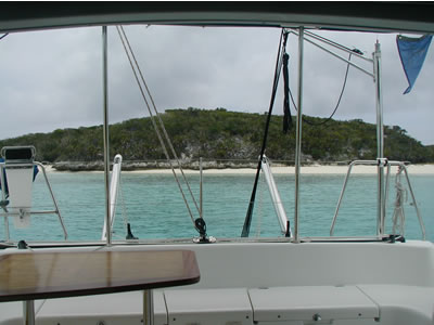
Part II: Little Harbor to Eluthera Finally, the day came: we were ready for an offshore crossing. We had our course laid out. The boat was ready. Everything checked, double checked, and triple checked. We sailed from Marsh Harbor to Lynyard Cay where we spent the night. Jus Dreamin’ was there too, but they were heading north the next day. We planned to head east out of North Bar Channel at the north end of Lynyard Cay. Once safely offshore, we would head due south in the open Atlantic for a sixty mile crossing to the Island of Eluthera and hope to make it into an anchorage there before sunset. We awoke early the next day and were ready to go. Just to make matters interesting, large swells were coming in from the Atlantic and building fast. On the VHF radio, I could hear reports of cuts to the north of us becoming “closed out” with swells producing breaking waves in places like deadly Whale Cay. There were no breaking waves yet in the North Bar Channel. But, as we made our way out into the open Atlantic, very sizable swells were coming in. It is a sensation that must be experienced to fully appreciate. We were headed directly east. There were no waves, but rather large patches of ocean the size of Walmart parking lots spread far apart while seamlessly moving up and down about ten feet or so vertically - all in a natural rhythm as the swells traveled to the southwest. Upon the surface, gentle breezes stirred patterns that shimmered nicely in front of us as the sun broke the horizon: rolling indigo blue hills with sequins, as far as the eye can see. As Indigo Moon traversed this seascape, her motion was as fluid as the ocean, effortlessly gliding up and over each swell. It is my favorite sea state, because it is simultaneously very BIG and very CALM. It’s pure majesty without confrontation, if you will. Also, making things interesting even more so, this was the deepest water in which I’ve ever sailed a small boat. The passage between southern Abaco and northern Eluthera is FOURTEEN THOUSAND FEET deep in some places. Considering you can drown in the bathtub, I guess it didn’t matter safety-wise. But, I found it interesting just to think about how amazingly deep the ocean was as we sailed in that area. Why so deep? Well, the Bahamas cover a large area and are complicated in their layout so as to defy any straightforward geographical description. But, an oversimplified description may help you understand. The Abacos are part of Little Bahama Bank, a large shallow area directly east of West Palm Beach and Ft. Lauderdale. To the south, Eluthera is part of the Great Bahama Bank, an extremely large shallow area located directly east of the Florida Keys and Cuba. In between the two Bahamas Banks is Northeast Providence Channel, a deep, sixty mile wide channel of the Atlantic Ocean that separates the two Bahamas Banks. That is what we are sailing across to get to Eluthera. Deep water means an opportunity for good fishing. So, once we were well offshore and headed south, in usual “never give up” fashion, I rigged fishing lines and began to troll.
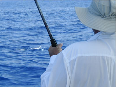
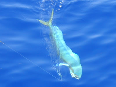
I admit that trolling on Indigo Moon had become somewhat of a lost cause, but still I meticulously put baits to work. I adjusted the lines. I made certain the skirted artificial baits were set out at a distance in such a way that they were occasionally breaking the surface while swimming down the face of waves produced by Indigo Moon’s wake. The drag on the reels was double checked. Everything was in perfect order. And I am certain we will not catch anything. Basically, setting out the lines had become a chore of responsibility that, once completed properly, I could ignore thereafter without excuses or guilt. Out of the blue, about ten miles south of Abaco, we got a strike. Something is hooked and ripping line off the starboard rod and reel. I tell Melissa to start the engines, ease the sails, and head up into the wind a little to slow down the boat. I grab the rod, tighten the drag and pull back. A really nice Mahi Mahi, in the 35 pound range, jumped out of the water and did a full flip. His back is a brilliant neon blue. WOW! That’s what I’m talking about!!! Now we are getting somewhere!!!!!! Melissa positioned the boat perfectly. Just as I began to put a little pressure on the fish, the line went completely slack. I reeled in a bare line, broken no doubt at the swivel as evidenced by the tiny curl at the line’s end. The fish is gone. My lure is gone. I immediately pulled in the other line too and stripped a good ten yards off each reel, re-tied new “Bimini Twist” knots on new swivels and got both lines back out with new lures. In the meantime, Melissa was busy getting the boat back under sail and on course to Eluthera. We were both excited, watching the new baits. Melissa was at the helm and saw a splash ahead and pointed: “Over there, what’s that?!” I looked and saw a Mahi Mahi ripping through the water about one hundred feet off our starboard side. A split second later, the fish took off after our starboard bait and just plain demolished it. I don’t think the fish ever slowed down – it ate the bait a full speed. Very exciting! FISH ON AGAIN!
The seas were calm. The little Mahi Mahi was played out and docile. Melissa was at the helm. Everything was going great. Then I got stupid. I had the fish right up to the back of the boat and could see it was hooked really well. Rather than call Melissa down from the helm, I decided I could put the rod in the holder and take one second to grab the line and gaff. Not so. The instant my hand left the rod, the fish bumped it’s head on the stern, unhooked itself, and swam away at a very leisurely pace. (All my offshore fishing friends are laughing at me while reading this, because they all know I knew better than to try that!) I pouted like a ten year old while Melissa laughed at me. I got the lines out again and minutes later we hook up AGAIN on an even bigger Mahi Mahi. Two beautiful jumps, but the hook was thrown. Strike Three! You’re out, Buddy Boy! No more bites that day. No fish. Melissa reminded me about what my dearly departed mother said years ago, the first time she saw a picture of a Mahi Mahi. Momma said she could never kill anything that beautiful. Melissa went on to say that maybe my mother had a hand from above in the fish getting off. After all, it was actually Mother’s Day. I convinced Melissa that she should cease all efforts to cheer me up and simply leave me to lounge in misery and self- criticism. As we continued on our passage, the swells got bigger and Bigger and BIGGER! At least we were headed downwind and the swells were slowly overtaking us from the stern. There is no happier place than downwind on a catamaran! Every now and then, we would catch a swell and speed up to ten knots!
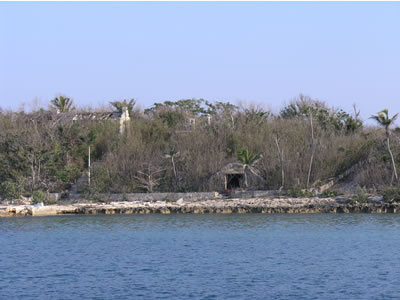
The swells included rogue twenty footers. One time, I saw only a “tuna tower” cross our path – the 36 foot boat below it was completely hidden in the trough of a giant swell. I could not see the boat until it was beam-to us. We dodged ship traffic, fishing boats and other cruisers to make it safely to Eluthera. By late afternoon, we were anchored safely in a fully protected harbor on the south side of Royal Island, located at the very northern tip of Eluthera. Royal Island has always been the logical layover for cruisers headed south in that it is the first place you can seek refuge after leaving the Abacos headed south. Royal Island is interesting in that Floridian W.P. Stewart, purchased Royal Island in the 1930’s and developed a very elaborate plantation that ultimately failed, as did all such attempts throughout the Bahamas. Plantations failed in the Bahamas mostly because the soil there is so poor in quality that it was exhausted after only a couple of crops. Crop failures and the abolition of slavery marked a permanent end to plantations. Although we only stayed one night at Royal Island and moved on the next day, Melissa and I had a wonderful time there. We jumped in the kayak at dawn and paddled over to the plantation ruins. After a thorough inspection of the villa and its out buildings, we kayaked all the way around the harbor in the shallows. It was a perfect setting for a beautiful sunrise tour. Mangrove roots lined the shore on the west end of the harbor, providing a nursery for all sorts of fish and rays, etc. The kayak is a wonderful mode of viewing these habitats. We can glide silently through very shallow water and not disturb the wildlife. At one point we stopped paddling and remained perfectly still and quiet, allowing the kayak to drift right beside a small pod of bottle nosed dolphins; a mother and baby were feeding in the shallows. Hearing them breath, watching them interact, and literally being inches away from them was amazing. It is rumored that the Atlantis Casino in Nassau has purchased Royal Island and will develop it. So, again we feel as if we are getting to see parts of history that will soon disappear to make way for “progress” ala Joni Mitchell’s They paved paradise and put up a parking lot.
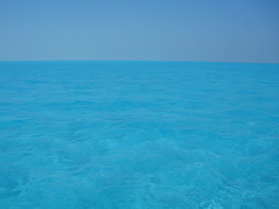
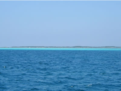
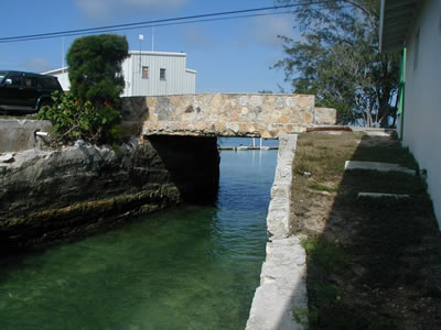
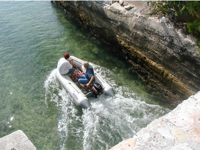
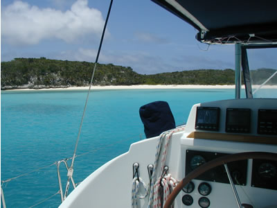
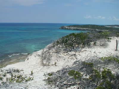
After our kayak at Royal Island we pulled anchor and headed further south toward the top of the Exuma Islands. In order to get there, we had to either go around a western peninsula jutting miles off the north end of Eluthera, or go through the peninsula via a passage named Current Cut. We opted for Current Cut. I could see nothing in any of our navigation materials that indicated any type of danger there. As I approached the cut, it didn’t look too menacing. It’s was a little narrow, but no waves or rough water. It’s flat calm. Sure, I could see a slight “babbling brook” effect ahead to starboard where the paper chart indicated shallows, but it seemed very “doable.” So, we went for it. As soon as we were in the cut, the current instantly raised our speed to eleven knots! And more: the current was pushing us toward the “babbling brook” side of the cut where the water is only inches deep! YIKES! I immediately gave Indigo Moon full throttle and turned away from the shallows. It was just enough power to allow us to go through the cut sideways for about an eighth of a mile! As Current Cut spat us out its south side, we were turned about forty-five degrees to port from our actual heading, still “crabbing” at near full throttle. There were several fishing boats in the forty to fifty foot range anchored out at the mouth of the cut. We had to pass close to them. I noticed lots of cheering and grinning. It took about a second for me to realize that they were all waiting for slack tide and no current. Also, I realized that going through the cut as we did was tantamount to a death defying stunt that entertained them immensely. I was the new Evil Knievel! They cheered. I tried to breathe. Just as my circulatory and respiratory systems were stabilizing, I looked back at the fishing boats again. Virtually all hands on all boats were frantically using full range arm movements indicating I should turn to starboard! I did until I got the “ok” sign from them. The sun was in my eyes and I could not see that I was about to get too close to a sandbar and run aground. Non-transitional insert: (At Current Cut, I confirmed warnings of significant inaccuracy regarding “C-Map” electronic GPS charts in the Bahamas. In the U.S., my C-Map charts have always been spot on. Looking at my GPS after going through Current Cut, however, the track line showed we went across the land of the peninsula, not through the cut. As such, C-Map electronic cartography is not always accurate. Your GPS will surely tell you exactly where you are on the globe – the latitude and longitude numbers are right, but the chart image is sometimes skewed. Thus, we adhere to the rule that accurate paper charts always be the first navigational tool no matter where we are.) So, dumb luck thinly veneered with skillful re-action got us through Current Cut without a scratch. Bahamian fishermen saved us from the sandbar thereafter. All that and it was not even 10:00 a.m. yet! The rest of the passage to the top of the Exuma Island chain was less stressful, and a gateway to the most beautiful waters we saw in the Bahamas. I am learning that I need to save up my best adjectives for the long haul. As you all know, we love the Abacos. It never dawned on me, though, that other waters of the Bahamas could be markedly more striking in color and clarity. By the end of the day I would be amazed. Part III: Exuma Islands Making our way south toward Sail Rocks at the top of the Exumas, we crossed the “Middle Ground” that is the largest sand bar I have ever seen. Miles and miles and miles and miles of spotless, white sand bottom only ten to fourteen feet below us. The water is as clear as water can be. It is so brilliant in the midday sun that it was hard to keep your eyes open, even with sunglasses on. It was exactly like sailing in a swimming pool that was twenty miles wide. Amazing.
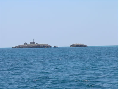
After safely sailing across the Middle Ground, we reached Sail Rocks at the top of the Exumas and turned south on the west side of Sail Rocks so as to be headed down the Exumas on the “inside.” As we headed south down the Exumas over the next weeks, to starboard and the west were miles of shallows that are part of the Great Bahama Bank. To port and the east was the barrier island chain of the Exumas, with Exuma Sound beyond. Exuma Sound is actually the very deep Atlantic Ocean sprinkled with a few large outer islands such as Cat Island, Conception Island, and San Salvador all about sixty miles out. Accordingly, we traveled on the shallow side of the Exuma island chain to be protected from the large seas in Exuma Sound, exactly as we did in the Sea of Abaco. Also, there are cuts between the Banks and Exuma Sound between various Cays, exactly in the same fashion as the cuts in the Abacos. Soon after we passed Sail Rocks, we came upon Beacon Cay where Ship Channel Cut opens to Exuma Sound. Ship Channel cut is the most straightforward exit from Nassau to Exuma Sound and the outer islands on the east side of Exuma Sound. The ruins on Beacon Cay came into view. Beacon Cay was once inhabited by two light keepers and their families. It is unimaginable that anyone could tolerate life on such an isolated, small cay. Comprised of “iron shore” and solid rock, it is simply not habitable in any reasonable sense of the word.
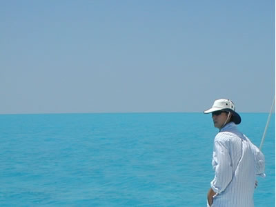
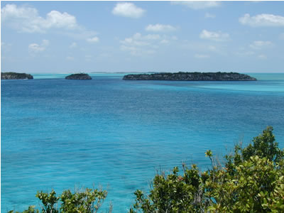
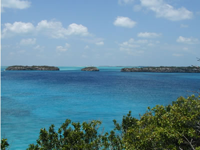
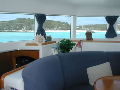
As we navigated the area further south, and left Ship Channel Cay to port, it was apparent we had entered waters that were much more brilliant than those we left behind in the Abacos. Is it the sand? Is it whiter? Is the water? Is it clearer? Is the sun angle sharper? I don’t know what the answer is. I can tell you this: we could not capture the brilliance of the water colors with cameras. It is breathtaking. As we made way south, about two or three miles west of various Exuma Cays, the water next to beaches appeared to be high-voltage neon green strips. Fellow cruisers I met in the Exumas tell me that the Turks and Caicos Islands (two hundred and fifty miles farther south) are more vivid still.
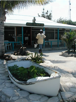
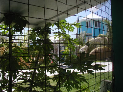
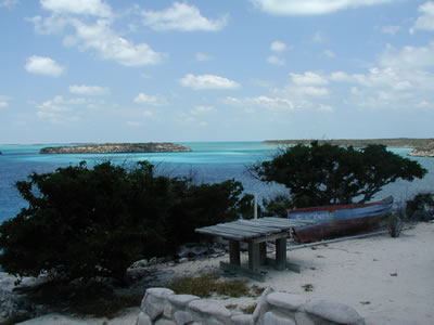
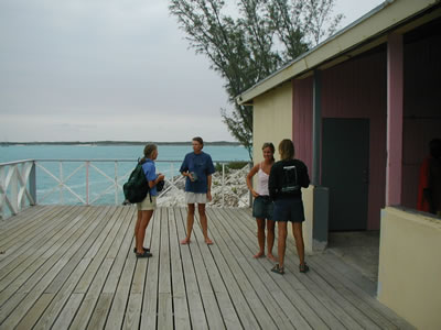
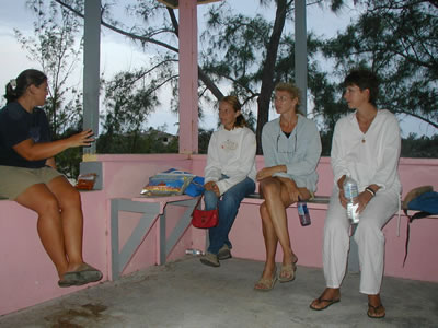
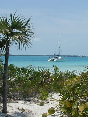
Our next stop of moment was Staniel Cay. There are many attractions at Staniel Cay: Staniel Cay Yacht Club; the wild pigs and cats at the “Big Major’s Spot” anchorage; and Thunderball Cave. Staniel Cay Yacht Club has a nice bar and restaurant and is a hot spot for local regatta racers. A tiller once manned by Prince Charles during a visit hangs above the bar. The open beams of the ceiling are decorated with burgees. Name placards from vessels grace the walls. We had a nice lunch there and then a walkabout on the Cay. Here are some photos:
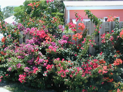
Once fed and ready for some exploring, Melissa and I took in some of the sights of Staniel Cay. Here are some of the things we enjoyed:
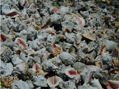
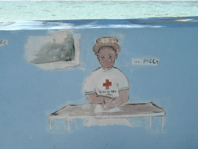
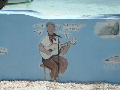
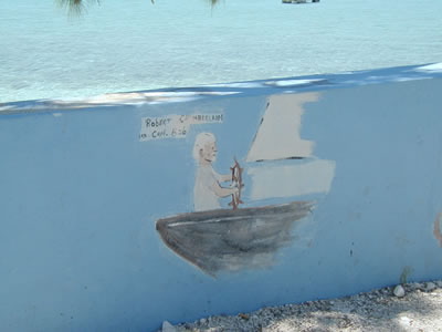
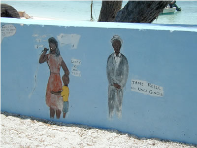
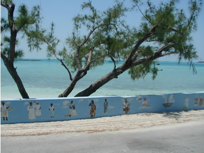
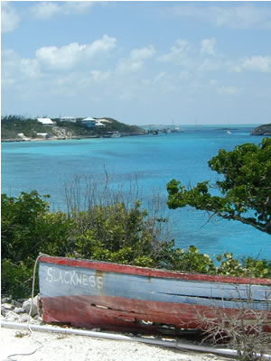
Walking along the shore, we saw our first “seawall artwork.” As it turns out, it is customary in the Exumas to decorate seawalls with art, slogans, or whatever. Here at Staniel Cay, an artist depicted some of the Cay’s citizens by painting their portraits on the seawall. It is keen folk art at its best.
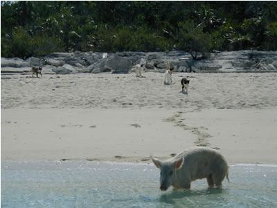
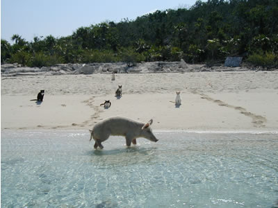
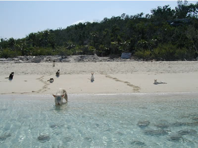
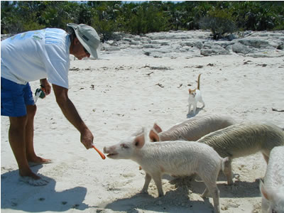
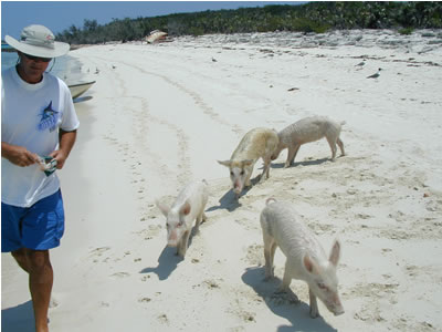
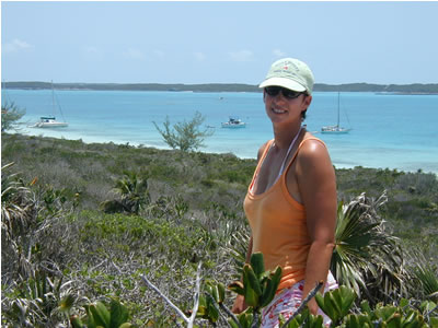
We had a nice walk, taking in the ambiance of Staniel Cay. Just a mile to the northwest of Staniel Cay is Big Majors Spot, a Cay that offers a favorite anchorage with good holding for vessels of all sizes. While there, we were in the company of up to thirty yachts, some in the one hundred foot range, and one that had to be two hundred feet long! Aside from the good anchorage, there is the attraction of feeding the wild pigs and cats that live together on the beach at Big Majors.
We saw many nice sunsets at Big Majors.
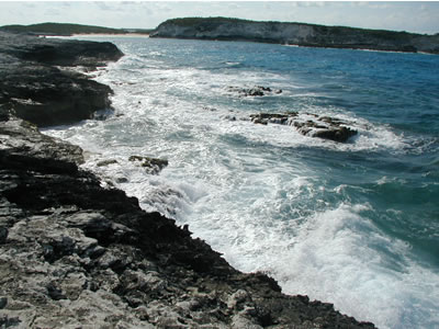
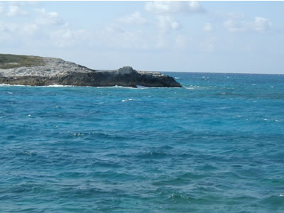
Melissa and I also snorkeled at Thunderball Cave, a notable Bahamian destination to many people. In the James Bond film, Thunderball, there is a scene where Sean Connery is stranded inside an island cave. In order to get rescued, he fires a flare up through an opening in the ceiling of the cave. Just so happens, the crew of the search helicopter spots it, and a cable is dropped thought the opening to air-lift James Bond out of the cave. All of that sequence was filmed at Thunderball Cave. Also, sequences of the movie Splash, with Tom Hanks and Darryl Hanna, were filmed there. Thunderball Cave is a park now, with no fishing allowed. The two entrances into the cave area are partially exposed or totally submerged depending on tides. Tropical fish are thick as thieves, waiting for snorkelers to feed them crackers. The cave is an interesting formation and very much reminded Melissa and me of the caves at Norman Island in the British Virgin Islands. Here are some views of the waters surrounding Staniel Cay: To the west, the beaches and shallows offer world-class water colors.
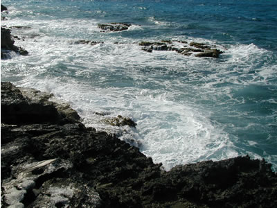
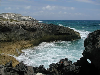
To the east, Exuma Sound and ocean waves pound the rocky coast of Staniel Cay:
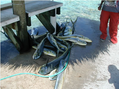
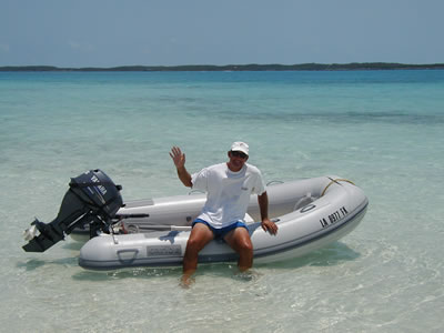
While at anchor one afternoon at Big Majors, a dinghy approached Indigo Moon and the folks came close to introduce themselves. Turns out, it was David and Jan Reeves from Pensacola Florida, along with their daughter, Lauren. They too are cruising on a sailing catamaran. They have been cruising for several years now and even have their golden retriever, Snowflake, on board too. They own ZING, a wonderful 43 foot St. Francis catamaran designed and built in South Africa. What a great name: ZING! They have done an amazing amount of work on their boat, basically rebuilding it themselves – new engines and all. The three of them are a great team. Growing up on ZING with Dave and Jan, daughter Lauren is an avid surfer and, at sixteen, she knows more about boats and sailing than most adults I know. Jan creates jewelry from “beach glass” -- bits of glass that have been churned in the surf until the sand has worn them opaque. She is really talented and makes other kinds of glass and beaded jewelry as well. We became great friends and wound up “buddy boating” with ZING all the way down the Exuma chain to George Town.
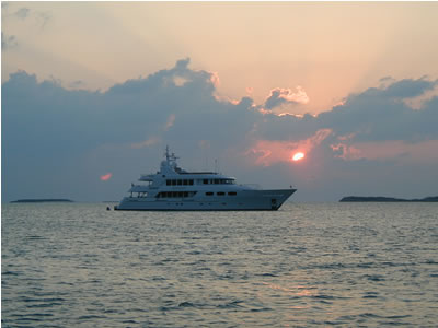
Our last night at Staniel offered a Thunderball sunset. We’ve never seen a sunset that more resembled an actual explosion. So, Thunderball it is!
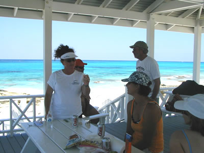
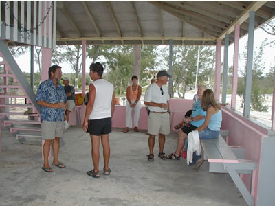
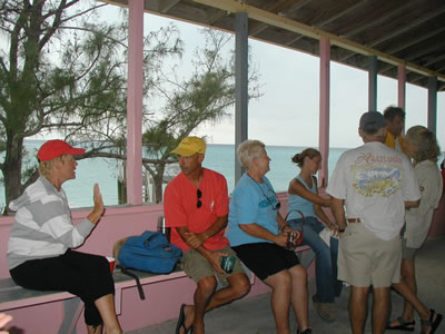
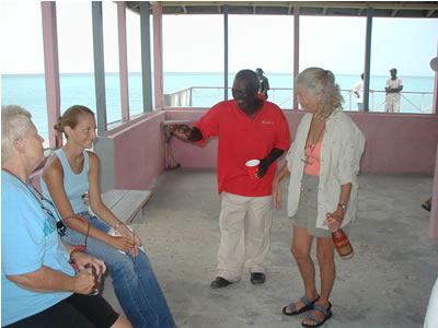
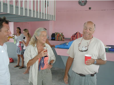
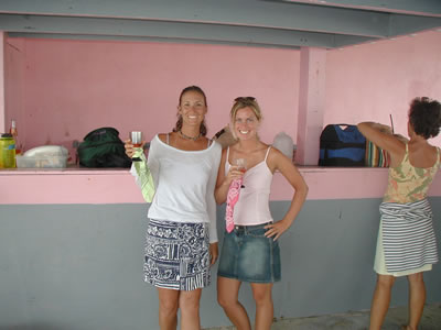
About mid-May, despite the fact that the wind had been blowing hard for days, we decided to leave Staniel Cay and move a few miles south in an effort to get to George Town. Staniel’s anchorage at Big Majors was getting really crowded. David on ZING joked that he had so many trawler-type power boats anchored so close to him that he was about to have to put fenders out to protect his topsides. On the subject of wind, this spring was been a windy one. The wind blew so hard for so long that it gave me the sensation that a pair of pliers would blow away if I so much as momentarily set them on the deck. It took some getting used to! Also, anchoring was a leap of faith at first, hoping that the boat would not drag. It never did. I can’t recommend DELTA anchors highly enough. Our 100 feet of chain rode and 35 pound DELTA anchor never gave up an inch! At Staniel Cay, the winds were out of the eastern quadrant, so we simply headed south in the lee of Staniel Cay and Bitter Guana Cay to Black Point on the north end of Great Guana Cay (this Cay has the same name, but is not to be confused with Guana in the Abacos). It was much nicer to ride out the winds at Black Point, because the anchorage was not crowded. If I remember correctly, there were only about ten sailboats and no power boats. For sure, no mega yachts were there. David on ZING recognized friends on other boats already there. One of the boats, Camelot, announced on the VHF the intent to organize a potluck birthday party. It was our first potluck and it was a great way to meet fellow cruisers who would become familiar faces and good friends in the days and weeks to come. Here are some shots of the potluck party:
A good time was had by all and we made many new friends at the pot luck dinner. Our thanks go out again to Harv and Anne Gross for organizing the get together. We stayed at Black Point several days waiting for the high winds to subside for a continued passage south. We hiked a couple of miles to the north end of the island where there is an excellent beach for seashell and glass hunting. We had lots of fun looking for shells and collecting all the beach glass we could find, giving all the glass to Jan as raw materials to be turned into her artful jewelry. We enjoyed it so much, we did it again the next day.
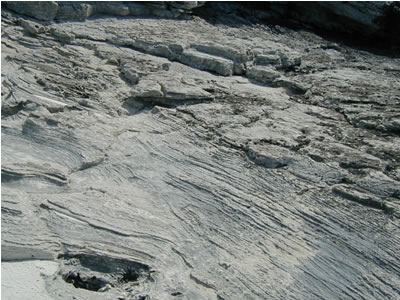
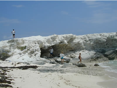
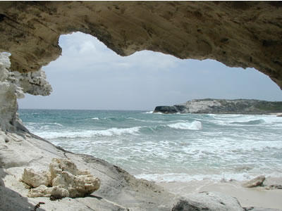
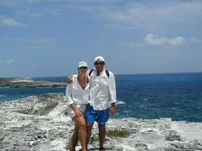
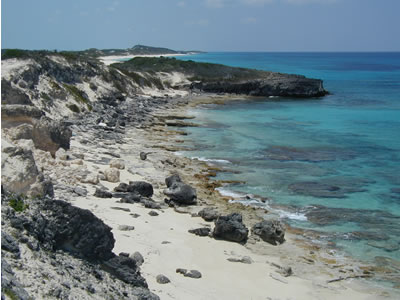
In typical Bahamian fashion, the north end of the island is terribly hostile. It seems impossible to survive wherever “iron shore” is present. The limestone rock of the Bahamas erodes in the most lethal fashion imaginable. Like three dimensional swiss-cheese, the iron shore is comprised of sharp stalagmites with small, penny-size holes eroded through, with some holes at the very edges being open and left as crescents with sharp corners. It is not an exaggeration to say that if one tripped and fell hard and face-first into some of this terrain, it would result in sudden death. I wondered: if I washed up here, would I feel more comfortable swimming back out to sea?
Other terrain is less hostile, though. There are sandstone cliffs and caves, and there is a large cliff at the very northern part of the island called the “White Horses.
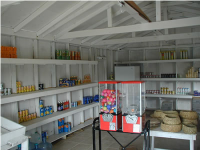
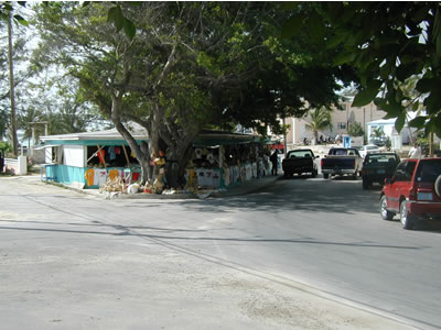
Also, while at Black Point we got to do some shopping at Ruby’s. Here is the equivalent of the Super Walmart at Black Point:
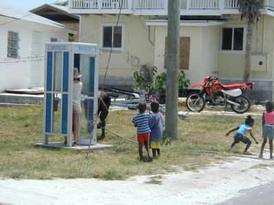
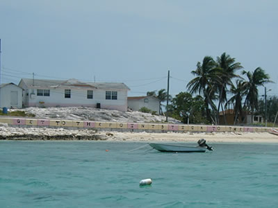
Melissa and I wanted ice cream. Ruby said to wait a minute. She left, went to her house, and came back with what we surmised was her personal chocolate ice cream. It sure was good! As with Staniel Cay, the citizens of Black Point had decorated their seawall. They used the tiles of the seawall to spell out the slogans of Black Point: “GET TO THE POINT STICK TO THE POINT.” Wow! What a great idea for a Continuing Legal Education seminar. Send a load of lawyers to Black Point, give them chaise lounges and umbrella drinks and have them read the sea wall over and over again for a week. I’m sure that many a judge would applaud any improvements realized in that vein. Now, all of you know about "the picture that got away, right? You know: a great shot presents itself and before the camera can be armed and fired, the shot is gone! Well, as we walked back toward "downtown" Black Point one day, we approached the sole phone booth on the island to find it occupied by a lady tourist and four local children who had all packed themselves inside the booth with her. It was funny. The kids were mesmerize as they looked up and watched/listened. The lady in the booth was stiff and motionless pretended nothing was out of the ordinary. Finally, the gentleman you see behind the booth made them scat!
It was time to get a move on. Melissa and I had to get to George Town by May 22 to renew our cruising permits. We had been in the Bahamas almost 90 days and needed an extension. The Reeves aboard ZING were shooting for George Town as well, so we departed Black Point and headed south, planning to stay on the Banks to the west of the Cays, in the lee of the still heavy easterlies. As the morning progressed, the winds got higher and higher and were well over twenty knots by noon. Even on the inside, we were getting pounded! As I have said before, the shallow Bahamas Banks stir up exactly like shallow Lake Pontchartrain does back in New Orleans. Very uncomfortable! As it built, the wind shifted more toward our noses and it was getting hard to sail that close to the wind. Just as I was thinking of reducing sail, ZING, also with full sail up, called on the VHF. They had snapped their boom in half! Indigo Moon was burying her bows into the steep four to six footers and it was time to reduce sail. All in all, it was a very rough day, but we all made it to Rat Cay and then to Glass Cay where we anchored. The next morning, I helped ZING get the sails and rigging off the snapped boom so that it could be removed and safely stowed. Amazingly, not a thread of ZING’s mainsail or sailbag was disturbed by the jagged edges of the heavy boom. Once we had ZING buttoned up, we headed out of Glass Cut into Exuma Sound (the ocean) and made it to the entrance of Elizabeth Harbor and to George Town. You have to go out into Exuma Sound to get to Elizabeth Harbor. Both the northern and southern entrances to this area face east into Exuma Sound. You can’t sneak in the “back door” from the western Banks, like the smaller Cays. Once inside Elizabeth Harbor, there are plenty of anchoring options, and protection from any wind direction. The harbor is several miles long and at least a mile or so wide, with various sections of beaches and rocky shoreline. With the harbor oriented northwest to southeast, George Town is located on the southwest shore of the harbor on Great Exuma Island. This is the southern-most island in the Exumas Chain and it is huge compared to the tiny Cays that make up the Exuma chain to the north.
ZING anchored out across from George Town in Elizabeth Sound near Volleyball Beach. Melissa and I rented dock space for a couple of nights to give Indigo Moon a thorough cleaning with fresh water and to take care of our expiring cruising permits.
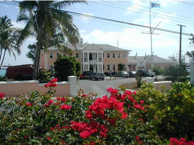
We went to the Divisional Headquarters Building for the Exumas and Ragged Islands and filled out paperwork necessary to obtain another 90 day permit to cruise in the Bahamas. The officials in the small immigration office were very friendly and helpful. There was no problem getting the extension, nor was there an additional charge.
Interestingly, there is a small lake ( Lake Victoria) in the center of George Town, with lots of dinghy docks so that cruisers can come in from anchored vessels and shop, etc. There is only one entrance, under a roadway via a dinghy underpass. There is only room for one boat at a time and incoming traffic has the right of way.
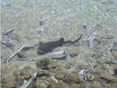
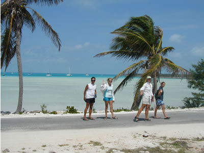
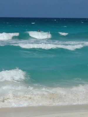
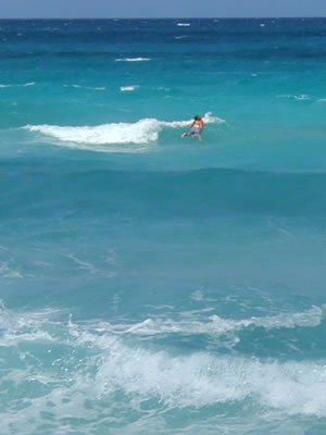
After taking care of all our business in George Town, we crossed Elizabeth Harbor to its east side (fifteen minutes at a leisurely pace) and anchored in a “primo” spot off Sand Dollar Beach on the west side of Stocking Island (the large barrier island that lies across from George Town and protects Elizabeth Harbor). What a great place to be! Stocking Island is miles long with coves and great anchorages that are adjacent to pristine beaches. A short hike over any of the trials to the outside of the island renders sparkling beaches on Exuma Sound. Surfing in this area is good. Lauren of ZING was happy to rejoin other surfing teens she knew from previous trips to George Town. Melissa and I enjoyed snorkeling with David and Jan one day that was especially nice. With flat seas and reefs only fifty yards off Stocking Island we saw lots of neat fish and some really big lobsters. Too bad it was not lobster season! On another calm day, Melissa and I kayaked out of a cut into Exuma Sound and had a great time paddling just off the reefs in the open ocean. It’s no wonder that George Town is a cruiser’s Mecca where as many as five hundred boats crowd the harbor in winter. We arrived long after the peak season and there were not many boats there compared to the high season. George Town is a winter haven for many cruisers and serves as a stopover point for destinations farther south. Beyond George Town, services for the mariner heading south are few and far between. So, Elizabeth Sound is also known as "chicken harbor" because many cruisers are scared to go any farther south into the "Ragged Islands" where there is nothing available except total self-reliance. What a nice backyard we have at Sand Dollar Beach!
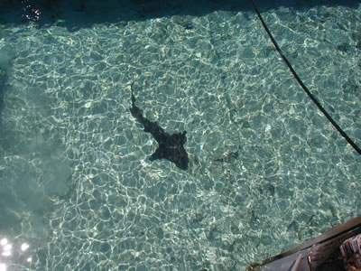
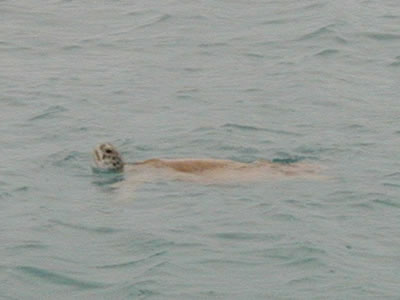
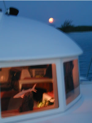
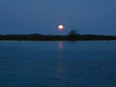
During our stay at Sand Dollar Beach we had lots of sea turtles keeping us company. Every now and then you would see them surface and look around. We still don’t know what the attraction was, but they surely spent their days and nights all around the anchorage where we were. On May 23rd, we enjoyed one of my favorites: moonrise at sunset. As the sun set forward of our bows, a big yellow moon rose up at our stern.
We also met new friends Betsy and Jonathan on a neat sailboat with twin wishbone rigs and pretty bark sails named Akimbo. We crossed wakes often and we were always impressed with their skillful practice of both pulling and dropping anchor without ever starting their engine. Also, both of them are in terrific shape. They don’t use an outboard on their dinghy and row everywhere instead!
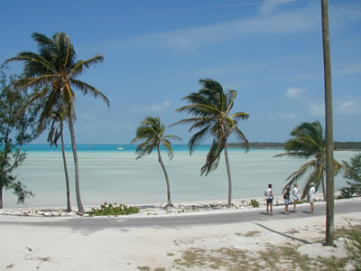
One afternoon, Melissa and I took the dinghy into Sand Dollar Beach and hiked the trail over the top of the Cay out to the ocean side. Here is a photo report:
The water is clear, the beaches are wonderful, and all in close proximity to supplies in George Town. Also, anchored near us at Sand Dollar Beach were Nick Chiapinni and Thea Bushell on the terrifically outfitted Morgan Out Island Ketch, Blue Bonnet. Nick and Thea came over for dinner one night and we became friends in no time. We enjoyed walks on the beach and snorkeling together. As the days passed at George Town, we discovered that Blue Bonnet also planned to head farther out into the Atlantic and visit the more remote islands of Long Island, Conception and San Salvador. As it turns out, we were on the “same page” so to speak and we were ready to head out for new adventure. We really enjoyed our time with the Reeves family on catamaran ZING. But, the time had come for us to move on and the Reeves remained in George Town to either make repairs to the broken boom there, or begin to motor back toward the USA for repairs. We said our goodbyes to ZING and headed east with Blue Bonnet across part of Exuma Sound to Long Island and beyond. That’s it for now. As I finish this report, we are docked at Portsmouth, VA. We have spent ten days here resting up and waiting for a weather window to move farther north. We will head out tomorrow and sail for two or three days in the North Atlantic Ocean up to Martha's Vineyard and Buzzards Bay in Massachusetts. Then, we will slowly work our way back down the east coast. We just met some new friends who are brand new cruisers aboard their new Lagoon 440 (what a fabulous yacht!). They are going to "buddy boat" with us for a while. We will publish the next and last trip report on the Bahamas very soon, because it is already written. Our travels through the Southern Bahamas simply would not fit into one report. And so, questions remain as this installment ends. Will we ever catch a nice fish? Will we ever find a dive site in the Bahamas that is more that twenty feet deep? Will the sharks ever leave us alone? All that and more coming up in the next installment. Stay tuned, the best is yet to come! Until next time, Fair Winds - - -
|
||||||||||||||||||||||||||||||||||||||||||||||||||||||||||||||||||||||||||||||||||||||||||||||||||||||||||||||||||||||||||||||||||||||||||||||||||||||||||||||||||||||||||||||||||||||||||||||||


|
![]()